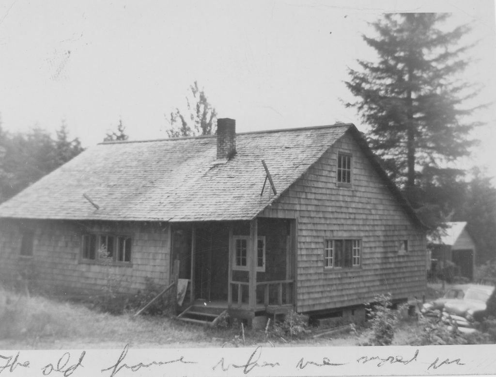
I was born in Aberdeen, on the central Pacific coast of the State of Washington. When I was 2 years old, my family moved to Amboy because my father was part of a venture that had won a contract to prepare a new railroad grade to a plywood mill. My parents bought 17 acres that includes a section of Cedar Creek, and came with a 1930s little house with no indoor plumbing. After renovations, that became my childhood home.
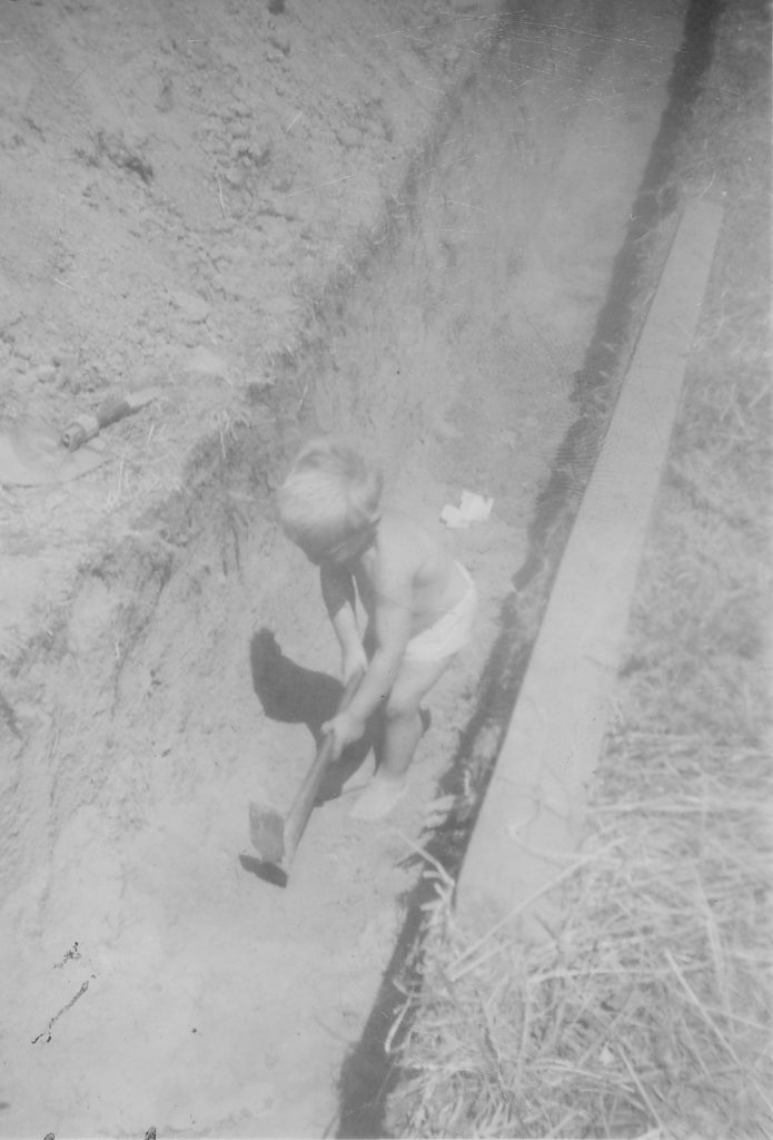
Here, though still in diapers, I’m helping dig a ditch for the new sewer line. We all worked. More than 65 years later, that well-designed and built septic system still does the job.
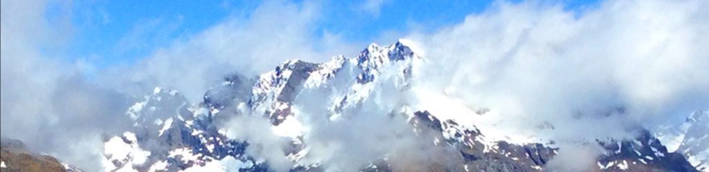
As I have two brothers living there, I decided to make Amboy my home base and legal residence after leaving Hawai’i. This is an area of rolling hills covered by Douglas Fir forests, with dramatic snowy volcanic mountains nearby.
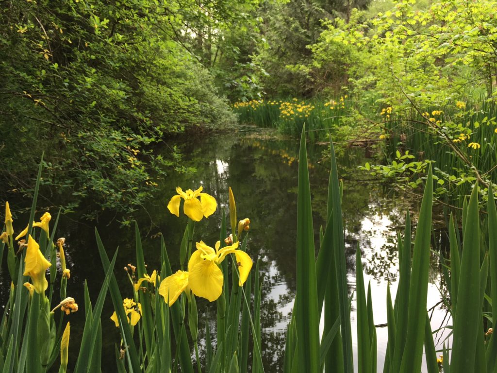
This pond near Cedar Creek has been used to raise and release salmon smolts to help restore salmon spawning.

Cedar Creek where it runs through our family land.
Though I have been concentrating on international travel and trekking these past two years, there is much good hiking in Washington, so I scheduled in two months to visit family and walk trails that I missed as a teenager.
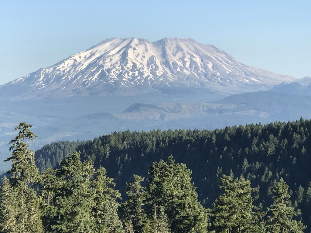
Mount St. Helens, whose explosive eruption in 1980 was the most destructive and expensive volcanic disaster in the history of America. The top dome and north side were blown away, killing 57 people and causing more than a billion dollars in damage, leaving this broad, jagged top.
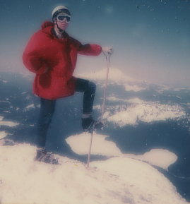
Photo by Les Nugent
In 1970, I climbed to the top of the pre-eruption mountain. Spirit Lake is below my foot, and Mount Rainier in the background. The smooth round profile of the mountain often was compared by Japanese visitors to Mount Fuji in Japan.
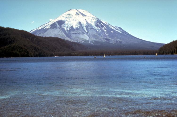
The mountain viewed from Spirit Lake before the eruption.
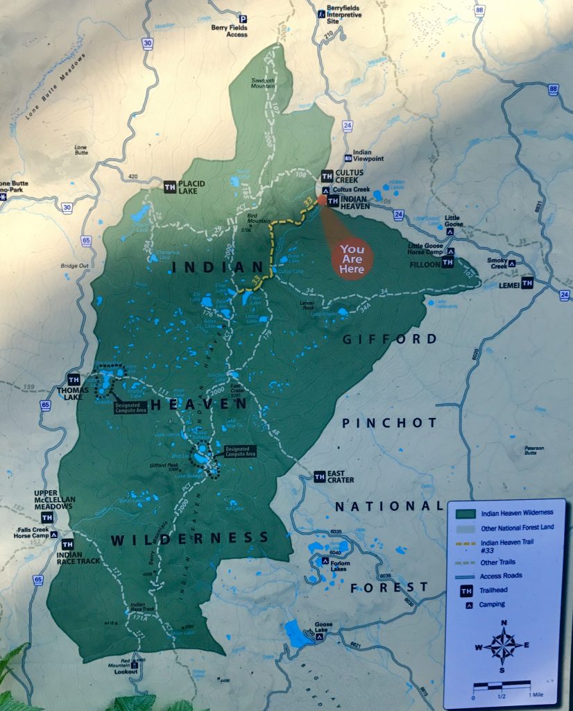
My first hike was in the area a bit south and east of Mount St. Helens, near Mount Adams, on the Indian Heaven to Lake Wapiki trail. This is described as “One of the best hikes in the Indian Heaven Wilderness: dramatic views of Mount Adams and distant views of Mount Rainier, Goat Rocks and Mount St. Helens.”
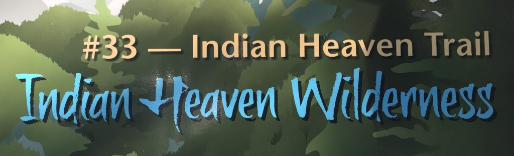
Indian Heaven’s lakes, meadows and wild huckleberries made it a popular gathering place in the late summer for local Indian tribes. They picked berries, socialized, and raced horses.
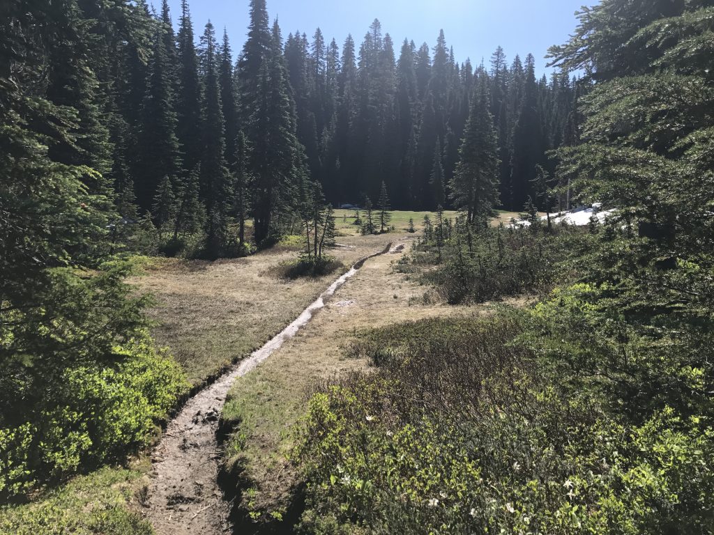
Meadows like this are common in Indian Heaven. So are mosquitos! Fortunately, I came prepared with gloves and headnet, and they were not able to feast upon me. I decided that it would be better to wait till later in the season to camp up there.
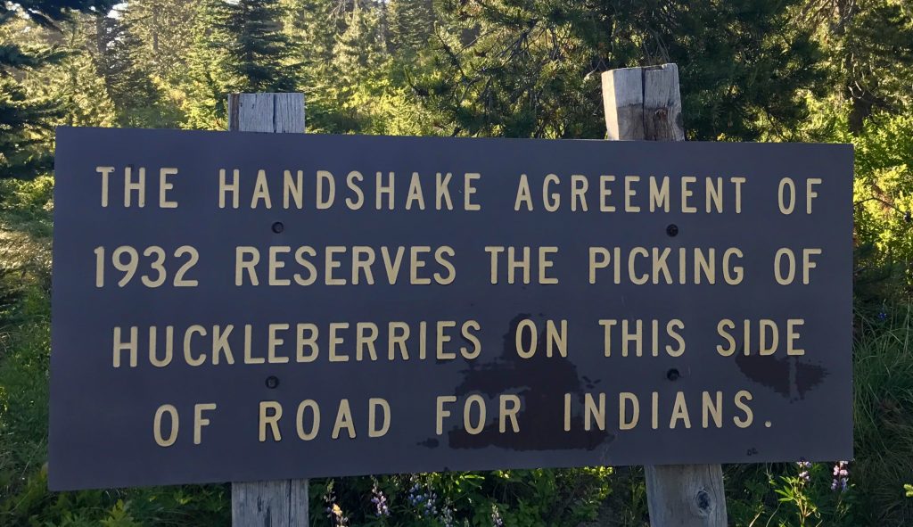
Half of the area has been reserved for harvesting by Indians.
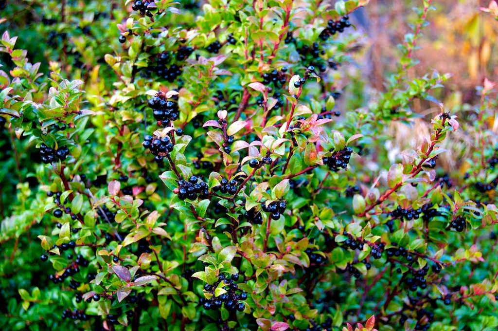
Wild huckleberries. They have a more intense, tart flavor than blueberries. Human fans of them compete with other huckleberry lovers such as bears, birds, coyotes and deer. As more trees grow up in Indian Heaven, the huckleberry numbers have been declining. Perhaps in years past, natural wildfires kept the area more open.
[vc_row][vc_column][vc_masonry_media_grid grid_id=”vc_gid:1500213655949-1bd0406b-8cf1-3″ include=”6594,6596,6597,6599,6598,6600,6604,6605,6601,6607,6610,6613,6612,6611,6609,6615,6616,6618,6619,6606,6620,6621,6623,6624,6625,6626,6627,6617,6603,6602,6595″][/vc_column][/vc_row]

After hiking in about 2 miles on a steep grade, you are rewarded by this view of dramatic, glaciated Mount Adams.
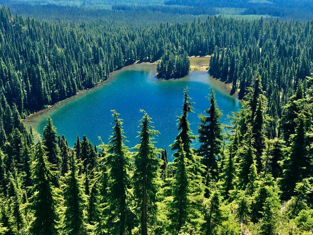
Another 2 miles brings you above Lake Wapiki, which is a lovely camping spot.
My next exploit was to camp at Goose Lake (near Mount Adams) with my friend for more than 50 years, Les Nugent.
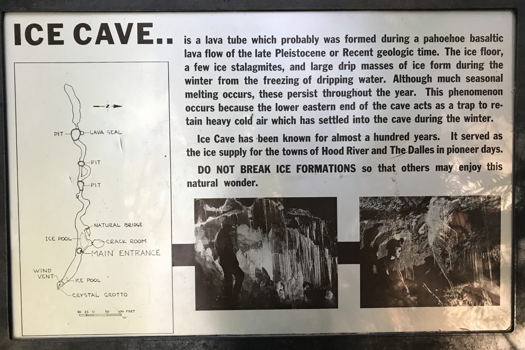
On the way back, at his suggestion I visited Ice Cave.
vc_row][vc_column][vc_masonry_media_grid grid_id=”vc_gid:1500515961619-a0818723-0ba7-1″ include=”6660,6661,6665,6666,6664,6663,6662,6667,6668,6669,6670,6671,6672,6674,6675,6676″][/vc_column]
Columbia Gorge Windsurfing from Mel Malinowski on Vimeo.
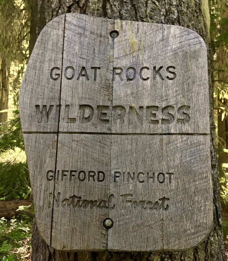
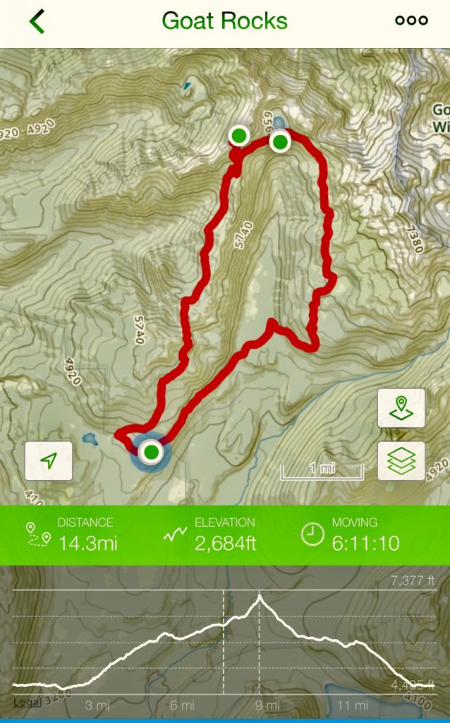
My next hike was to Goat Lake in the Goat Rocks Wilderness area near Mount Adams. The Pacific Crest Trail runs through GRW.
I’ve decided to include some backpacking/camping in my trips, something I used to do a lot, but then middle age and family intervened, and I got out of practice. Being able to camp at remote sites extends your range, and gives you the possibility of more ‘Edward Abbey’ pristine back country experiences. Some of our best wilderness areas require backpacking, perhaps so as to limit the numbers and impact.
Goat Rocks Wilderness did not disappoint. It was one of the most spectacular, pristine places I’ve ever been in the world. More below, but first, the view from my campsite at Goat Lake.
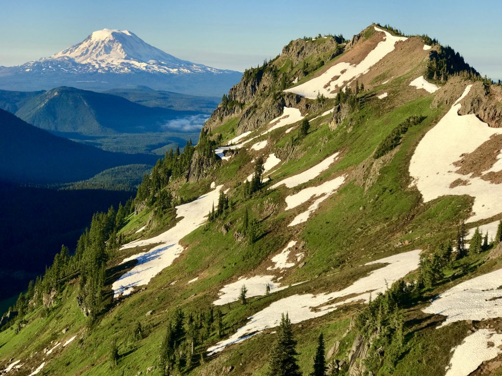
I will try to convey with a collage of pictures the stunning beauty of this area. It is dazzling in person.
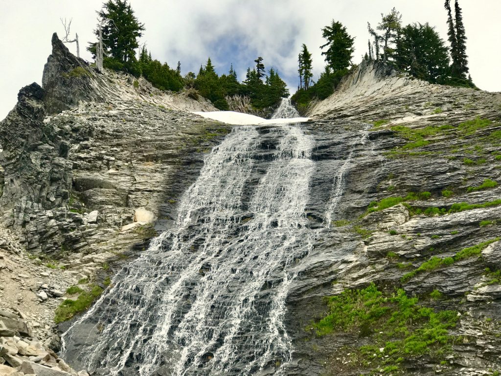
Along the way is a lovely waterfall emerging from a very unusual rock formation
Goat Creek Waterfall from Mel Malinowski on Vimeo.
[vc_row][vc_column][vc_masonry_media_grid grid_id=”vc_gid:1500682898694-a6690ece-686d-7″ include=”6696,6697,6698,6699,6700,6701,6702,6707,6706,6705,6704,6703,6708,6712,6711,6710,6713,6714,6715,6717,6718,6719,6716″][/vc_column][/vc_row]
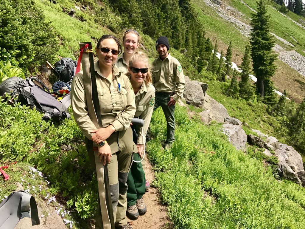
On the way, I met this US Forest Service trail crew. They were carrying (among other tools) this six foot long crosscut saw to clear the trail of large fallen trees. You have to be tough to hike this far in and do all that’s required. They looked tough enough, and were friendly, too. I’m glad some of my taxpayer dollars are supporting this work.
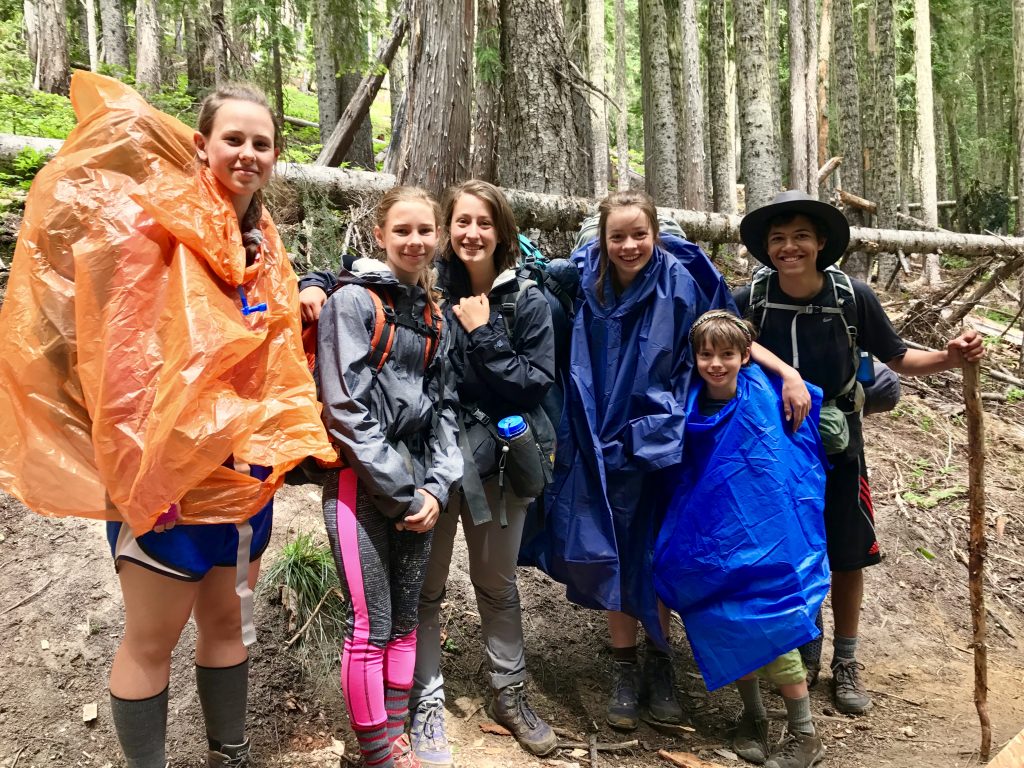
I met this group from Tennessee on their way down from camping. They have a friend (far right) from Seattle helping.
Their group included this nine year old camper! Glad to see new hikers on the way up. It takes spirit to hike this far in and camp. Kudos! Long may they hike.
On the way out, I walked up to the top of the ridge above Goat Lake. This is Mount Rainier from there. Like that unusual,possibly lenticular cloud?
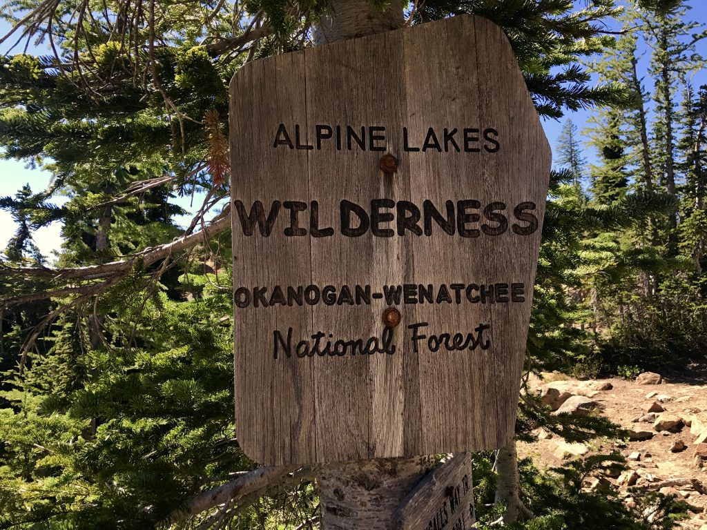
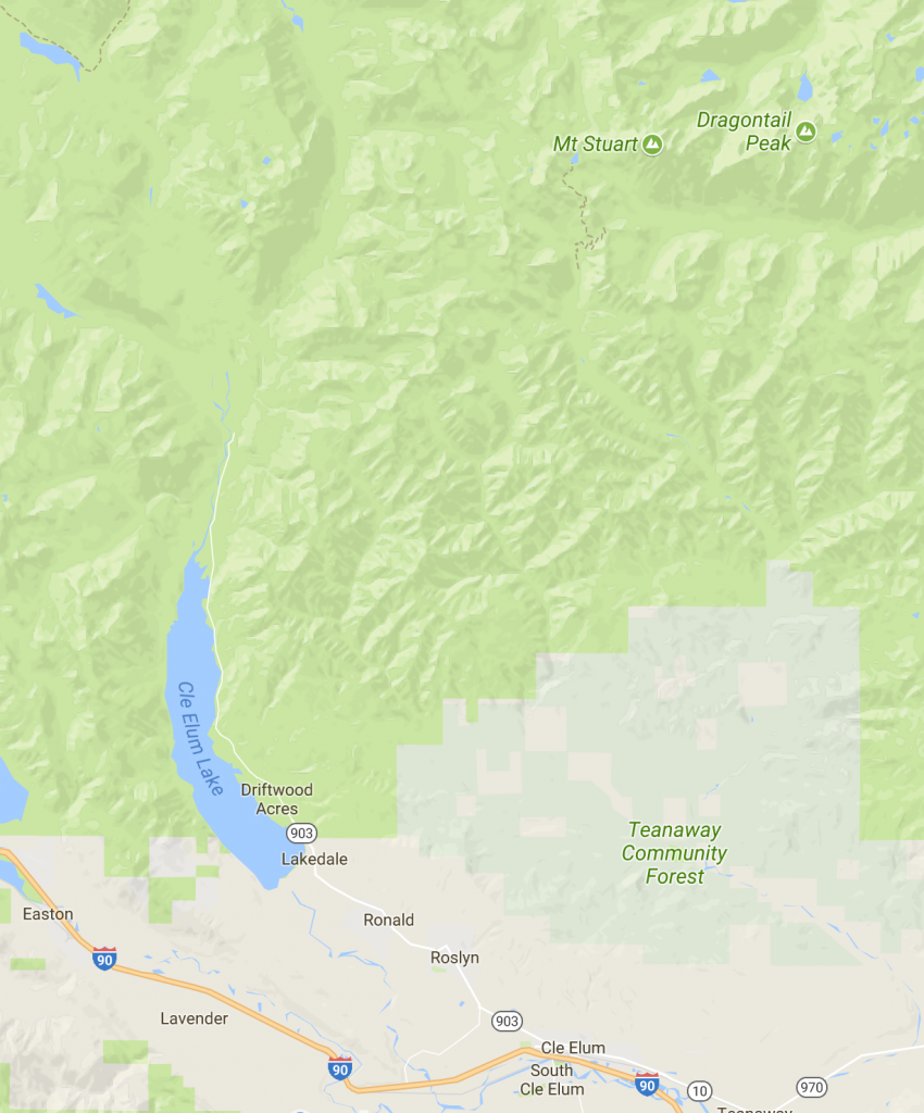
My next hike was into the Alpine Lakes Wilderness north of Cle Elum, Washington.
A friend that I climbed with many years ago and a friend of his backpacked in to camp near Lake Ingalls, in order to climb the West Ridge of Mount Stuart.
“Without a rival as the crown peak in the central Cascades of Washington, Mount Stuart has been pronounced the single greatest mass of exposed granite in the United States…its northern and eastern faces are the alpine climax of the Wenatchee Mountains. They make a powerful impact on first sight…The mountaineering problems are magnified by the mountain’s massive dimensions and its complexity.” Excerpted from “Cascade Alpine Guide”
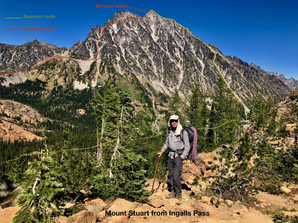
It is hard to judge the size of a peak from a distance. Here are some numbers to put this in perspective.
Mount Stuart is 9415 feet high. Being this far north, it is as snowy if it were perhaps 12,000 feet or more if located in the California Sierra. What matters more is its ‘prominence’ or elevation above nearby features. It has a ‘topographical prominence’ of 5354 feet, which is exceptional. The south face (in the picture) rises over 5,000 feet in just two miles.
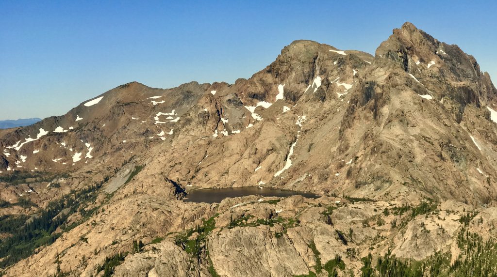
We camped near Lake Ingalls, pictured here. That is Mount Ingalls in the background.
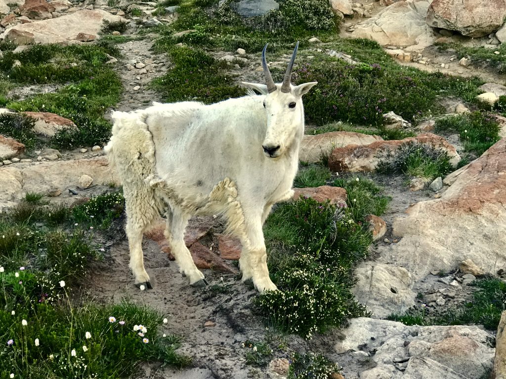
There is a large herd of wild goats here. Sometimes they will just wander through your campsite! Wild goats are attracted to hikers because where there are hikers, there is less threat from predators, and they like to lick urine on rocks for the salt. This goat is shedding last year’s wool. You find tuffs of it on the bushes.
Wild Goats near Lake Ingalls, Washington from Mel Malinowski on Vimeo.
Part of the wild goat herd grazing on an outlet creek from Lake Ingalls.The young goat is eating the blossoms of wildflowers.
It was a treat to be around all these wild goats. However, you should always remember that they are wild, and possess a sharp set of horns and hooves, and stay a good distance from them. If they feel threatened, they may defend themselves.
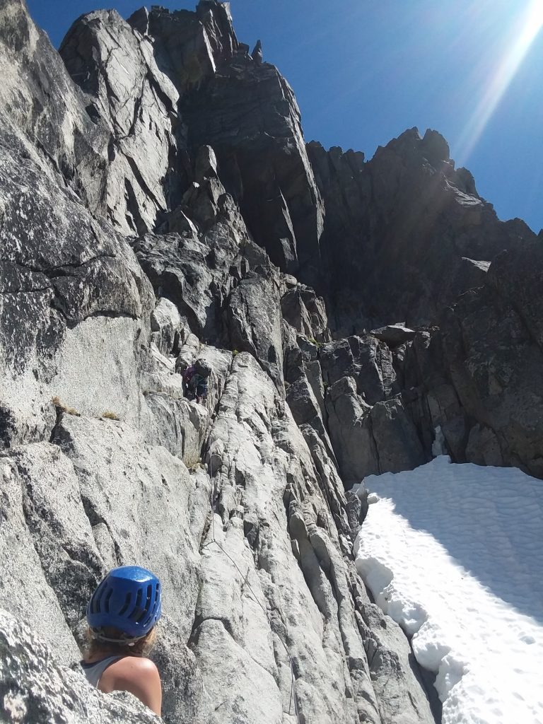
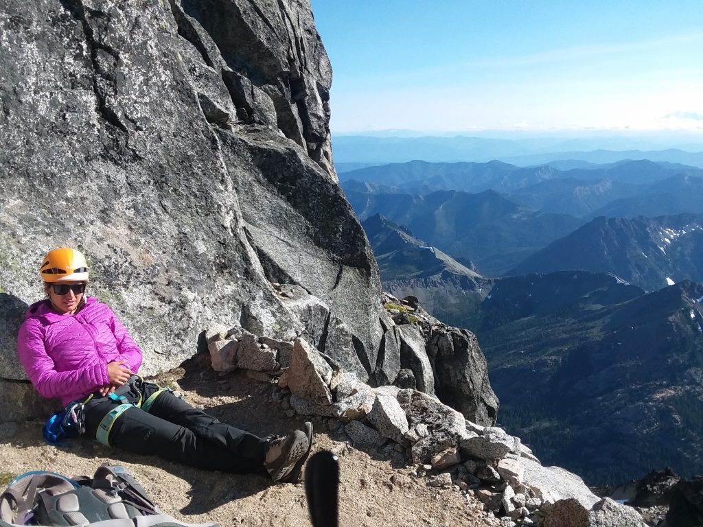
The West Ridge of Mount Stuart is both technically not too hard (perhaps 5.4 difficulty) and harder than you might anticipate, as it is remote and long and has some sections of great exposure where you move across areas with a drop of thousands of feet below you. It is dramatic, spectacular, and exciting. Once you get yourself up there (alone, we saw not another soul up there), you must rescue yourself. It is serious, sobering, and lots of fun. The views are literally stunning.
Two photos by Jaime McCandless
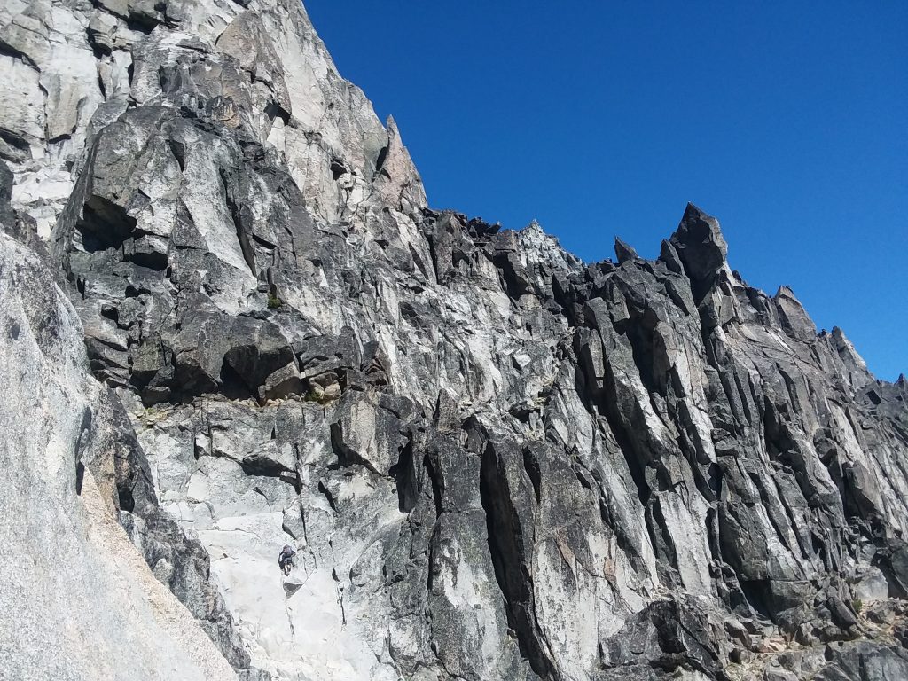
As we had one less experienced climber with us, we had to use ropes and belays on sections we could have climbed unroped (called Class 4 by the Yosemite system, which means you can climb unroped, but also could have dangerous falls if you are not on rope), and moved more slowly over difficult pitches, and that slowed us down.
The trip report we relied upon did not adequately address the difficulty level, nor accurately describe the route. As a result, we wound up not quite to the top at sunset, and had to bivouac on a very small ledge overnight. In retrospect, I think that few climbers would be able to do this route without a bivouac along the way. There is no running water along the way, so you must carry a lot or rely on melting snow.
With better information and planning, it could have been safer and more pleasant. A lesson to be learned here is that it is wise to always go prepared and equipped for a cold weather bivouac, despite the fact that this requires bringing more clothing and gear, which makes your pack heavier. You should not rely on others hoping all will go well.
The ledge was so small only one of us could lay flat, while the others had to sit up. It was cold, and we got little sleep. Unless you can lay flat, it is hard to fall asleep. Had the bivouac been planned, there are some larger areas available along the way, such as at somewhat lower ‘west notch’, which would have been more comfortable.
Another group of climbers bivouacing at the West Ridge notch a few weeks earlier.
Without that, and warmer gear, it was painful, and a long, hard night. At 4am, I stood up and danced in place to warm up and restore my circulation, as I was not sleeping anyway. As soon as there was enough light to resume climbing, we did, about 5am.
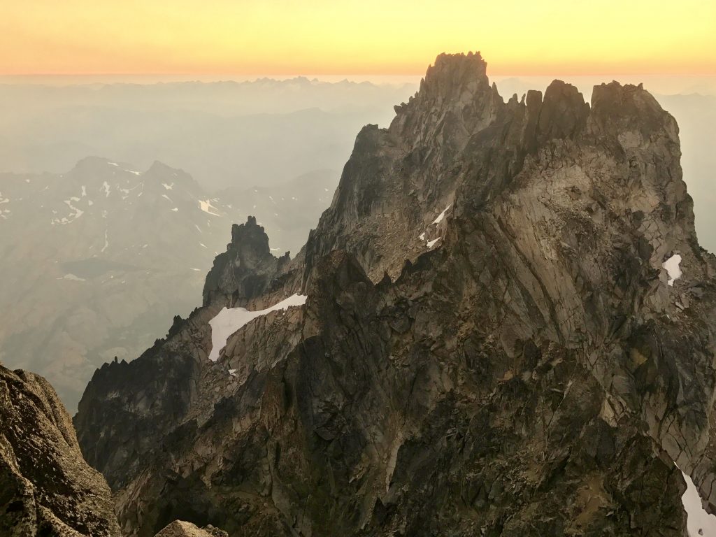
View from our bivouac ledge at 9200 feet altitude as the twilight faded.
At 9:40am, we finally reached the summit! Here is a picture of that area from Jaime McCandless, who had climbed the West Ridge a few weeks earlier.

Hiking back down via a technically easy (class 3 and 4) but very long route took more than 12 hours. We arrived down in the creek area very late, and at 2am, two of our party elected to bivouac rather than try to make it back to our tents in the dark. Not relishing another bivouac, I went on, and arrived at my tent at 4:30am, very glad to crawl into my sleeping bag.
All in all, a worthwhile hike and climb. Despite its hazards and difficulties, it was memorable. Mount Stuart is one of the most rugged, steep peaks I have climbed. The granite rock it is made of is a pleasure to climb upon, and very pretty. If you decide to climb it, be sure you have the experience and equipment to do so safely, and allow plenty of time, food and water.
[vc_row][vc_column][vc_masonry_media_grid grid_id=”vc_gid:1501911965036-d835a0c4-0945-0″ include=”6740,6743,6744,6742,6739,6736,6738″][/vc_column][/vc_row]
More hikes soon…
Leave a Reply
You must be logged in to post a comment.