Author: melmalinowski
-
Tainan, Taiwan April 2017
Sometimes you have to make adjustments. Two days ago I apparently pulled a muscle in my back (or injured a disc) lifting my motorcycle onto its stand the wrong way. Yeah, I should know better! Since I could barely stand up without severe pain, I decided I must alter my plans. Fortunately, train travel in…
-
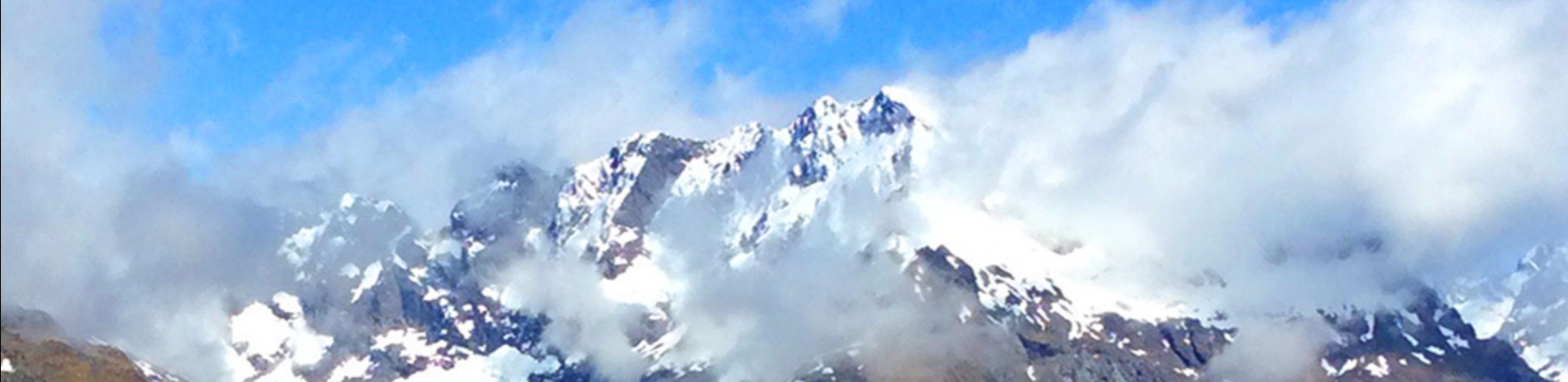
Yuli, Taiwan March 2017 (Yushan National Park)
Next stop: Yuli, near Yushan National Park. I rented another ‘Yamaha Breeze85’ scooter, and headed up to my accomodations at the Wisdom Garden Homestay, created by a Buddhist. I slept by myself in a large meditation room. My hosts. May is a very good cook, and made us sumptuous breakfasts. Lovely hillside setting. I think…
-
Taroko (Gorge) National Park, Taiwan March 2017
Train transportation in Taiwan is excellent and inexpensive. Today I took a two hour train ride from Taipei Central Station to Xincheng station, closest to Taroko (Gorge) National Park, for $14. Train reservations are easy in Taiwan. I went online, and in an English version of the website, was able to fairly easily book and…
-
Taipei, Taiwan March 2017
Taiwan is a mountainous island located about 120 miles east of southeastern China. It is where the nationalist “Republic of China” forces who were losing the war to Mao fled. It is currently an independent nation, though it may eventually merge with the mainland. It is my next destination. Taiwan is a bit smaller than Switzerland, and…
-
Halong Bay, Vietnam March 2017
On March 19th, I departed Hanoi for a two night cruise on Halong Bay. First, a four hour van transfer from Hanoi, not scenic. I listened to 4 hours of “Down the River” by Edward Abbey. Along the way, we stopped for a break and chance to buy souvenirs. I don’t buy souvenirs these days,…