Train transportation in Taiwan is excellent and inexpensive. Today I took a two hour train ride from Taipei Central Station to Xincheng station, closest to Taroko (Gorge) National Park, for $14.


Train reservations are easy in Taiwan. I went online, and in an English version of the website, was able to fairly easily book and pay for a series of train tickets around Taiwan. High Speed Rail was an exception, as their site does not have an English version. I had to go over to the central train station to book those. You also must go there to pick up the tickets, which is quite easy.
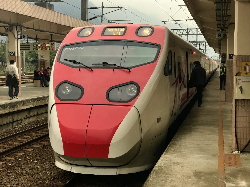

Comfortable seats that recline. Nice train. Quite a lot of very long tunnels along this rocky coast. I wouldn’t call the ride especially scenic.
I rented a very nice motorcycle (‘scooter’) for $14 a day. Overall, a higher quality scooter than I was getting in Vietnam for $7. I like it! But the gas tank only holds 2 liters, have to be careful to not run out. I’ve decided that the advantages of a scooter outweigh the obvious risks. Car rental here costs perhaps 4x that in New Zealand, and several time that in the USA. Rates over $100 USD per day do not appeal to me.
(picture soon)
Tomorrow, I go to the park, apply for a permit required for one hike, and begin exploring Taroko.
It is tomorrow. Beautiful sunny day. Time to head up into Taroko Gorge.
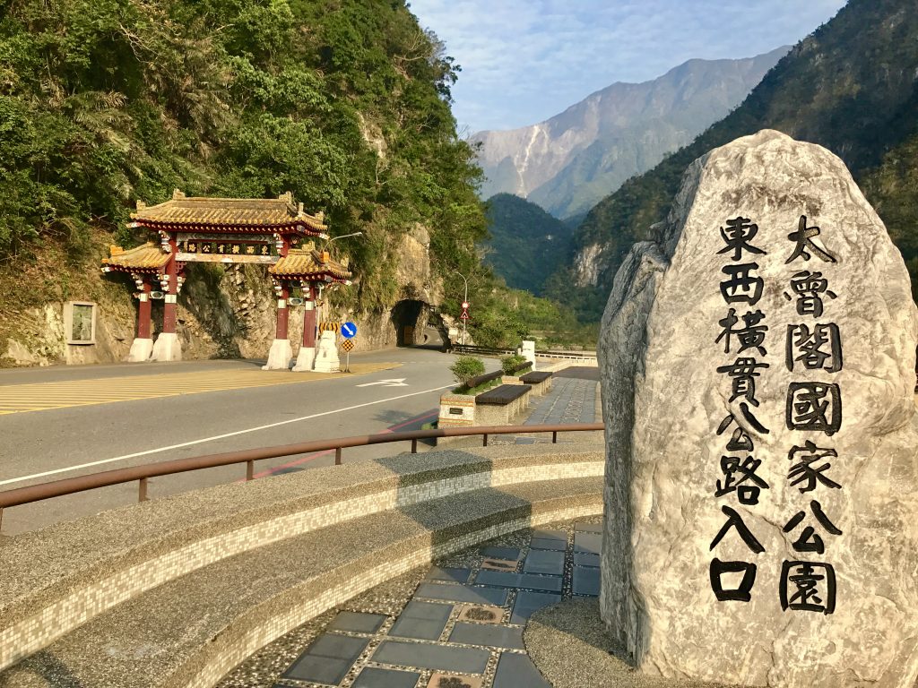
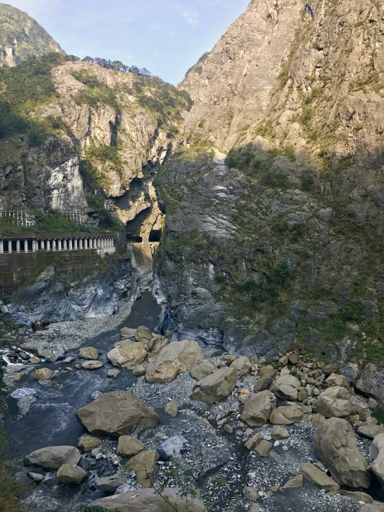
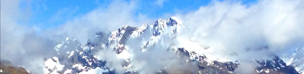
Spectacular narrow high gorge cut in the marble by the Li Wu river.
Marble is very interesting. It is formed when limestone (which are deposits of calcium marine shells formed at the bottom of oceans) are subject to great heat and pressure under the earth. The calcium carbonate crystallizes, and if the limestone is very pure, forms white marble. If there are impurities, other colors are created.
Crushed white marble is one of the best antacids, and is used in Tums and Alka-Selzer. Marble is rather soft, and easily carved, as the river has done here at Taroko.
How to view photo collages as a slide show
[vc_row][vc_column][vc_masonry_media_grid grid_id=”vc_gid:1490713375404-ab965c3e-edcf-0″ include=”5489,5490,5488,5487,5492,5494,5495,5496,5497,5498,5499,5501,5505,5503,5502,5506,5512,5509,5514,5515,5511,5510,5516,5517,5518,5520,5513,5522,5523,5524″][/vc_column][/vc_row]
Taiwan is at the juncture of the Euroasian and Philippine tectonic plates, and this gives rise to a lot of earthquakes and also hot springs. In 1957, while a section of road was being built, including a bridge over the Ludan River where it enters the LiWu River, a major earthquake struck overnight. The chief engineer went out to inspect the damage at 6am, and was killed by a landslide. The bridge was subsequently named Jinheng Bridge in his memory. But the fates have not been kind to this bridge. In 1997, a typhoon destroyed it. It was replaced. In 2000, another typhoon destroyed the replacement! Tough weather. The current bridge has now survived for 17 years.
A Buddhist temple is in the higher area of the canyon:
[vc_row][vc_column][vc_masonry_media_grid grid_id=”vc_gid:1490713788658-a968c2d6-7fc4-7″ include=”5529,5519,5525,5526,5527,5528,5523,5524,5522,5520,5521″][/vc_column][/vc_row]
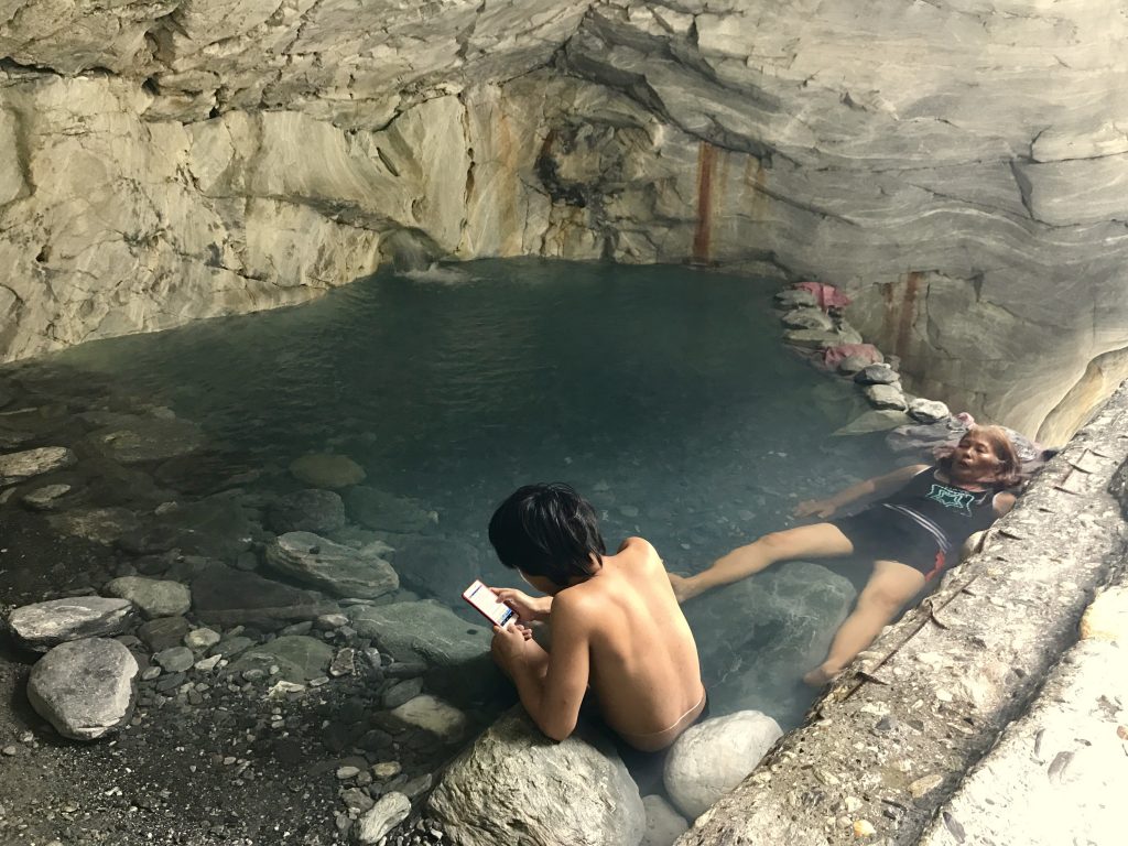
On the way back, I stopped to explore a suspension footbridge. It turned out to be to Wénshān Hot Springs. Officially, the trail was marked ‘closed’ but I noticed that the gates were not locked. Apparently someone was injured and sued, so they ‘officially’ made the hot springs ‘closed’ so anyone who goes there does so at their own risk. My guess. And locals go.
[vc_row][vc_column][vc_masonry_media_grid grid_id=”vc_gid:1490714259230-1fde0587-520d-5″ include=”5530,5531,5533,5534″][/vc_column][/vc_row]
Onw of the loveliest outdoor hot springs I have been at, and free. Just two locals were there when I arrived. The water is very hot, Japanese-onsen hot, about 44°C (110°F). My favorite temperature. The natural hot water just gushes out of the back wall into this natural canyon cave.
[vc_row][vc_column][vc_masonry_media_grid grid_id=”vc_gid:1490715662549-9c83ba3e-2f59-2″ include=”5555,5554,5553,5552,5536,5535″][/vc_column][/vc_row]
A Taiwanese and a Polish woman at Wénshān. Ah, I’d love to go back there if I have time. Tomorrow, I will hike up the ‘old road’ built by the Japanese with lots of local slave labor during their occupation of the island of Formosa (Taiwan). Isla Formosa it was called: “Beautiful island”
The Old Road over Juilu Cliff trail requires a police permit (as do a number of the high country trails here). A cheerful Taiwanese policeman promptly issued one for me the day before (a list goes out each day of who is permitted to hike these trails). He is pictured in the collage.
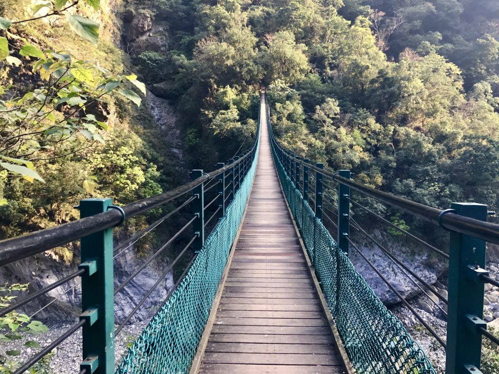
You start by walking over a dramatic suspension bridge above the Liwu River.
I was looking forward to seeing some of these, but alas, none showed up. Perhaps this is intended to discourage people from wandering off the trail, as if that were an option in these rugged mountains!
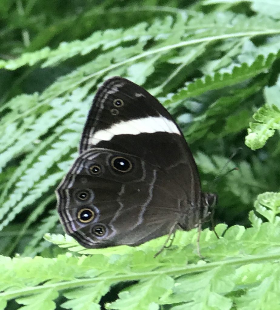
As I walked up the steep trail, there were butterflies of at least a dozen types and colors along the path. I managed to get a few pictures, but they flit about so much, it is not easy.
Along the path, I saw this big ‘grasshopper’ munching away on a leaf:

grasshopper from Mel Malinowski on Vimeo.
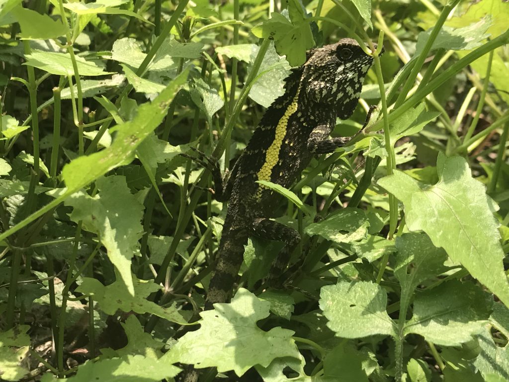
Big lizard, about 10″ long!
After toiling up several thousand feet in altitude, I arrived at the exciting part, where the ‘road’ (I’m not sure how you can call a path that varies from 2′ wide to a maximum of 4′, averaging 3 feet, a road) cuts across Juilu Cliff. This path was carved into the cliff face 100 years ago by local tribespeople under the kind supervision of the Japanese occupying forces.
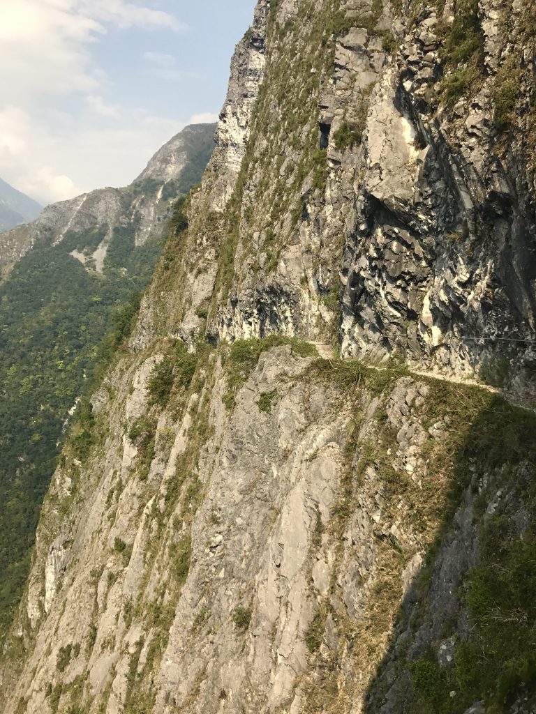
I have been a rock and mountain climber my whole life, and still, the sheer exposure was breathtaking. There is a cable along the cliffside that you can hang onto for security, but it is impossible to forget that if you stumble or faint, you would simply roll off the edge and fall nearly 2,000 feet to the river below. It is sobering and spectacular. I have seen few trails with this kind of exposure ever. This could be why they limit access.
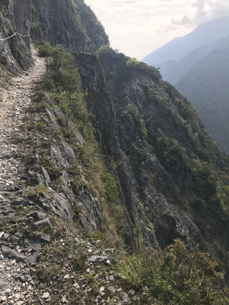
You can look down the sheer cliff and see the river and road below. Later, I tried looking up to pick out the trail on the massive cliff, and could not make it out.
I could hear and see monkeys in the treetops in the distance, but never up close. They must be Formosan Maquaques. There was a picture posted on the trail of one of the giant Formosan hornets, but I did not see any. I met fellow hikers on the trail from Germany and San Francisco.
After this strenuous hike, I went back and spent a couple of hours soaking in the hot pools of Wénshān hot spring for my second time. Ah! I will miss it, but there apparently are more ahead.
[vc_row][vc_column][vc_masonry_media_grid grid_id=”vc_gid:1490825312341-be55671d-5f5e-5″ include=”5589,5584,5582,5588,5583,5585,5586,5581,5579,5578,5577,5580,5592,5565″][/vc_column][/vc_row]
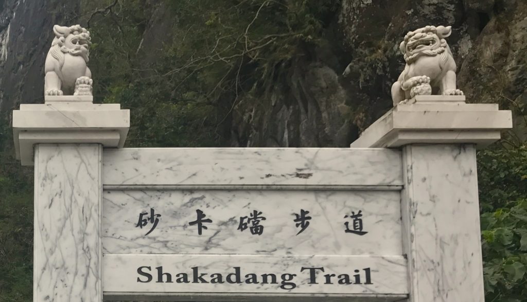
I picked a challenging all day hike for my last day in Taroko NP. The Shakadang Trail was carved out of the canyon wall by the Japanese in order to facilitate building of a hydro dam upstream. It is now a park trail. My goal was to hike up it, and on up to the very high village of Datong, then to the village of Dali, and back.
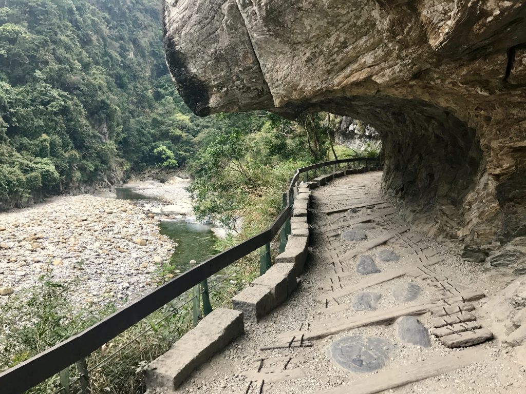
This tributary of the main Li Wu river still has massive boulders. You see boulders the size of small cars, then ones the size of large cars. As well, ones the size of small houses, and then ones the size of large houses!
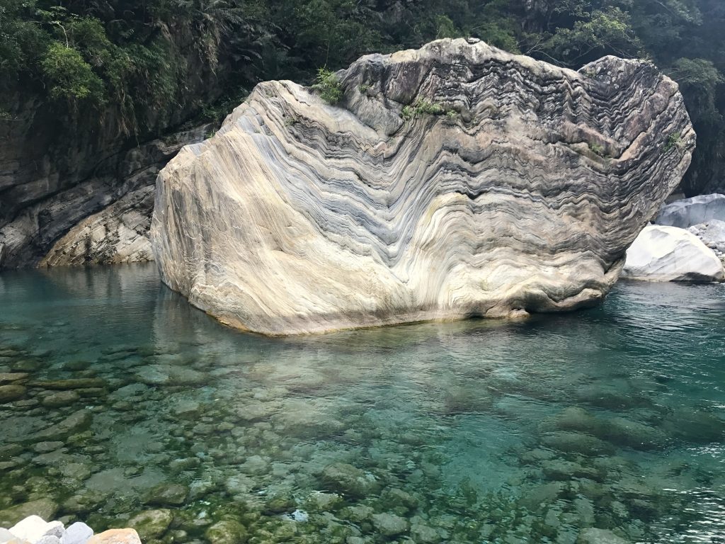
The water is a marvelous teal color, and the boulders of marble have amazing folds, bends and twists.
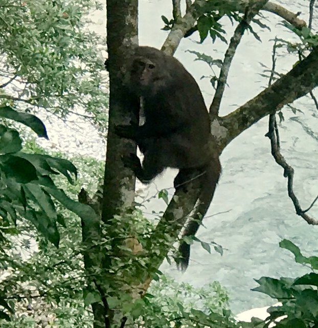
On the way up the river, I looked over and saw a Formosan Maquaque looking at me (my first up close). As soon as he realized I was watching him, he disappeared.
As I climbed up the mountainside, at times I (thought) I could hear distant monkeys. I later found out that this was the warning ‘bark’ of a small ‘deer’, the Reeve’s Muntjac. I never saw one, so this is not my picture.

The trail soon left the river, and began a two hour steep climb up the mountainside, on an old tribal trail about a foot wide. Spectacular subtropical jungle garden on the hillside, ferns, banana, mosses. Quite primeval. I was all alone out there on that mountainside, the way I like it. Good thing I carry a PLD (personal locator device), as if I sprained a knee out there, no one would find me for weeks.
[vc_row][vc_column][vc_masonry_media_grid grid_id=”vc_gid:1490878808941-7a265340-0cb4-2″ include=”5607,5606,5605,5604,5603,5602″][/vc_column][/vc_row]
[vc_row][vc_column][vc_masonry_media_grid grid_id=”vc_gid:1490930204798-e75a3f76-e1a6-7″ include=”5620,5621,5623,5624,5626,5627,5628,5629,5630,5631,5632,5633,5636,5637,5638,5634″][/vc_column][/vc_row]
I have found some secrets to hiking far: take good care of your feet with proper socks and boots. They are my weakest point for long hiking. I have been wearing thin inner socks that have five toes (available at REI) and help prevent toe to toe blistering. Pay attention to how your feet feel, and adjust how your foot strikes the ground. If the ball of your foot begins to get sore, strike with your heel more. And just keep walking! A one hour rest in the middle of the day does wonders. On steep climbs, if necessary, take one breath per step as mountain climbers do.
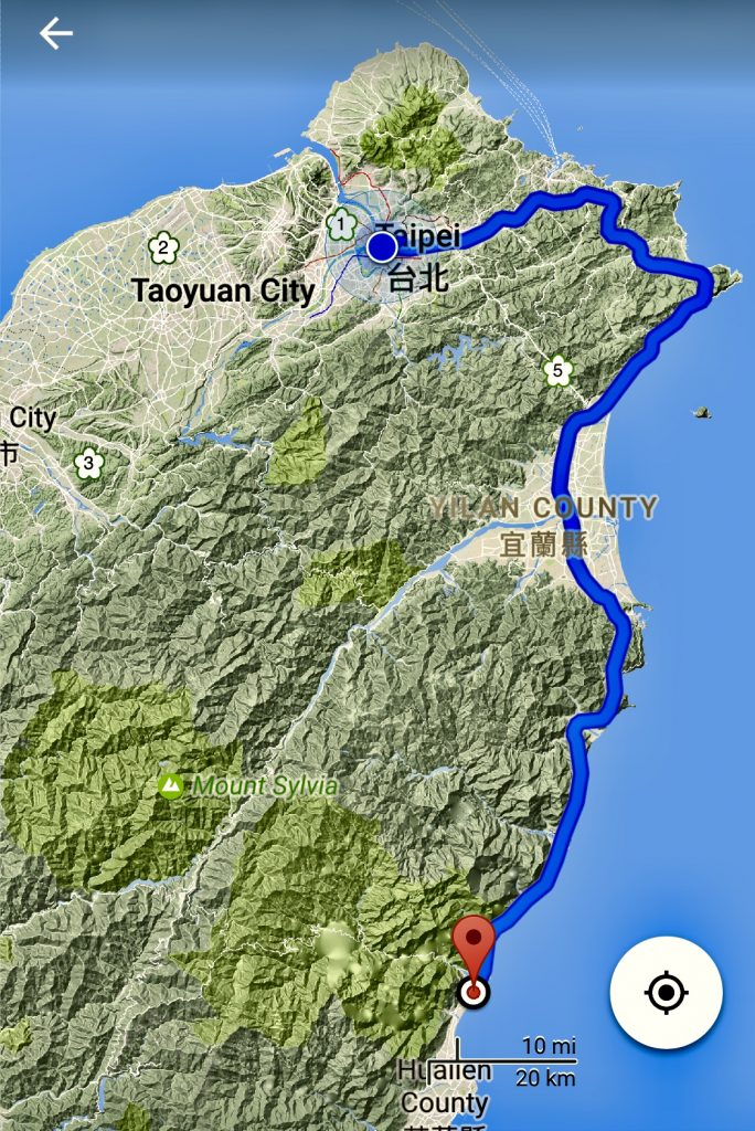
Now, time to take a train south to Yuli, my base for 3 days.
![]()
Leave a Reply
You must be logged in to post a comment.