I began my exploration of Tasmania by flying from Auckland via Melbourne to Hobart, Tasmania. 3 ¾ hours Auckland-Melbourne, 1 hour further to Hobart, Tasmania
I flew from Auckland to Melbourne on Air New Zealand, in a rather new 787-900 plane with an interesting premium coach seat configuration that I think is a very clever and passenger-friendly idea:
IMG 8963 from Mel Malinowski on Vimeo.
I think I’m not in Kansas anymore! Locals call Tasmania Tassie or Tas. As Tasmania is not on most travelers itineraries, I’m putting more pictures and details in than usual.
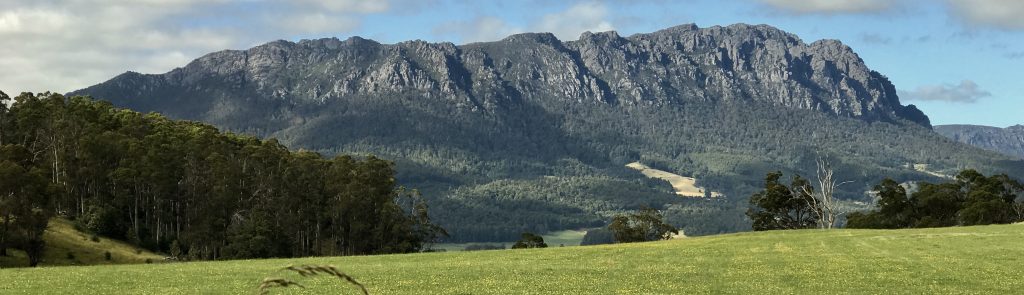
I began my Tasmanian hiking in Mount Field National Park, after driving about an hour or so up from Hobart. Hobart is part of eastern Tasmania, which is the drier side. I like the lush western area more (so far).
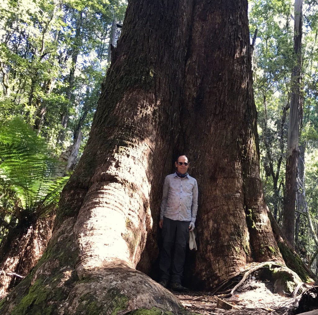
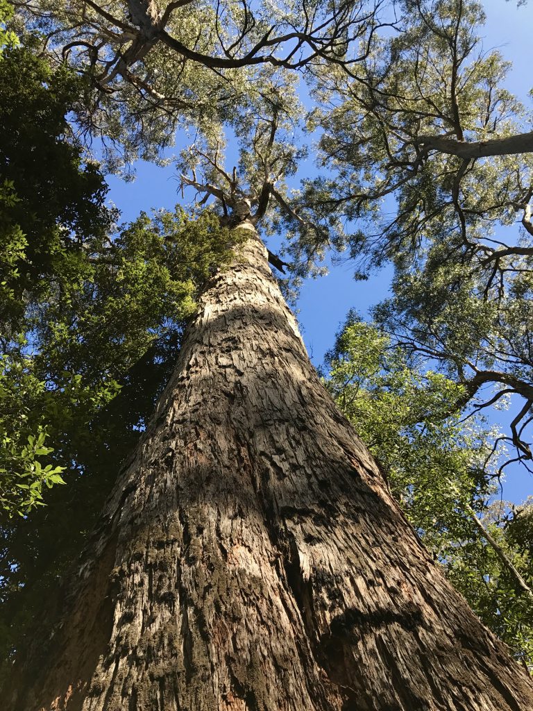
Australia may be the evolutionary source of Eucalyptus trees, as more occur there than anywhere else in the world. Eucalyptus are the tallest flowering living organism. Tasmania has some of the biggest. This ‘Swamp Eucalyptus’ is over 260 feet tall, about the same height as Hoover Tower at Stanford University.
Tasmania was part of the ancient supercontinent ‘Gondwana’. Here is a video showing an animation of how this is believed to have occurred. The video just covers the period from 460 million years ago (460 MYA) to the present.
ContinentalDrift from Mel Malinowski on Vimeo.
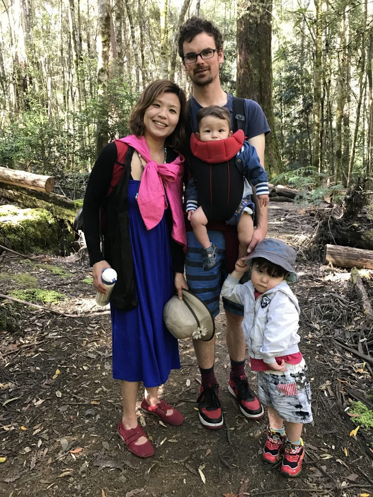
A local family I met on the trail
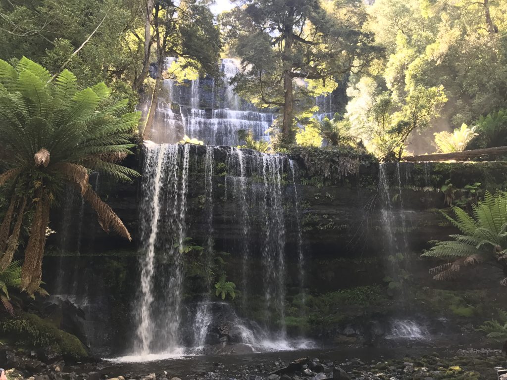
Russell Falls, a lovely three tier wedding cake of a falls.
RussellFalls from Mel Malinowski on Vimeo.
There are also several other lovely falls in this area. At night, I walked in to near Russell Falls to see the ‘glow worms’ along the trail. Not photographable!
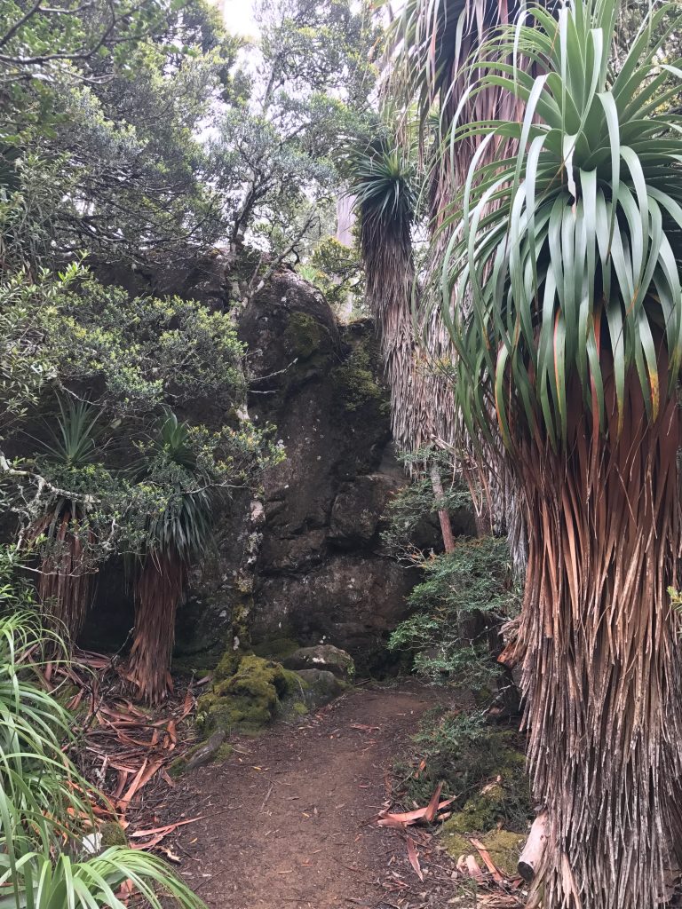
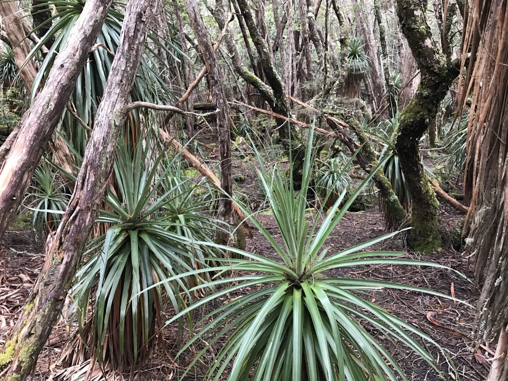
Another day, I drove way up in the hills, and walked around Dobson Lake. They have Pandani grove, one of the many plants here that grow only in Tasmania. Tasmania was separated from mainland Australia 12,000 years ago, and numerous plants evolved and became unique.
I stayed in a B&B along a country road. They had some interesting critters:
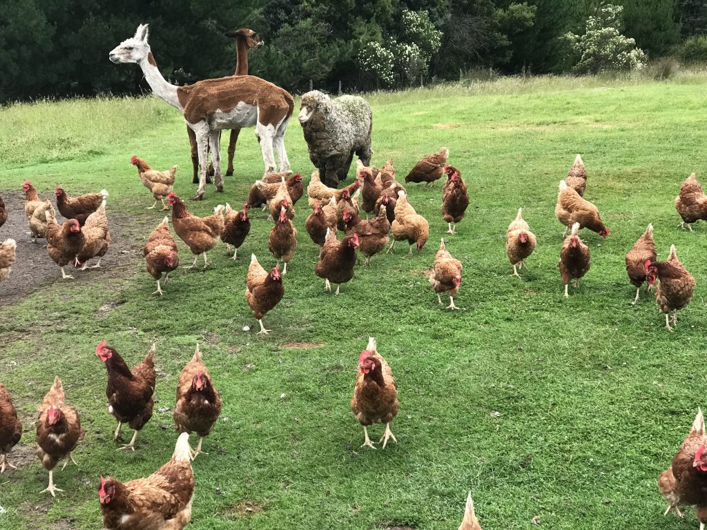
A couple of alpacas, who are good guard animals. They protected this Merino sheep from me and the chickens. The chickens mobbed me and pecked burrs from my boots.
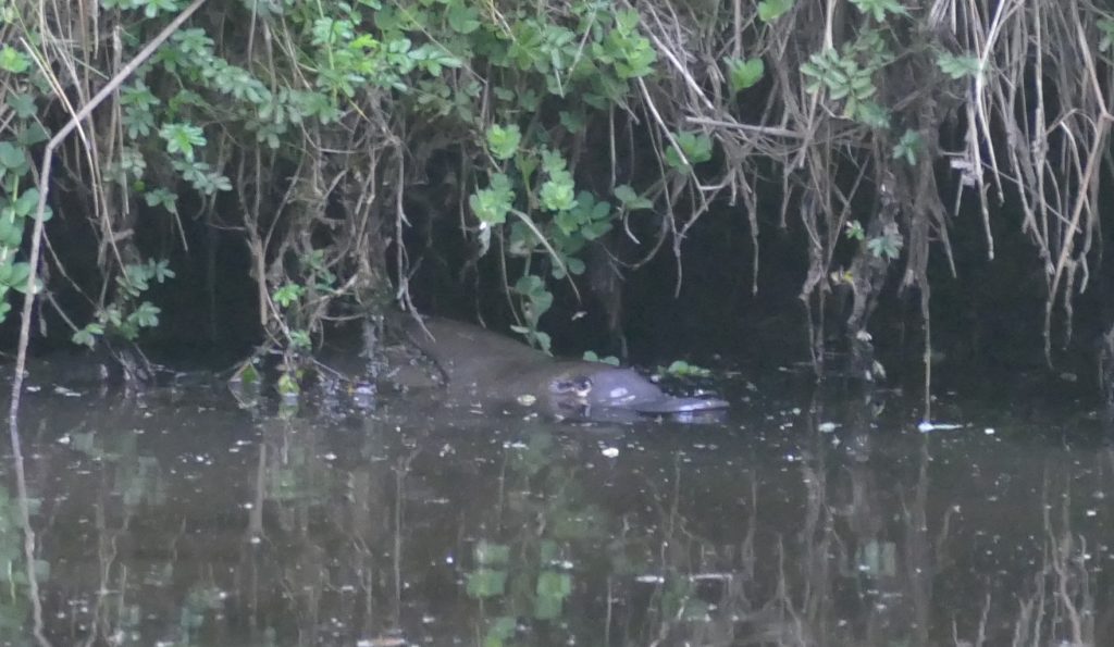
They had a pond up the hill with a platypus in it. I got up at 5am and went up and watched it swim around.
Then I headed further north. Driving through a park area, I stopped to take a walk on one of the ‘Great Short Walks’. As I walked towards the trail, a critter a bit smaller than a soccer ball was waddling along:
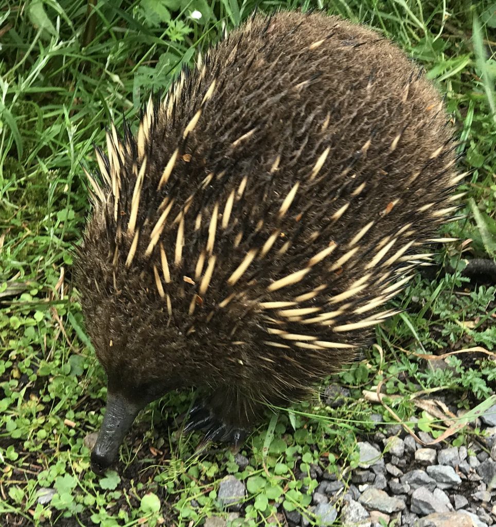
Though it looks a bit like a porcupine, it is not. It is an anteater! Note the long nose.
Rufous Wallaby, Tasmania from Mel Malinowski on Vimeo.
This is a Rufous Wallaby, a rather small relative of the Kangaroo
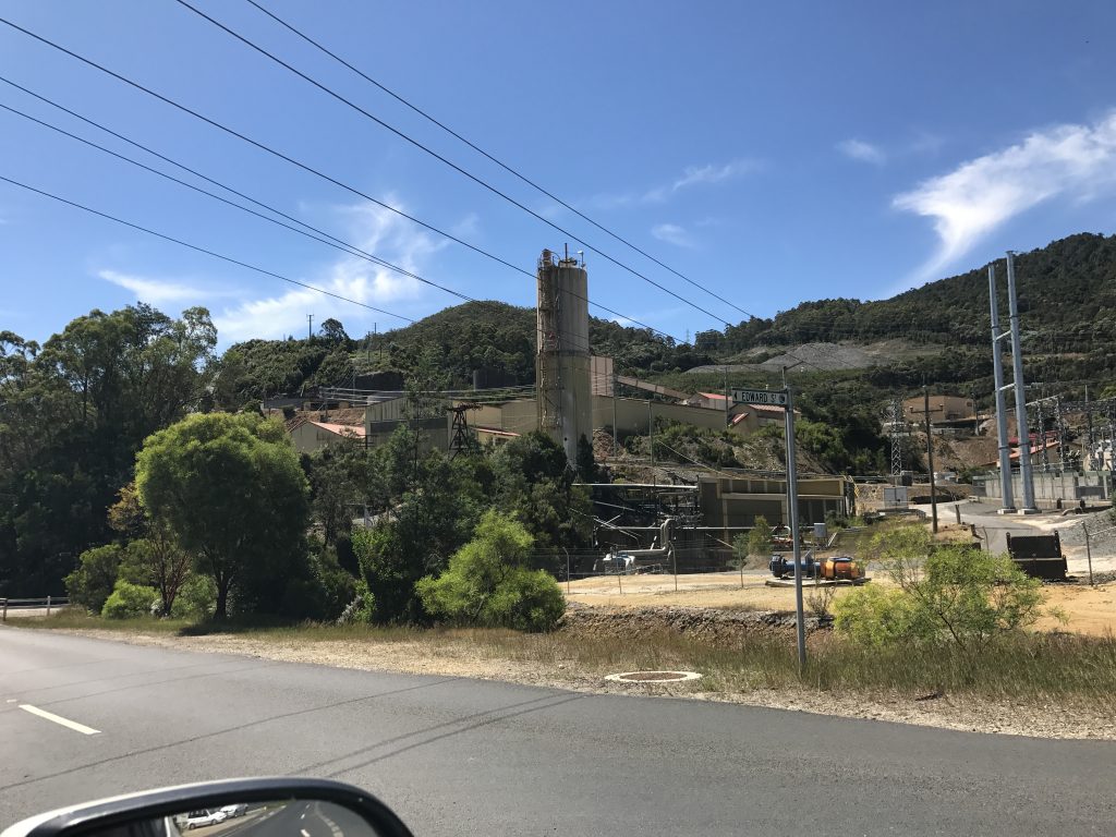
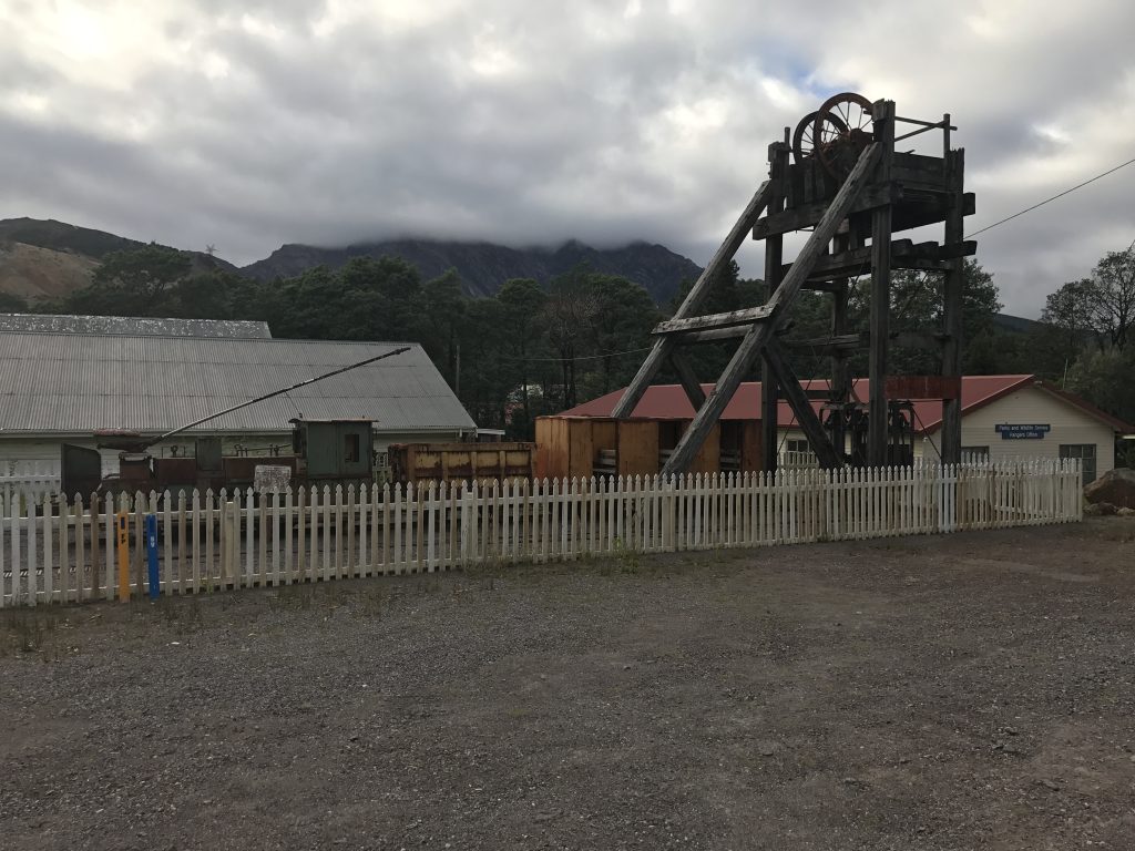
My next stop was Rosebery, a mining town like many in Western Tasmania. This is a working mine that extracts mostly zinc, as well as some silver and gold.
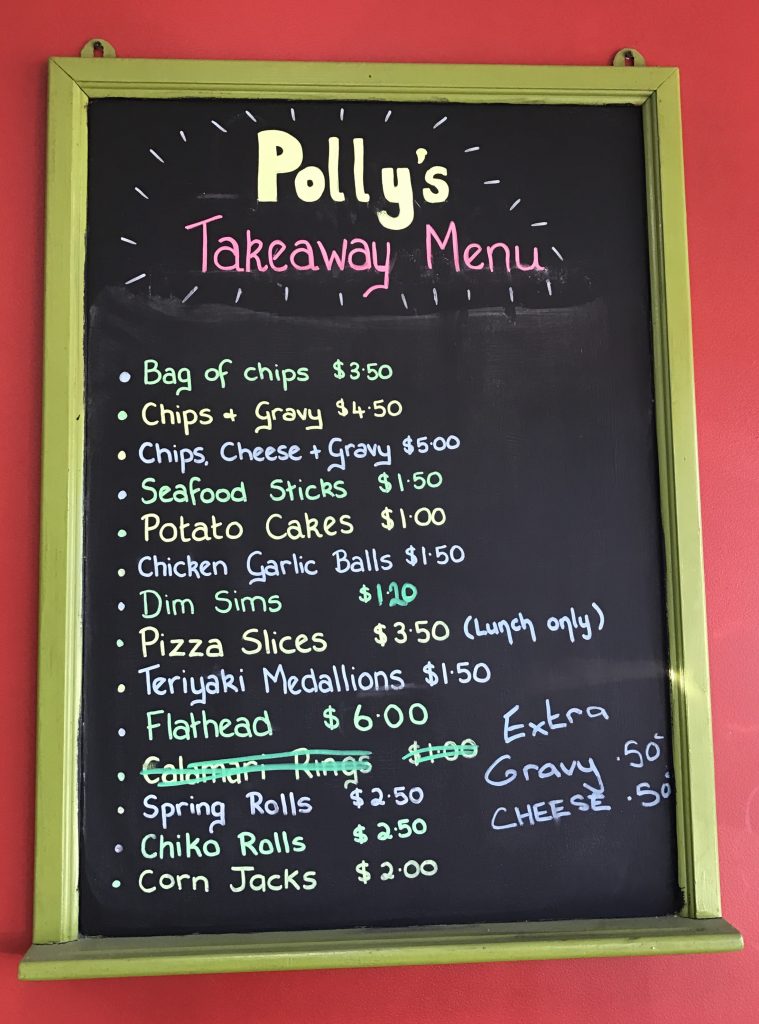
You know you have reached a corner of the world that time has forgotten when there are no MacDonalds, KFC, Burger King, or Subway sandwich shops. I did not see another of these until I reached the north coast at Devonport. Dim Sims must be an Australian invention. They are NOT won tons, or dim sum, or pot stickers. They are a little pastry filled with minced meat, deep fried. I think I’ll stick with pot stickers. $10 AUD (Australian Dollars) are about $7.29 just now, so reduce these prices by about 27%
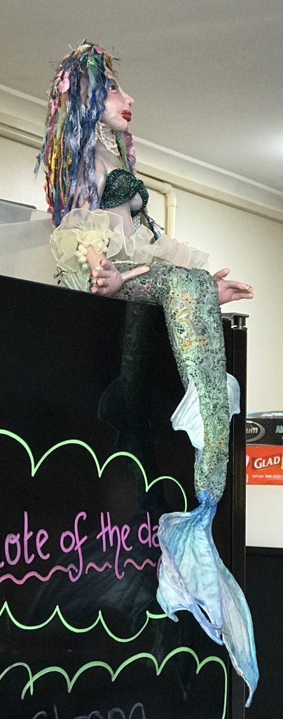
This mermaid watches over the Polly’s kitchen.
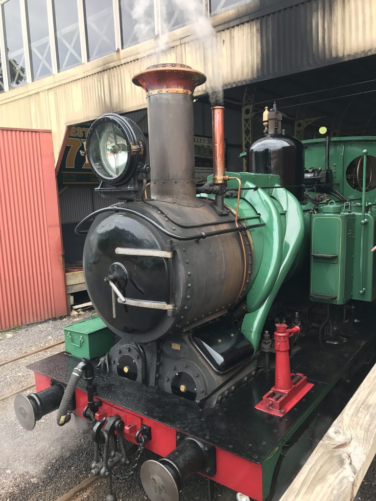
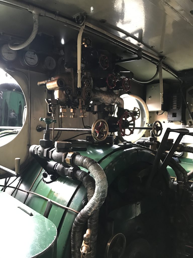
I drove through Queenstown, site of a huge copper mine. It has the ‘Western Wilderness Railroad’, so I drove back the next morning to take a ride on the steam train.
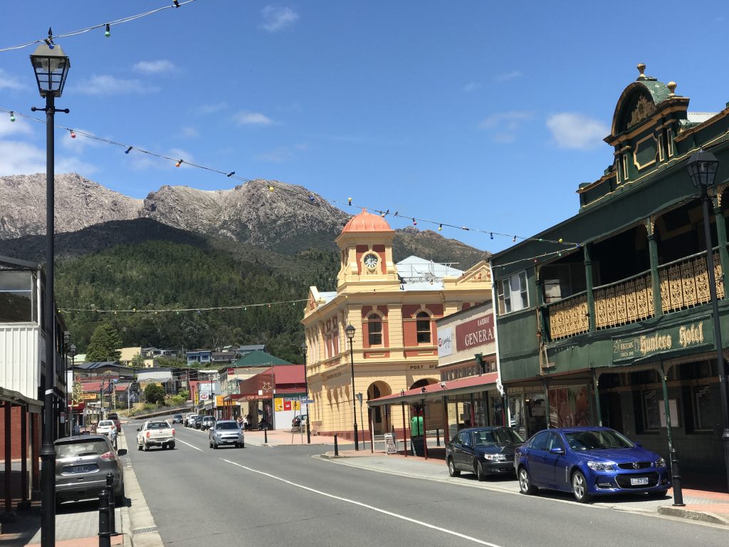
Downtown Queenstown.
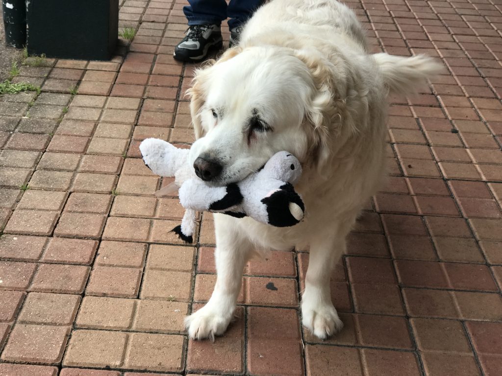
Where I met a local golden retriever with a security blanket of sorts he carries around:
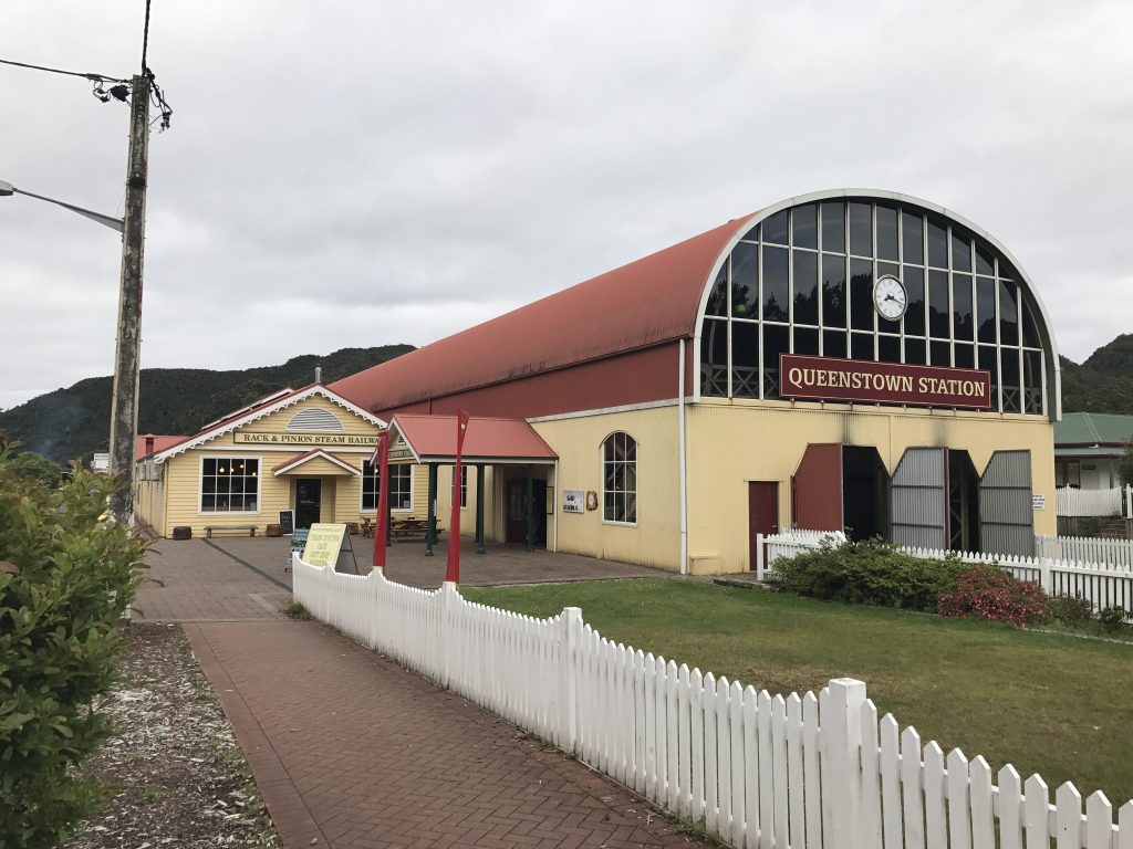
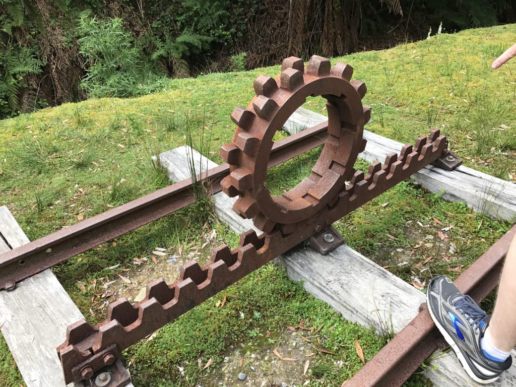
The ‘Rack and Pinion Steam Railway’ starts here. They needed the rack and pinion to climb over the steep hill on the way to the coast.
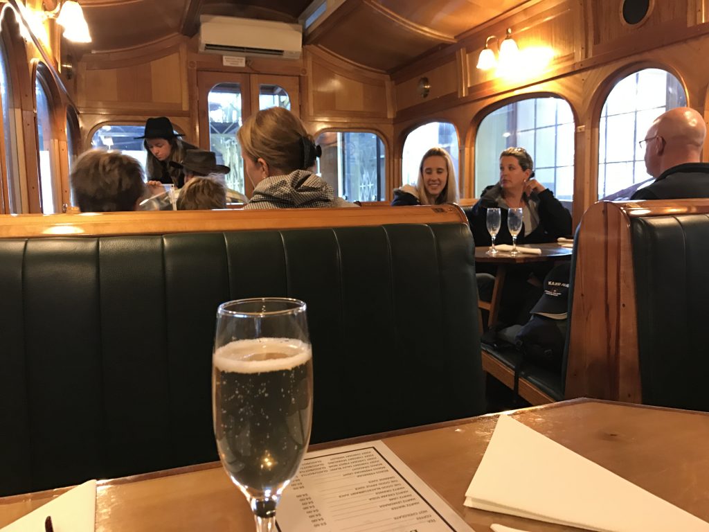
Old-fashioned coach and dining car
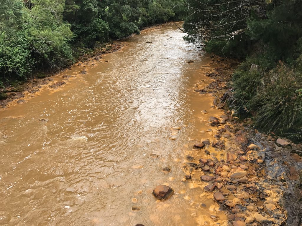
The yellow color in the river is due to runoff from the spoils of the big copper mine. It is said that the river may take 1,000 years to recover, if ever. There have been many instances of this kind of damage from mining in the USA. Unless strict environmental rules are enforced, much harm can be done by mining and other such activity.
This is difficult politically, as in the short run, companies and local people often want the work and money and dismiss the long-term effects. Read “Hayduke Lives!” and other works by Edward Abbey. If we ignore the impacts of mining, fracking, and oil drilling, and simply shout ‘drill, baby, drill!’, we may find ourselves living in a much degraded world as you see in this river. As Joanie Mitchell sang “Don’t it always seem to go, that you don’t know what you’ve got till it’s gone. They paved paradise, put in a parking lot.”
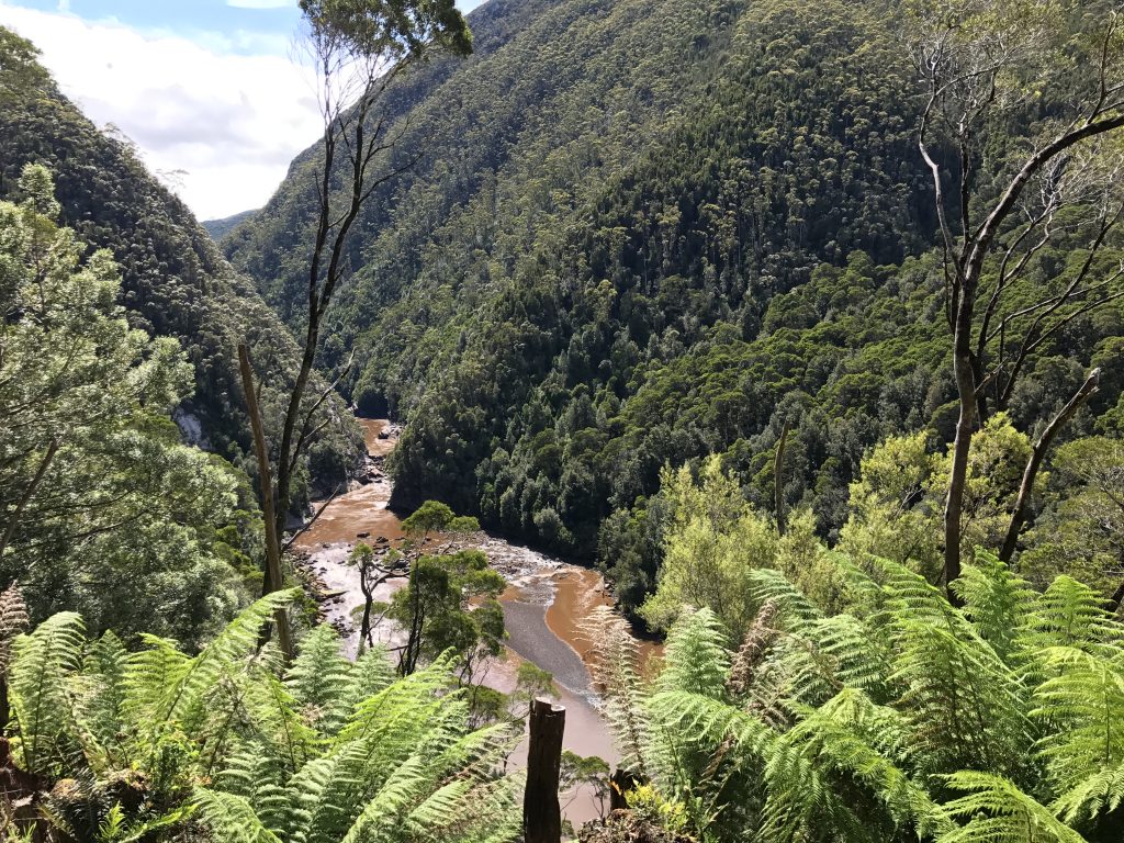
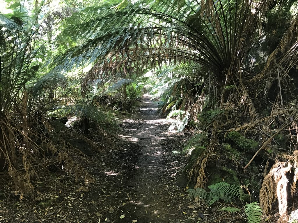
I also hiked in to nearby Montezuma Falls, one of the highest in Tassie.
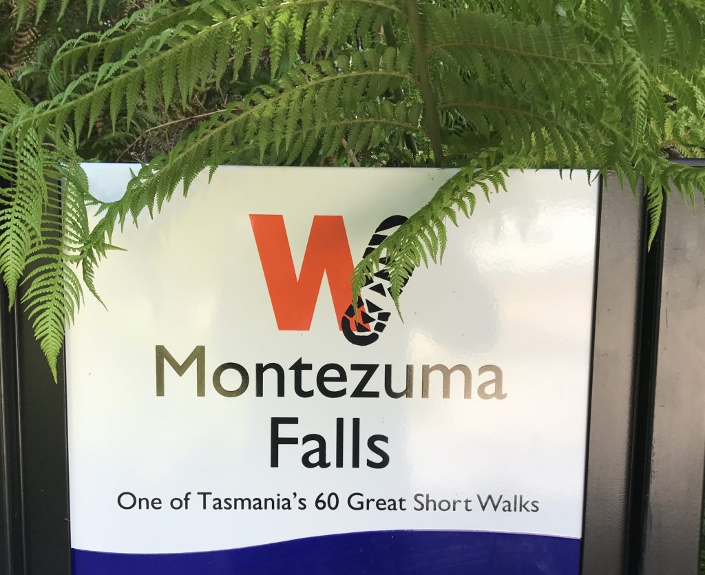
I am hiking as many of these 60 walks as I can. ‘Short’ is a bit of a misnomer. Cradle Mountain summit, for example, is 7-8 hours and 3000 feet of climb. ‘Long’ means multiday backpacking trips.
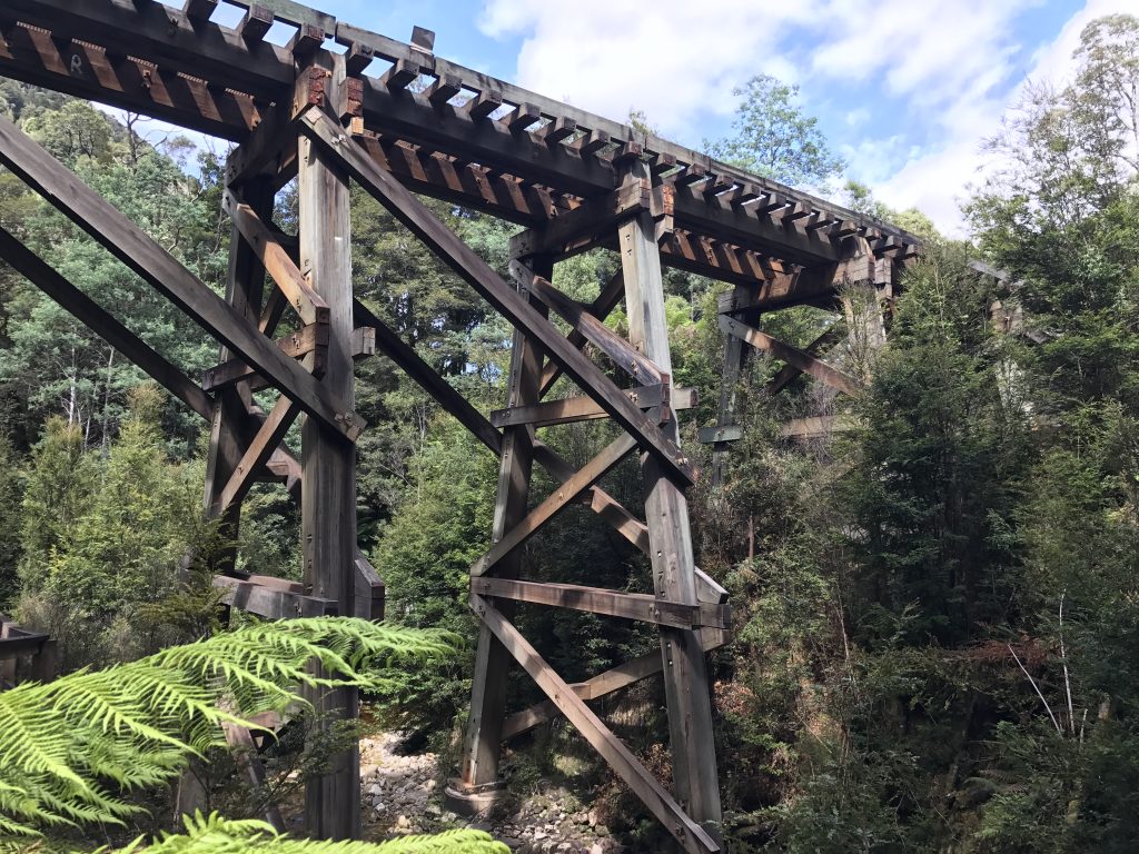
To get to the falls, you hike along the abandoned right of way of a narrow gauge railway built in 1890 to carry wood from the mountains to a smelter 45 miles away.
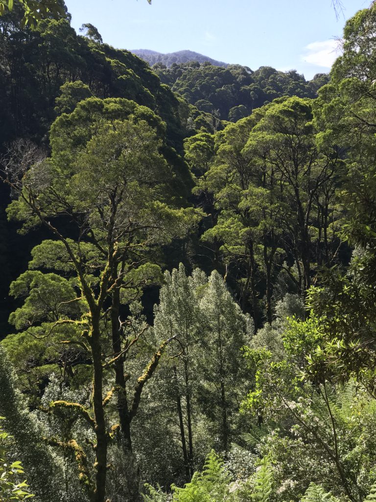
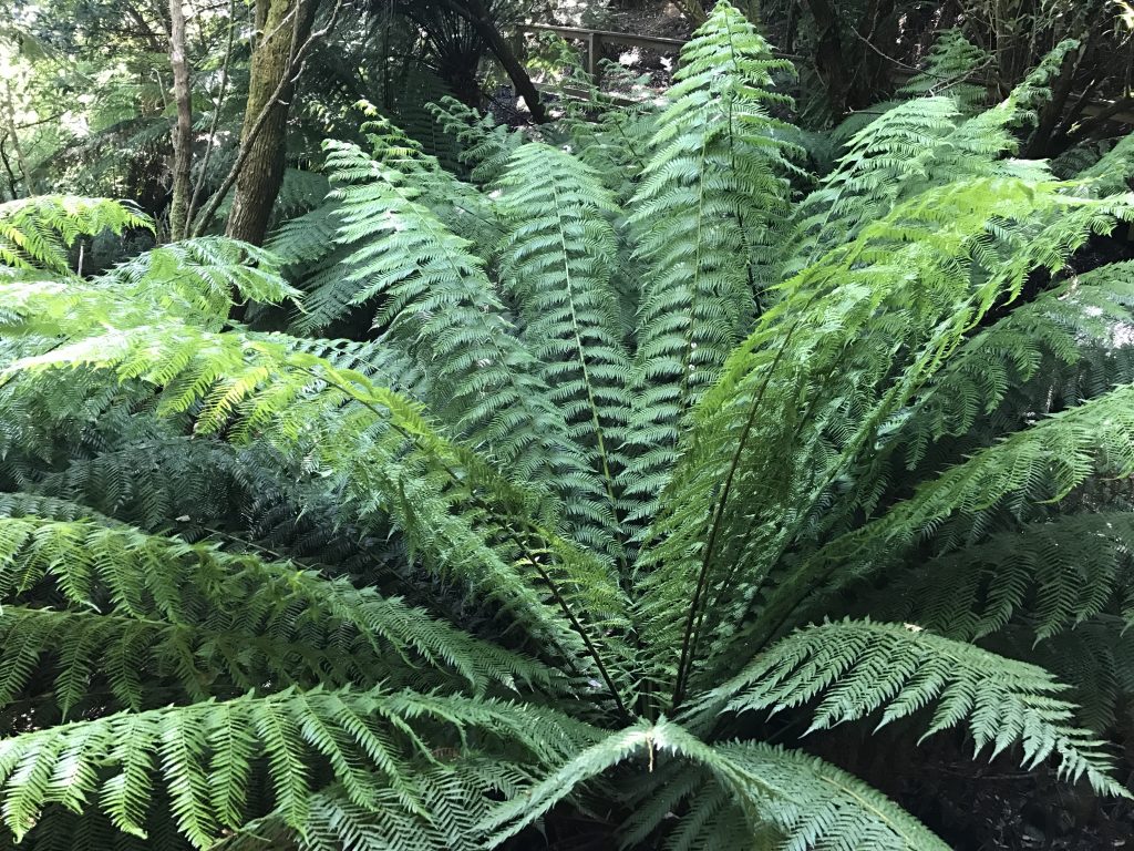
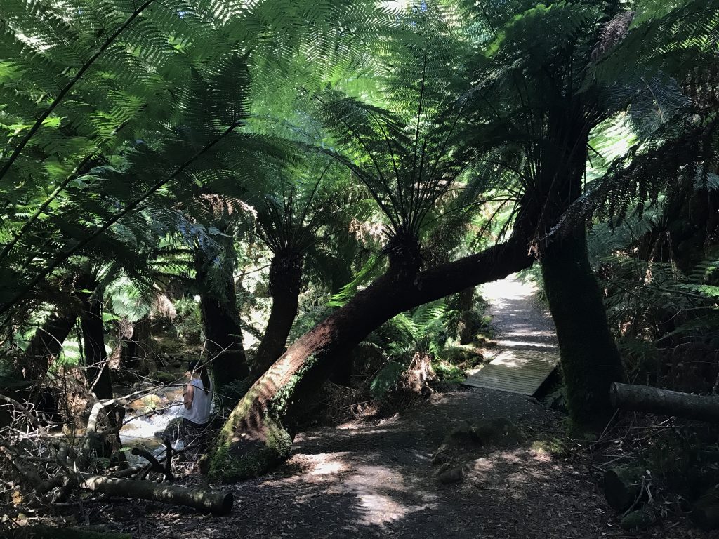
This is a temperate rain forest area. This is second growth, as the area was clear cut for wood.
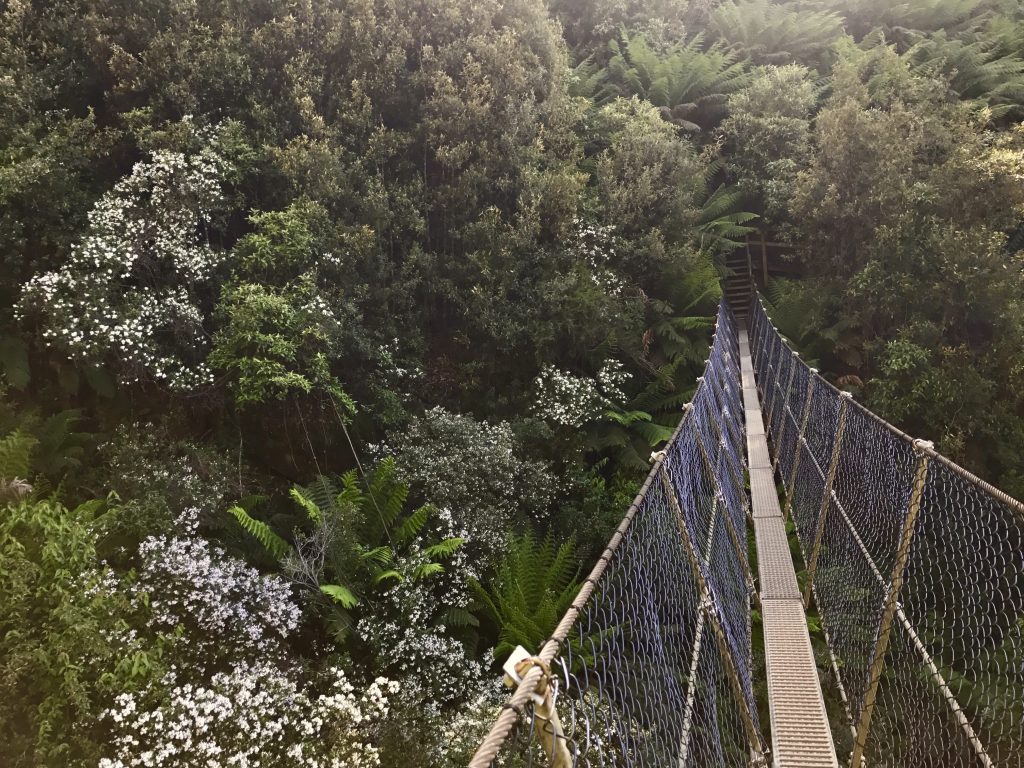
A 158 foot long cable bridge spans the canyon just below the falls. It must be almost that far above the river, and standing on it is a thrill. That is where this picture was taken:
Next, I drove an hour northeast to Cradle Mountain National Park. When I arrived at 8am, the trailhead was buried in fog. I began my hike to the summit of Cradle Mountain anyway, hoping it would clear off. It did not, and although I had a lovely misty hike, I had NO idea where I was along the way, or when I summited. Well, some idea, as the trail goes almost straight up near the top, clambering over car size boulders. Bad luck that it did not clear.. 9 miles and 3,000 feet climb. Oh, well.
The next morning, however, arrived clear and blue sky, so I decided to make the hike again. This time, it was spectacular. Here is a collage of pictures. The upper part of this trail involves clambering over huge boulders, some taller than you are, and is very steep. Lots of fun! The visibility from the top was more than 60 km. A fellow from Melbourne said that there were no more than 20 days a year this clear at Cradle Mountain. Today, I was in luck.
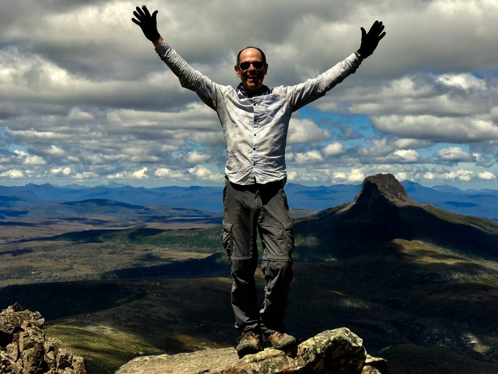
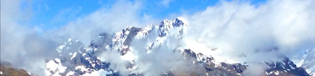
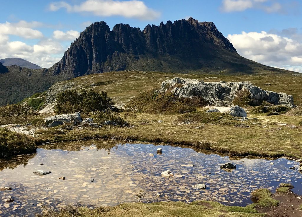
At last, the summit of Cradle Mountain in the sunshine! The top of Cradle mountain is an example of a ‘Nunatak’ or glacial island that stuck out above the glaciers, and hence was not itself worn down by the glacier. That is Barn Bluff in the background, which would be interesting to climb!
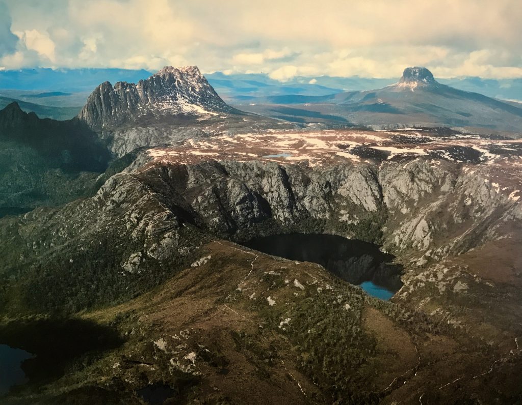
Aerial view of Crater Lake, Cradle Mountain (on the left) and Barn Bluff (on the right) with a little snow.
Along the trail on the way back, I saw a wombat about the size of a big rabbit, out eating:
That evening, I went over to a nearby Tasmanian Devil sanctuary, where they are breeding this small endangered marsupial that is only found in Tasmania. A communicable disease is devastating wild populations, so several ‘insurance’ populations of TD are being grown, in the hope that a vaccine will eventually cure this in the wild populations, and they can be re-introduced.
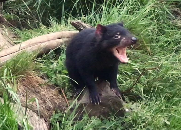
The Tasmanian Devil is the largest marsupial carnivore. It mostly scavenges, as they do not hunt in packs, and are not very effective predators. ‘Devil’ is derived from the Maori name for them.
Here is a video showing four Tasmanian Devils feeding on the carcass of a Wallaby. Notice that one smaller animal is timid, and is having a hard time getting her share of the meat.
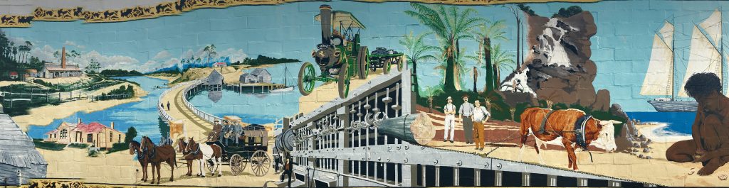
Moving on, I drove east to Sheffield, ‘The Town of Murals’.
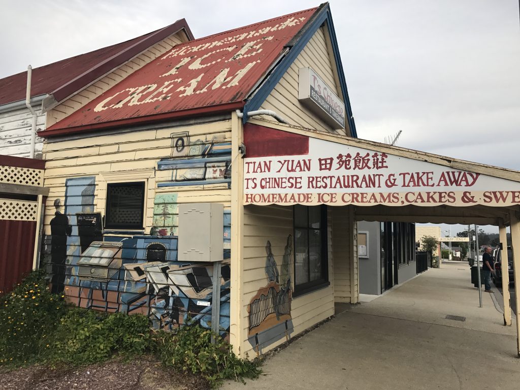
I think this has been preserved for historical reasons, as a modern version of this restaurant is just next door.
Just outside of this small town is this rugged massif.
There is an annual mural painting contest in Sheffield. Here are a few of the many murals scattered around town, many of them decorating buildings.
I chose Sheffield because it is near to Mole Creek Karst National Park, where there are many limestone caves. You can take tours through two of them, Marakoopa cave and King Solomon’s cave. I found the latter the most interesting. It is rather cool in the caves, about 9°C, so you bundle up. The variety of stalactites and stalagmites are incredible and amazing. Here are a few views.
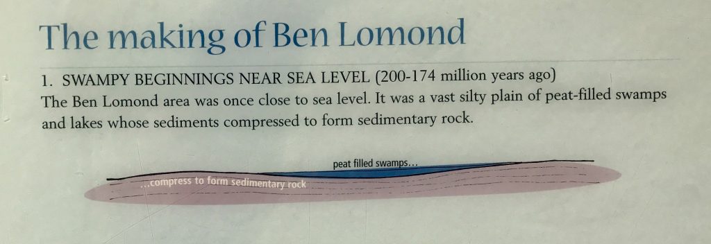
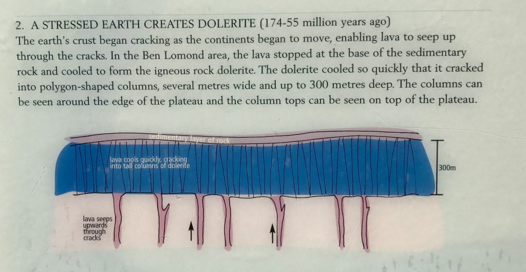
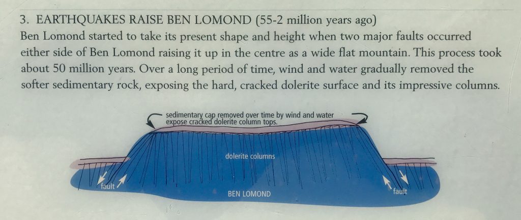
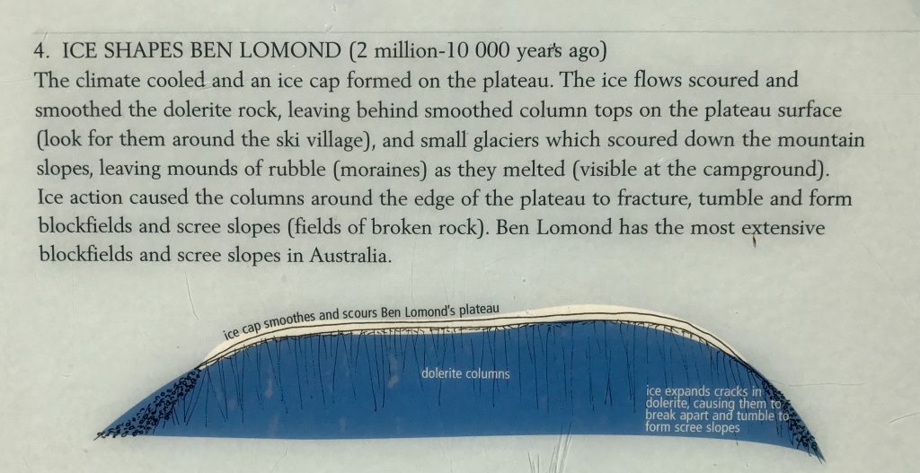
There is a big ‘Central Plateau’ in the middle of Tassie. It was formed when igneous rock (Dolerite) intruded up through the sedimentary rock and formed a cap, which glaciers and rivers eroded away on two sides.
Here is a view of this area from ‘Devil’s Gullet’ overlook:
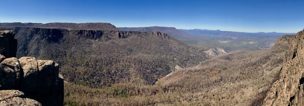

In this closeup, you can see Cradle Mountain far in the distance (the right most bump on the horizon). The Dolerite here has broken into its characteristic columns. This is similar to the USA area called ‘Devil’s Postpiles’.
I next drove to Devonport, on the north coast, and on to Baker’s Beach. Tomorrow, on to Ben Lomond National Park, and then the east coast beaches.
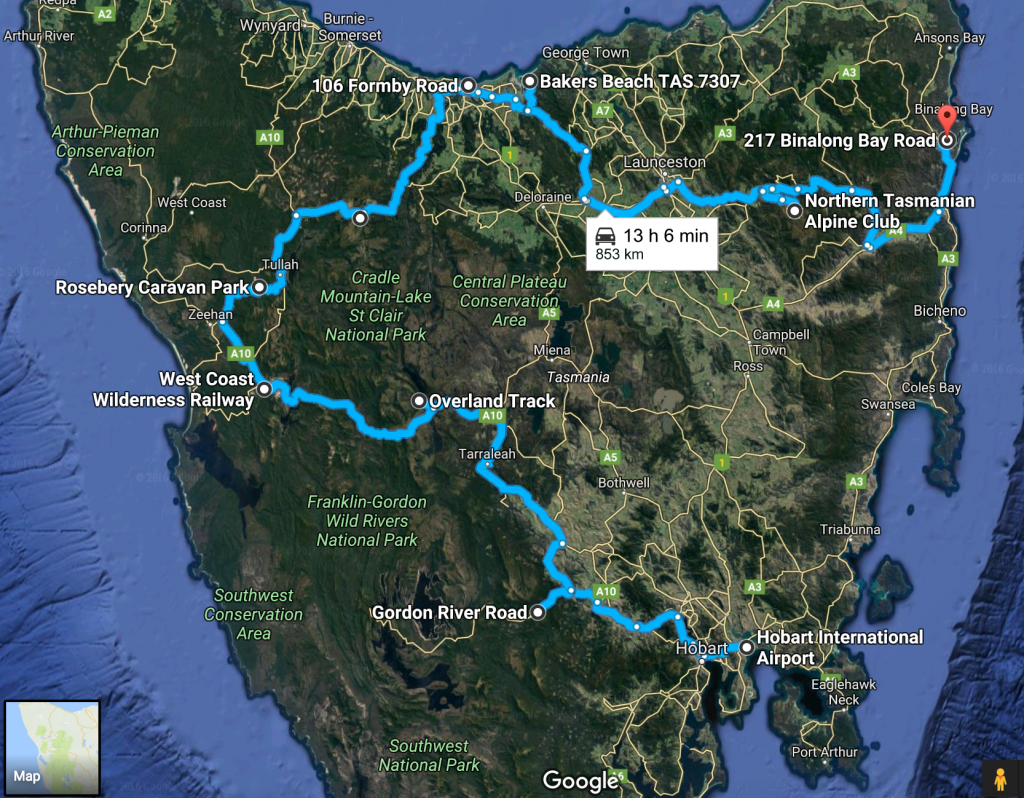
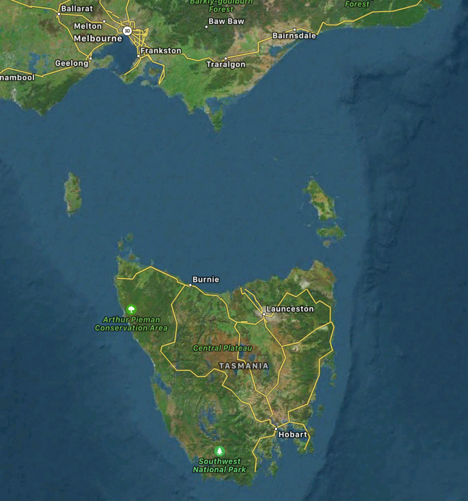
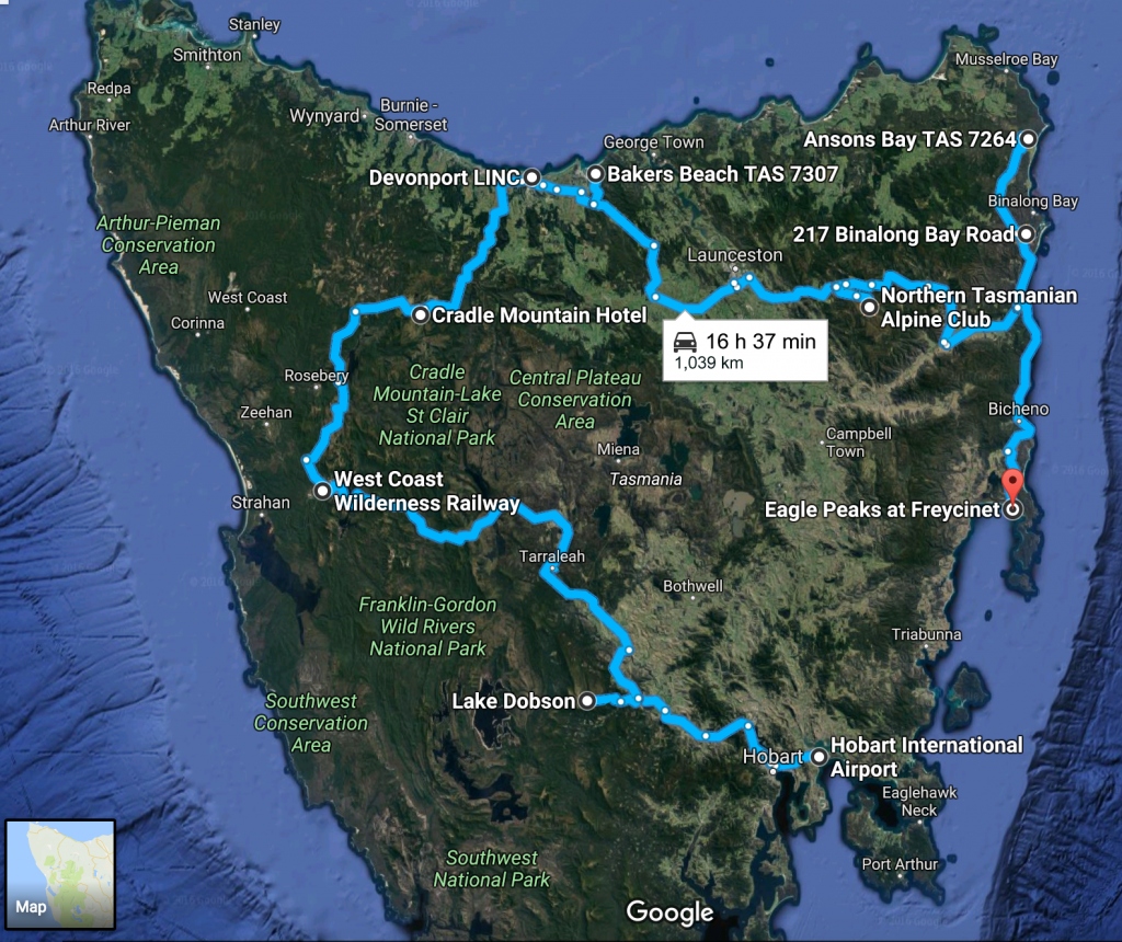
My journey around Tasmania so far (somewhat simplified, I did more, but the Google Map will only show 10 waypoints). I’d love to go in the area in the bottom left corner of the map, but there are no roads! I may get near it later in my trip.
I decided that I should visit the east coast, so I headed that way, taking time to drive to the top of a big plateau out in the middle of the relatively dry (compared with the western areas) farmlands and forest area. The crops here are irrigated.
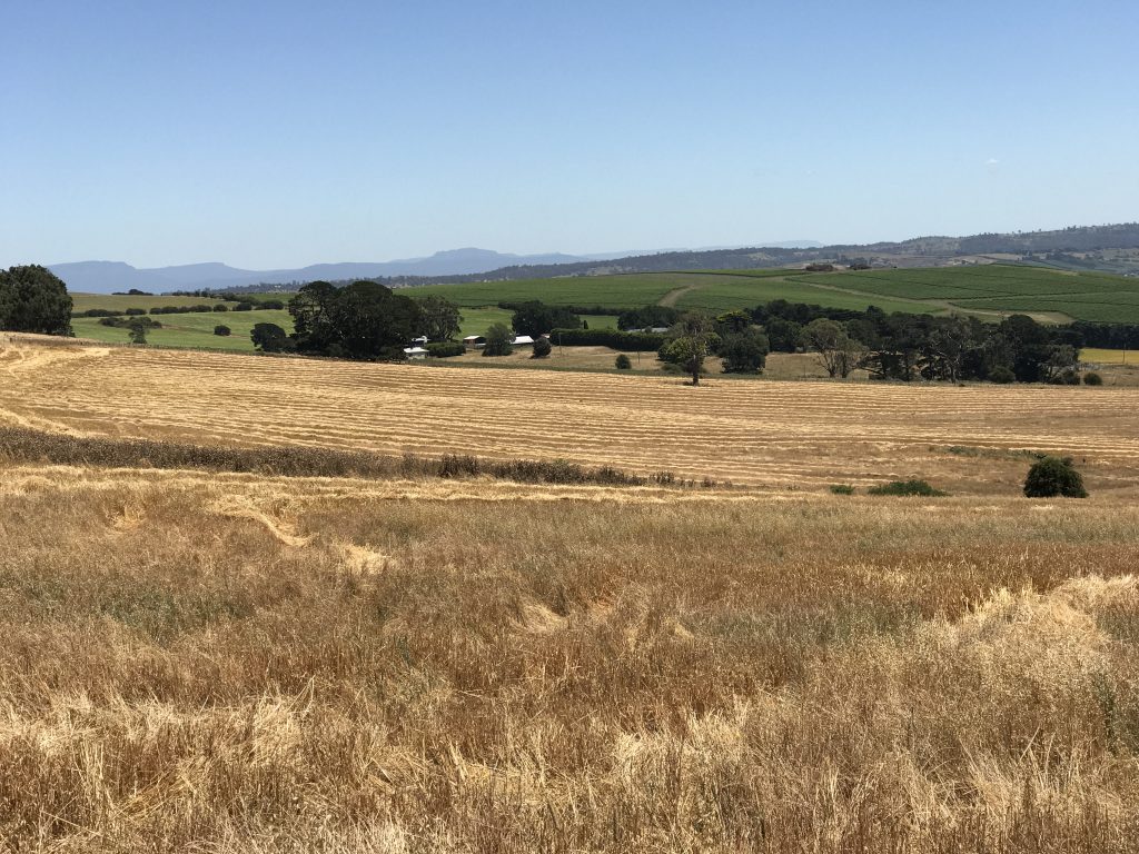

Most hay is bailed in large rolls, and then wrapped in plastic for the winter, left stored around the edges of the fields. Here is a roll bailer in action. Anyone else think it looks like a large green hen?
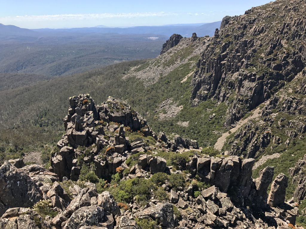
Ben Lomond National Park is the highest road-accessible area in Tasmania.
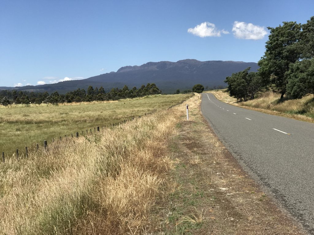
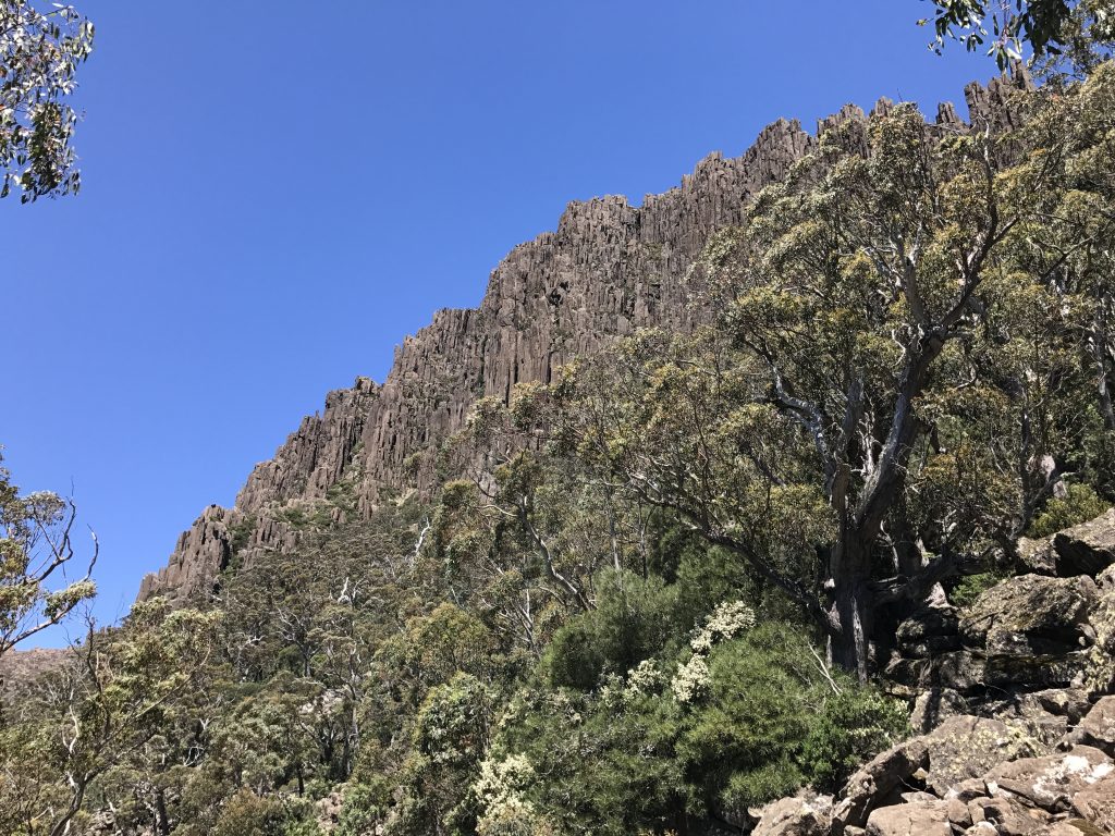
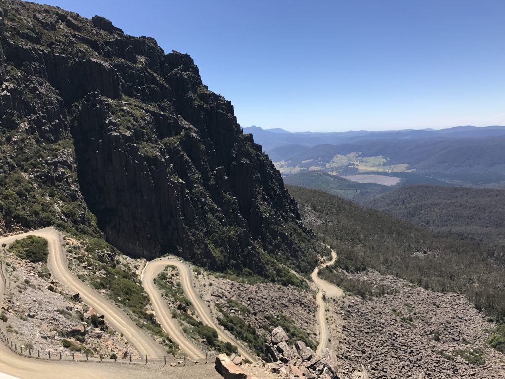
Rugged Dolerite columns. The gravel road up includes a steep switchback section they call “Jacob’s Ladder”, and it is one of the more hair-raising roads I have driven:
The top of the plateau has a ski area with winter-time lifts, and the Northern Tasmanian Alpine Club
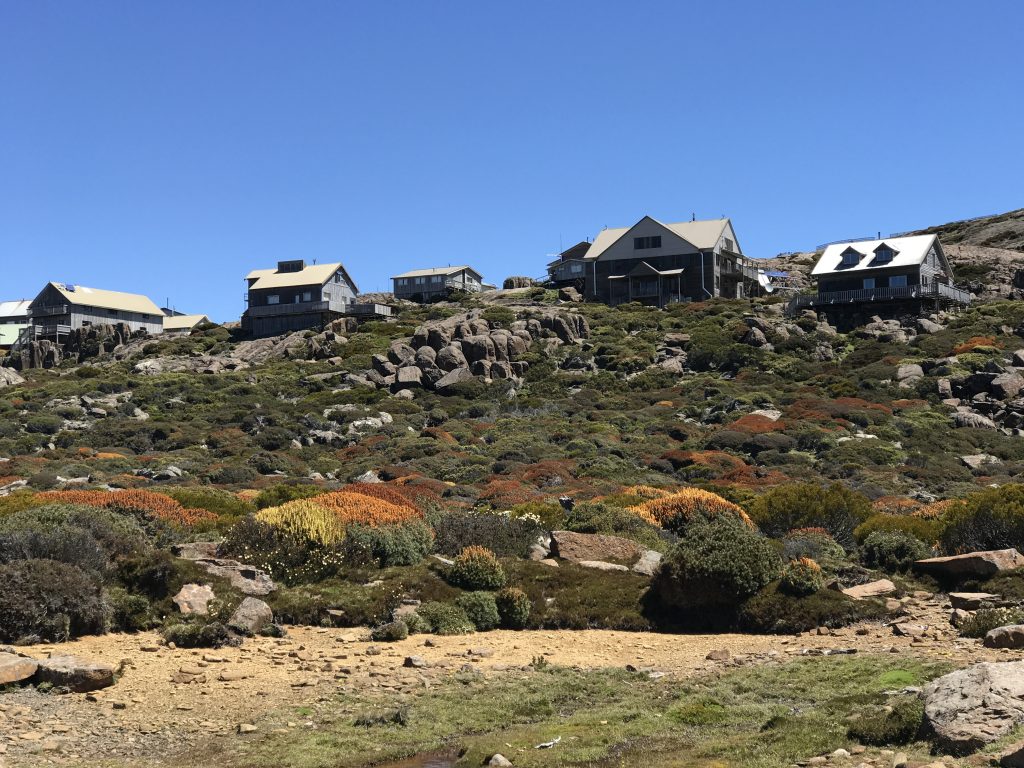
Ski chalets
The geology here is so interesting I’m including the details:
The rugged roads up here require a lot of gas, and as I drove on toward the coast, I noticed that I was getting down toward ⅛ of a tank. So at the first opportunity, I sidetracked a bit to a little town which thankfully had two pumps sitting outside a pub that was open on Sunday.
Unfortunately, the one gas pump had a sign ‘Out of unleaded gas’. Uh-oh. The locals seated on picnic tables outside discussed my plight, and were pessimistic about my chances of making it the next 90 km. In Tassie, most little gas stations are closed on Sundays. This left me wishing I had thought to top up back in the last big city this morning.
I decided to conserve the few liters of gas left by careful driving, and managed to make it down to the coast and finally found an open station! I shall try to be more careful in the future. On the way, I was driving through an area of huge fields and no farm houses or mobile phone service, where I would have faced a walk of many miles to find help.
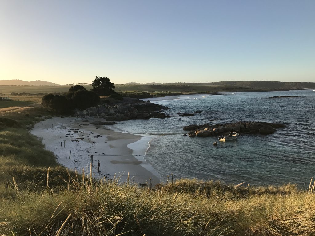
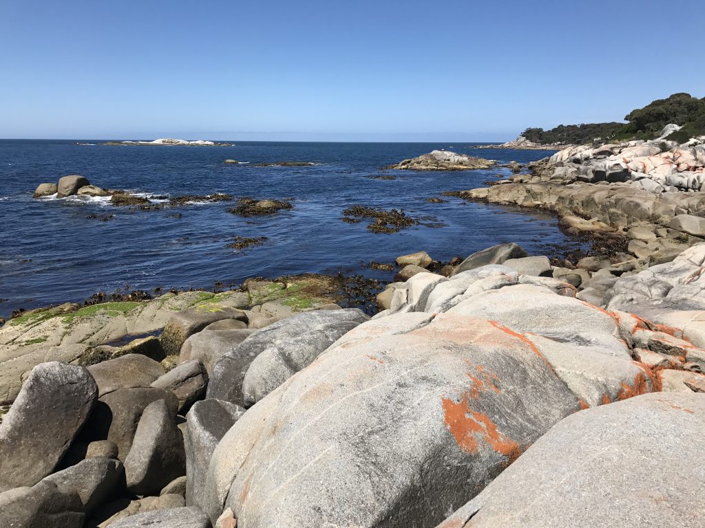
At last, I arrived out at my dwelling for the next few days, in St. Helens near the “Bay of Fires”.
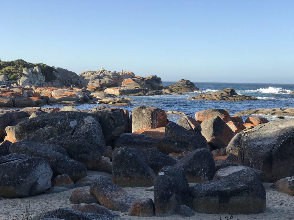
The orange on the big dolerite boulders are lichen.
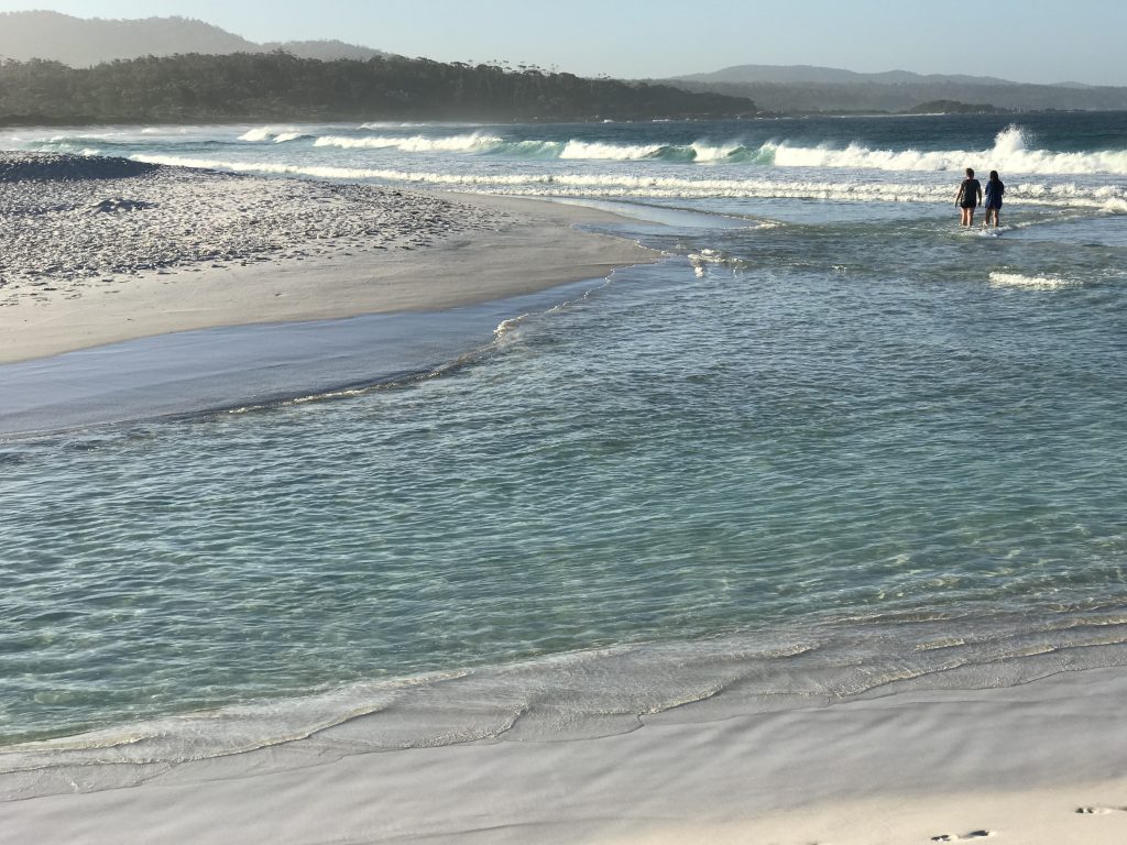
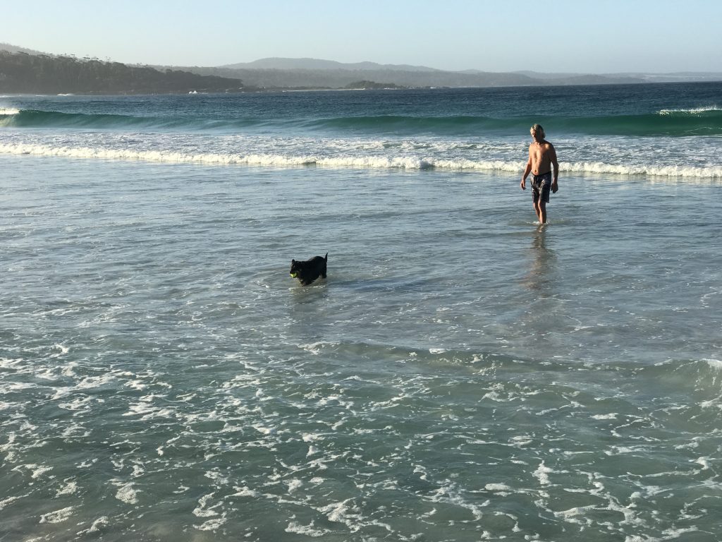
I plan to go swimming myself. The water is not quite Hawaiian warm, but clear and pretty. However, there are a lot of big ‘March flies’ that pester you especially near or on the beach and bite you to suck blood if they can. They are very persistent, darting at your face.

That makes it harder to enjoy hanging around these beautiful beaches. March flies are a common pest in Australia. Fortunately, I came prepared for any number of flies and mosquitoes. The trick is to completely cover up, head to toe. This includes wearing thin gloves and a net over your hat and head. The head net is almost transparent, and is not a bother. I had to use this outfit in New Zealand in areas with sandflies.
St. Helens is not without murals:
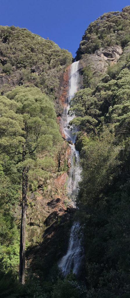
My AirBnB hostess recommends St. Columba Falls, so I headed up there this morning.
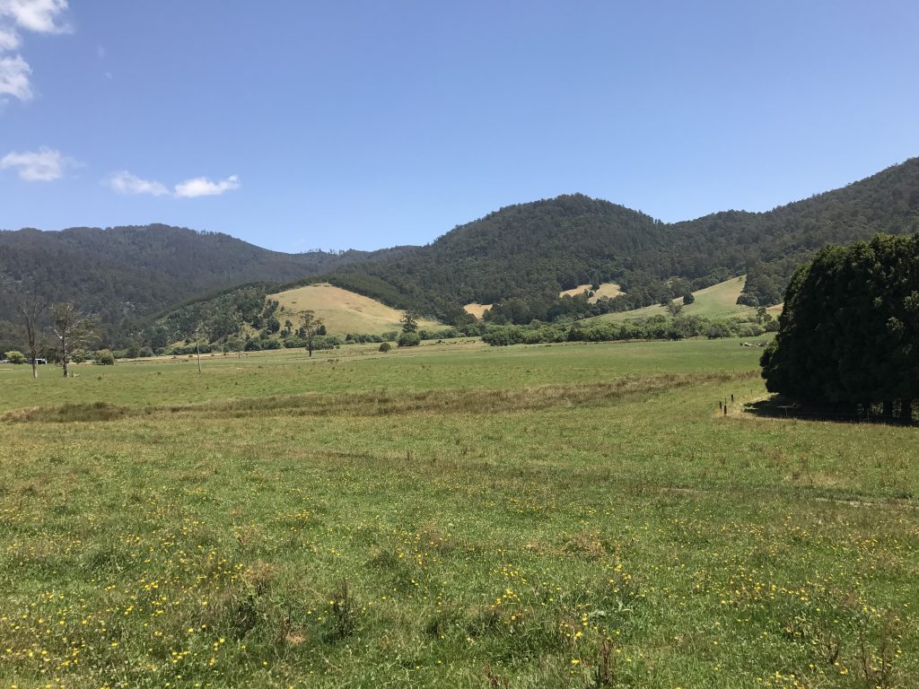
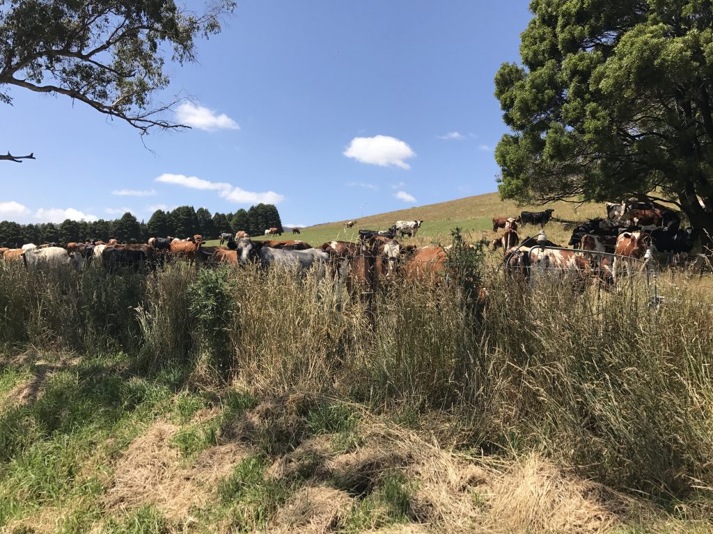
Some nice farmland along the way.
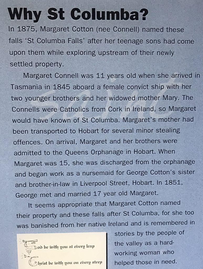
With a very interesting story. Back from the days when Australia was used as a penal colony for Great Britain. Apparently, even minor offenses could get you sent there!
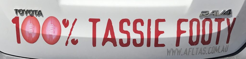
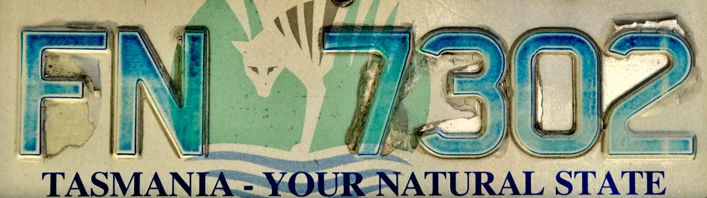
I saw this license plate there:
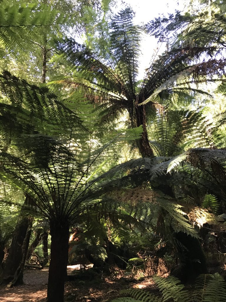
Really big tree ferns!
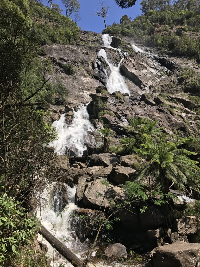
St. Columba is a powerful, 300 foot high waterfall. I liked the falls so much, I decided to do a little Class 4 rock climbing up to the base of the upper falls. A bit tricky, as any wet rocks were very slippery.
A woman from Brisbane, Australia that I met along the trail who offered to send me pictures of my climb up the falls, which was watched with interest by those at the viewing platform.
I took this video there (slo-mo)
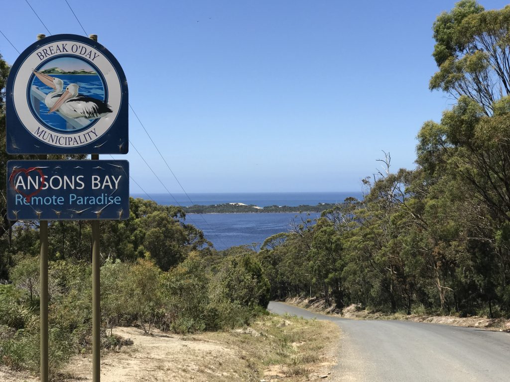
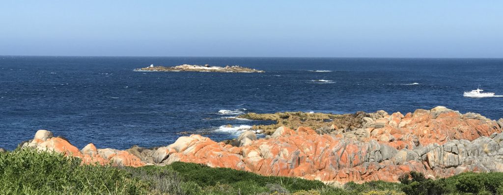
Next, I drove over to Ansons Bay at Mount William National Park.
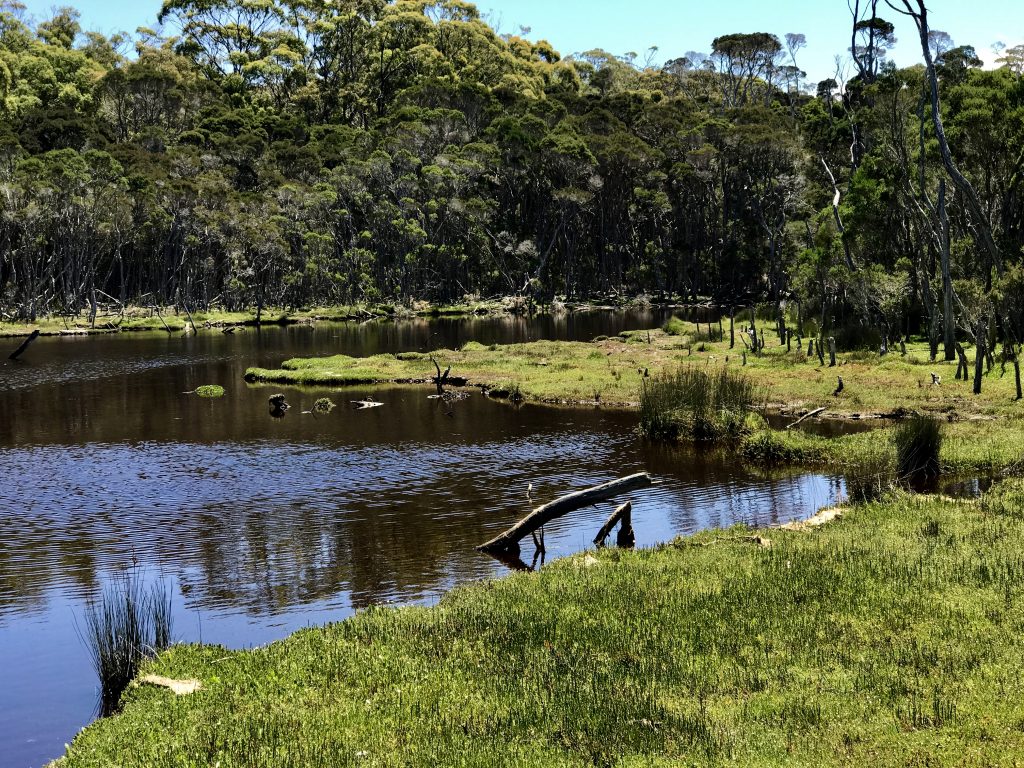
An estuary area there.
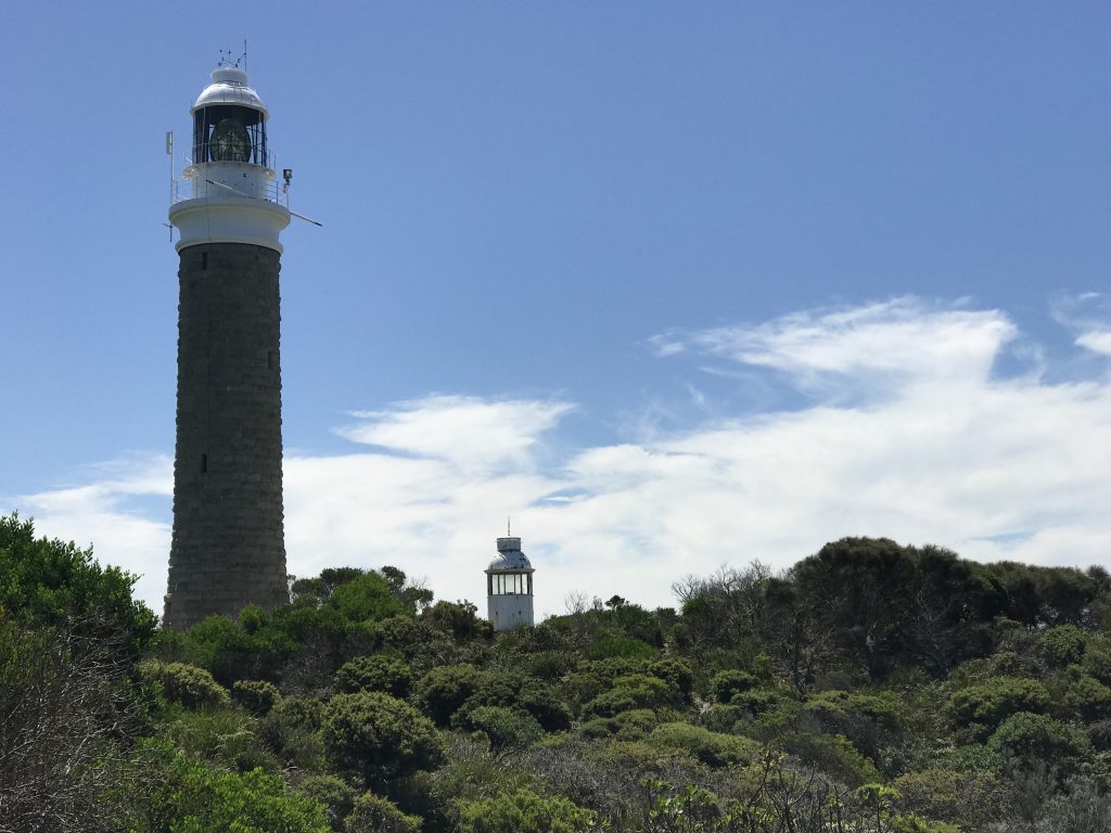
Eddystone Point Lighthouse, first built in 1869
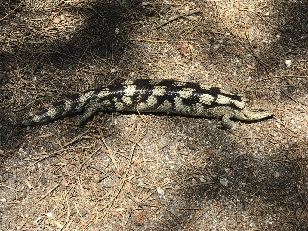
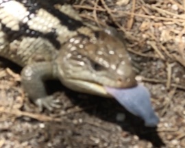
A blue tongue skink, about 12″ long.
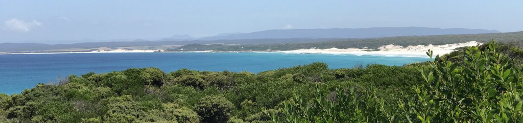
Tomorrow, I drive further south to explore Freycinet National Park.
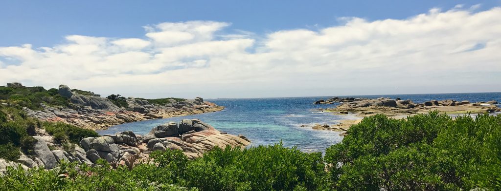
A pretty drive along the coast.
My first hike at Freycinet NP was from Sleepy Cove up to the top of Mt. Parsons.
Sleepy Cove is lovely:
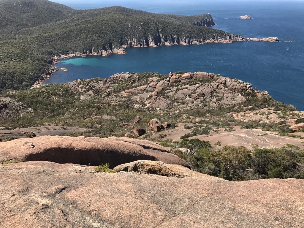
The trail is steep and marked only with occasional rock cairns. In the upper areas, you are walking up weathered Dolerite domes so steep you barely have traction with vibram soles. But the way is spectacular.
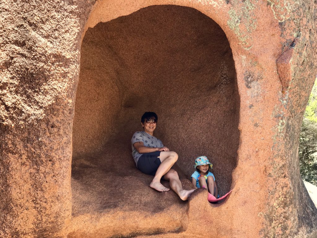
Great hiking options here. My next hike was the Peninsula Loop, which normally is done camping, taking 2 or 3 days. I did it in one day, 30 km (18+ miles) and 1200 meters (3900 feet) climb including a side trip to Freycinet Mountain.
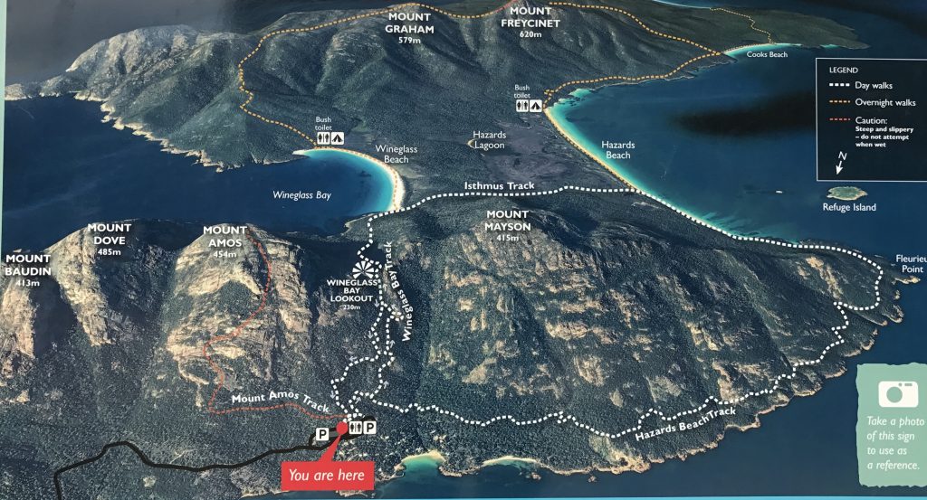
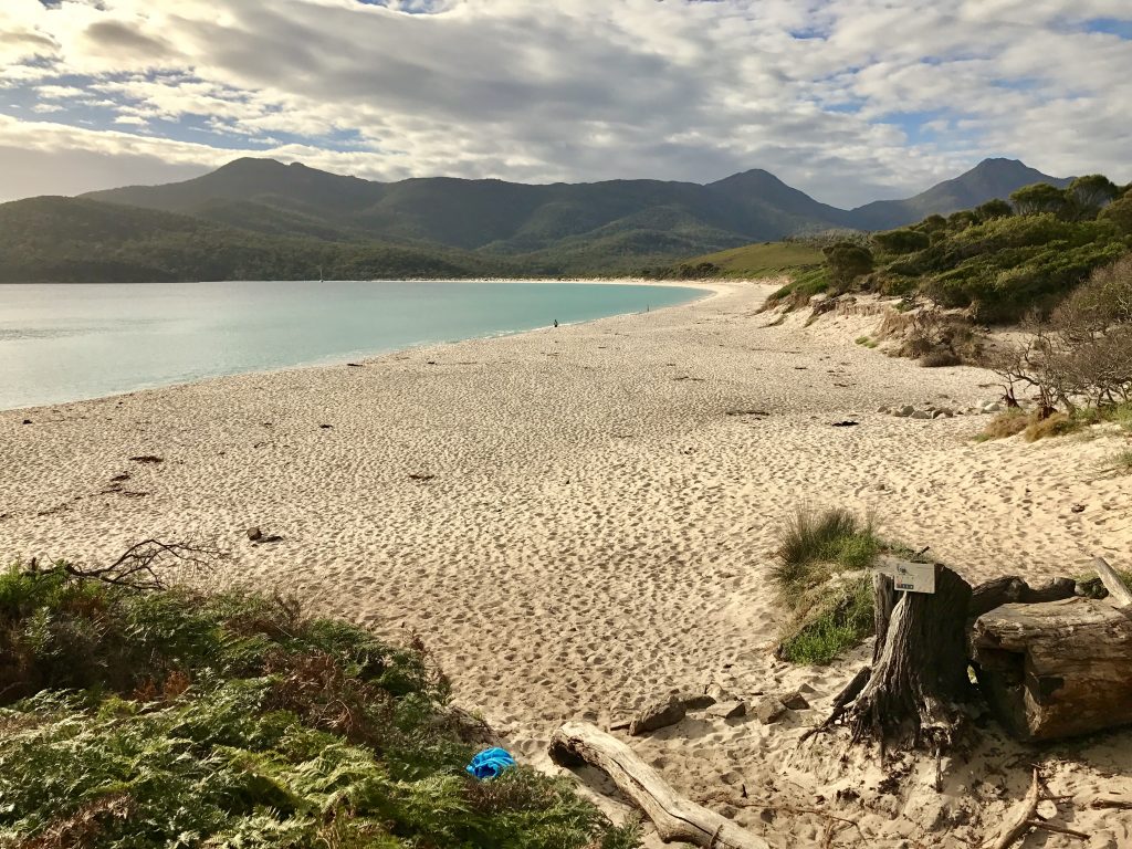
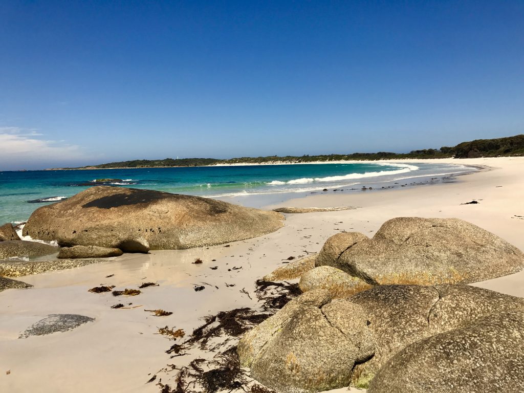
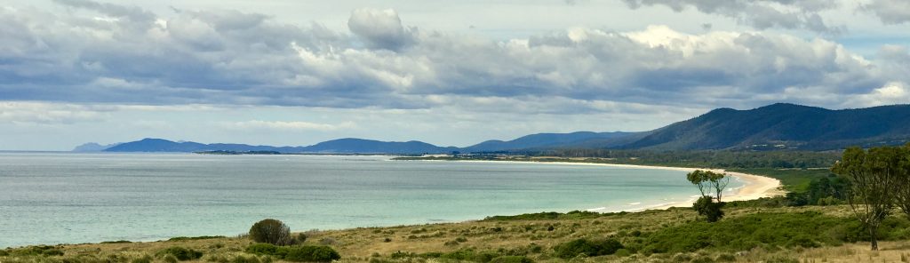
Wineglass Bay beach is very long and pretty.
While toiling up those mountains yesterday, I made up a silly poem to pass the time.
Timeless
Which did come first,
Time or the Universe?
said Chicken to the Egg.
The Egg did not reply.
A silly question,
said the Fox,
who likes to think
out of the box:
For universes come and go,
as astrophysicists can show.
Not true! chimed in a little shrew.
If all at once the world should go
I’d be the very first to know!
Don’t be too sure, Owl
spoke as he flew by,
then had for lunch
a shrewish pie.
Elephant, he gave a scowl,
And said ‘The universe is NOW’
For without Time, it’s plain to see:
The Universe would cease to be.
(Just like it is for you, and me)
Lizard said “It’s all too deep”
And fell into a peaceful sleep.
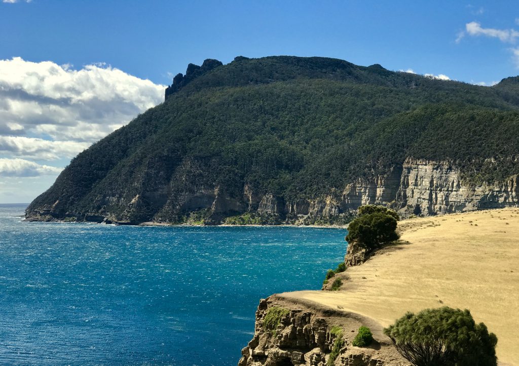
Time to move on south to near Maria Island.
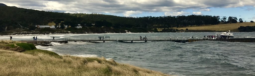
Visiting Maria Island National Park requires taking a half hour ferry ride across the channel. On the morning I headed out to take it, the wind was blowing hard, gusting to 40-50 mph, generating big chop and swell. In short, it looked like we were in for an adventure ride!
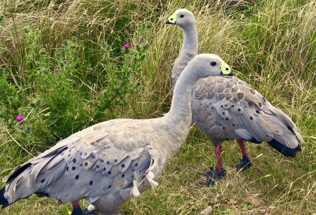
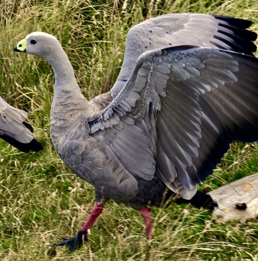
Great Barrens Geese were grazing in the greener areas
It was a pretty day, though, with fluffy clouds. Hiking out from the dock on the ‘Fossil Cliff’ loop, I saw about 30 Forester (Eastern Grey) kangaroos scattered over the hillside.
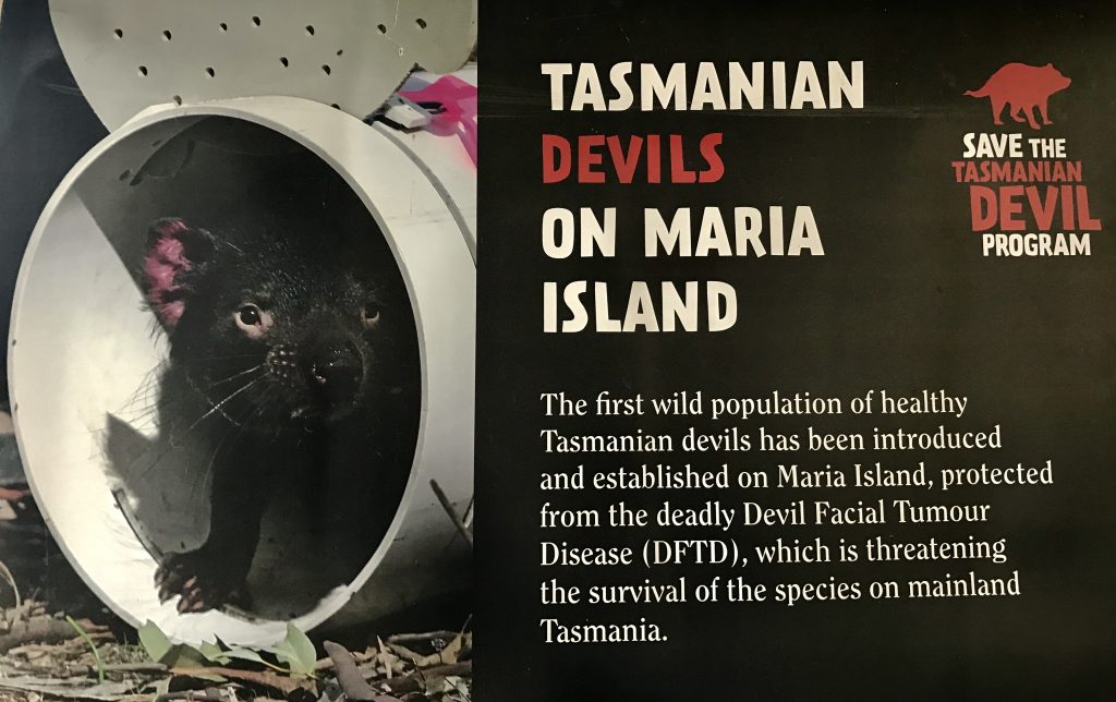
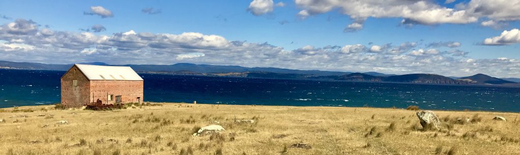
As an isolated sanctuary, Maria Island is perfect for this purpose.
But the highlight of the day was the ‘Painted Cliffs’, an area of colorful sandstone with amazing designs reminiscent of wood grain. It is one of the more beautiful natural phenomena I have ever seen.
I next headed down to the Port Arthur area, and then over to Hobart, where I began my tour, to spend my last two days.
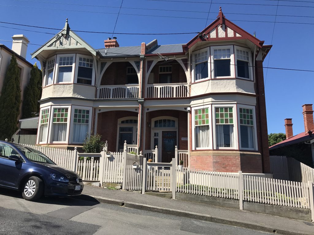
Here’s where I stayed two nights in old Hobart.
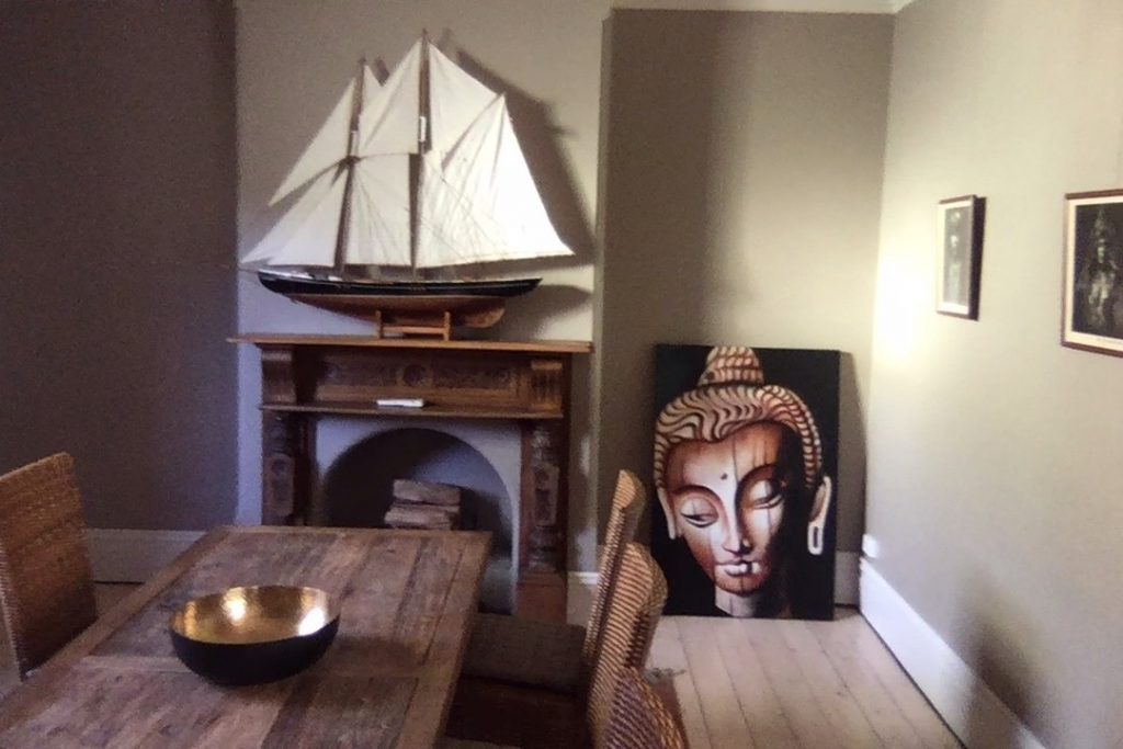
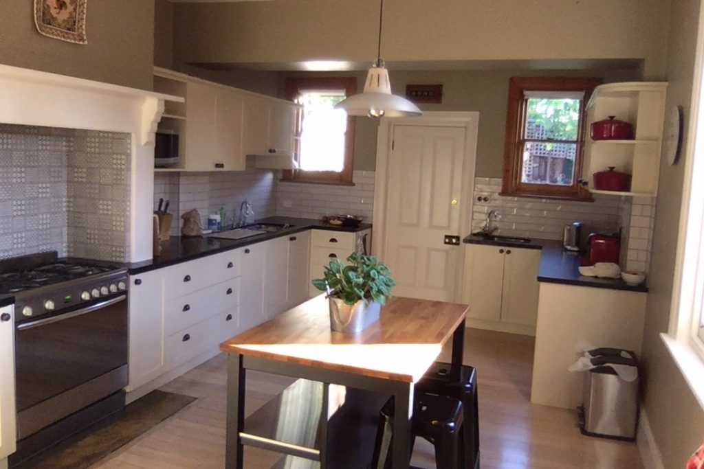
Charming place. AirBnB gives me the opportunity to stay in some great places.
The owner encouraged me to take the boat trip out around the Capes near Port Arthur. On the way, I visited this interesting site:
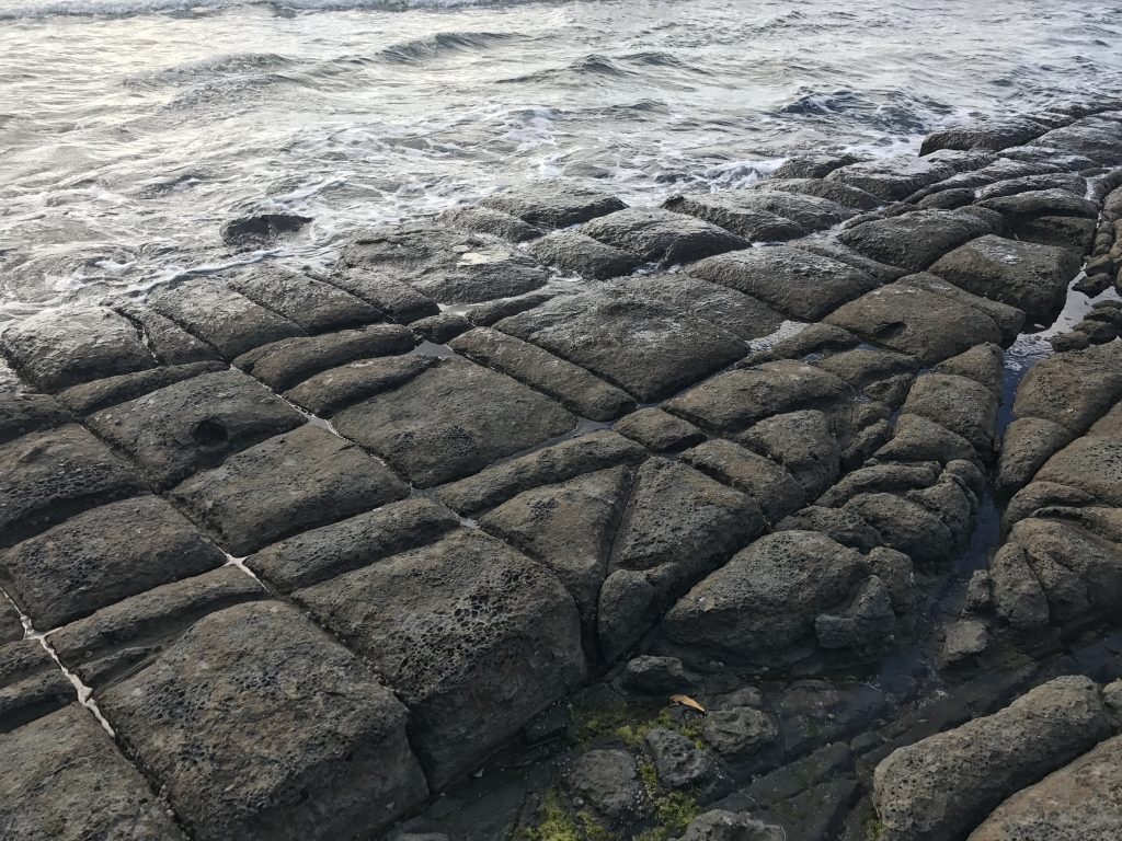
The ‘Tesselated Pavement’
Port Arthur Capes boat trip from Mel Malinowski on Vimeo.
Heading back to Port Arthur in heavy swell.
Tasmanian highlights for me: the temperate rain forests of Western Tasmania, the waterfalls, the exotic animals and plants, Cradle Mountain Park, Mt. Freycinet and The Hazards, and the Port Arthur capes. Quite a wild place still, Tasmania! There are some very remote areas in the southwest that I did not have time to visit, as you must fly in or take a long boat ride there.
Time to journey east, Hobart-Melbourne-Bangkok, to begin Chen Tai Chi training.
![]()
Leave a Reply
You must be logged in to post a comment.