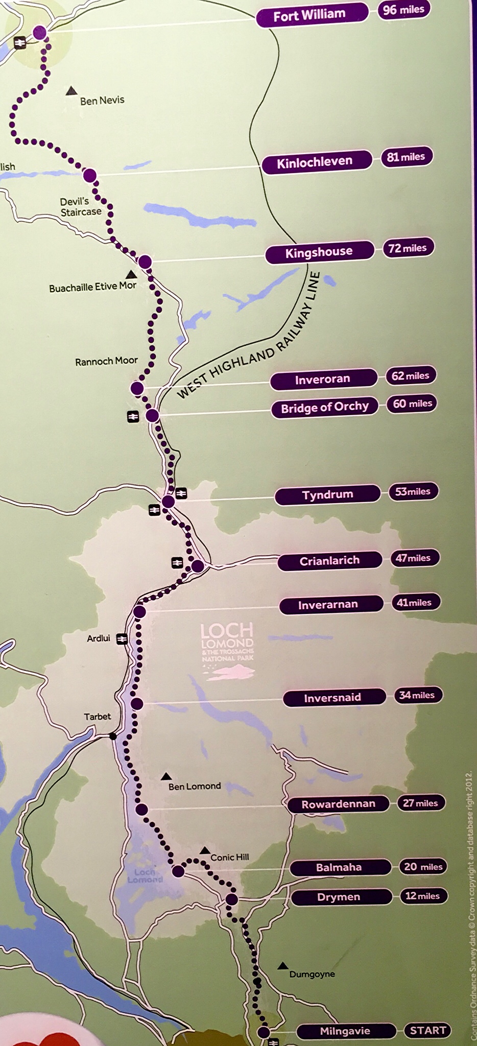
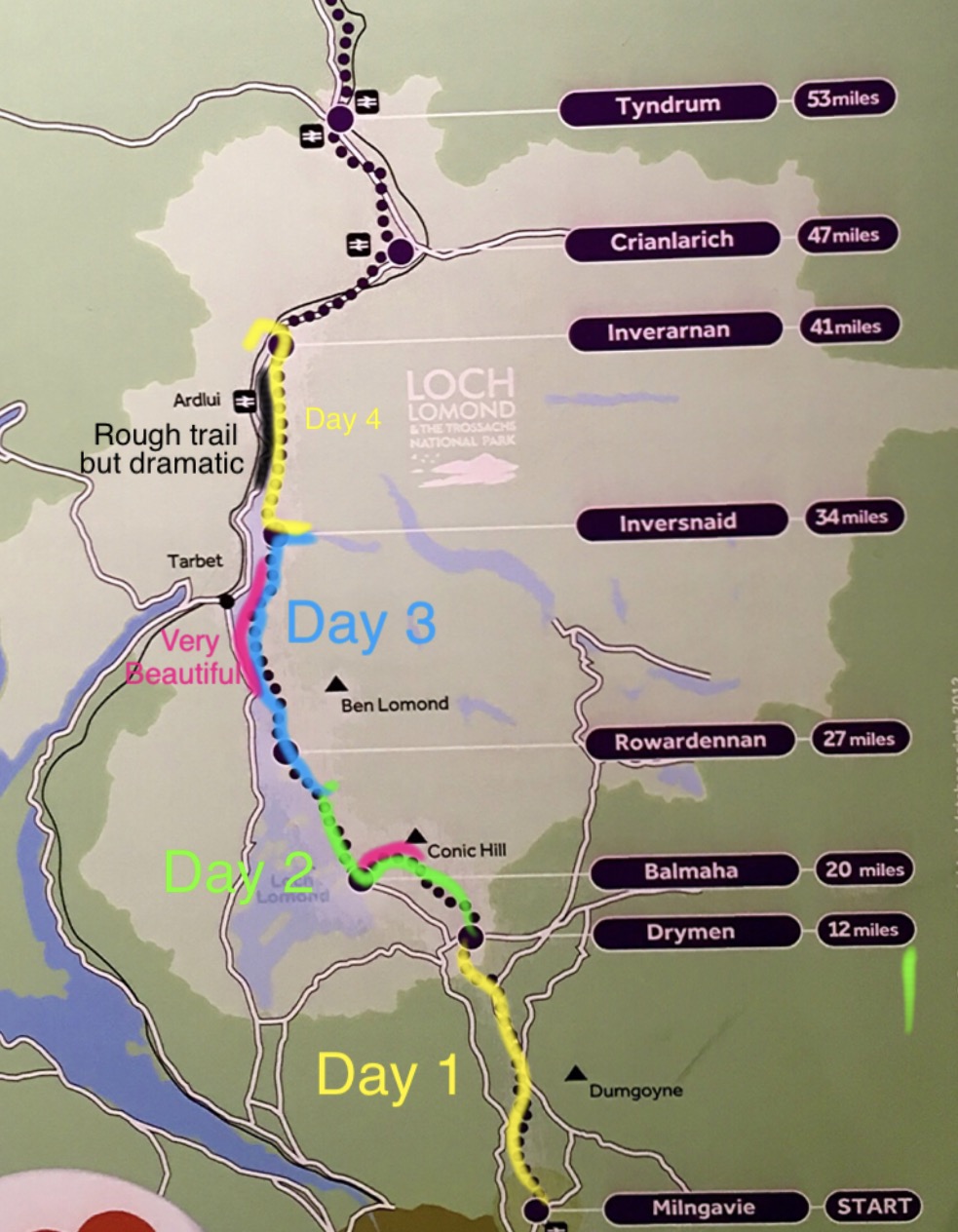
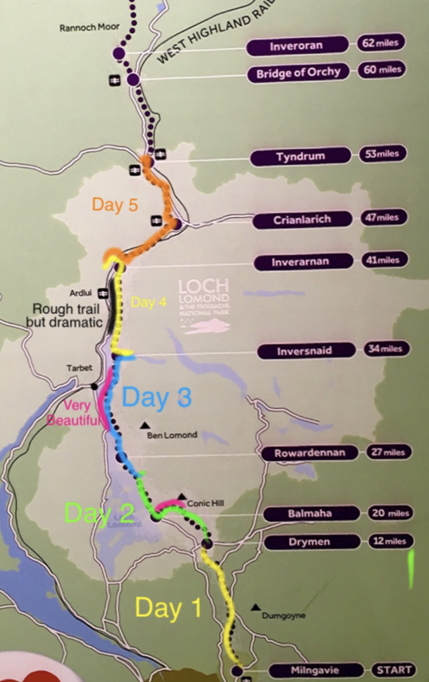
The West Highlands Way is the longest of the long distance Scottish walks, at 96 miles. Starting not far north of Glasgow, it climbs up into and through the Highlands and moorland of Scotland, the home of ‘Rob Roy’ MacGregor and the Highlanders who wound up battling for control of their own lands. Reading of the conflicts that rose as most of the land came under the control of a very small group, it does make you wonder if we are heading into a similar situation in the modern western world.
Note: the following is a very long post, as the West Highlands Way is a very long hike!

In the morning, I took a 45 minute train ride up to Milgavnie, the southern portal for the West Highlands Way. Here is the beginning of this hike.
As there are many detailed guides to the WHW online, I will just show a lot of pictures, and comment on my experience, rather than create a guide. As always in these posts, I will try to provide enough pictures to give you a feel for the varying terrain, with a few comments. Believe me, this will not spoil the experience for you if you come and hike them yourselves, as the reality of being there is far better! And if you cannot come, I hope you can share the feeling.
First, a few useful words from Scottish:
Ben = mountain or hill
Inver = mouth of a river, as in Inverness (mouth of the River Ness), Inversnaid, Inverarnan
Burn = stream
Croft(er) = small scale farm(er)
Cullen Skink = soup made with smoked Haddock fish
Firth = estuary
Glen = valley
Hootenanny = celebration
Loch = lake
Muir = moor
Wee = small
Saying: “Tak tent o time ere time takes tent of thee” = Take care of how you spend your time before time takes care of you (you die).
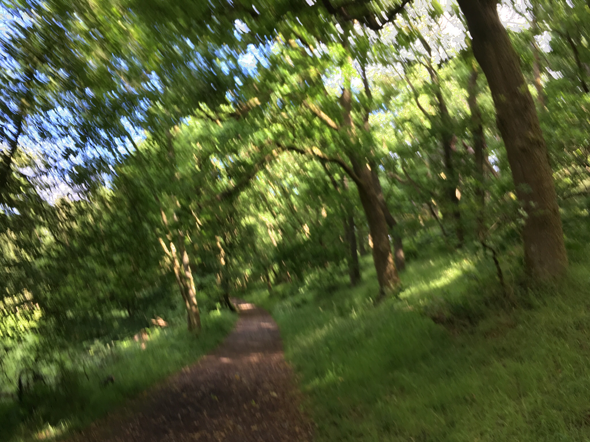
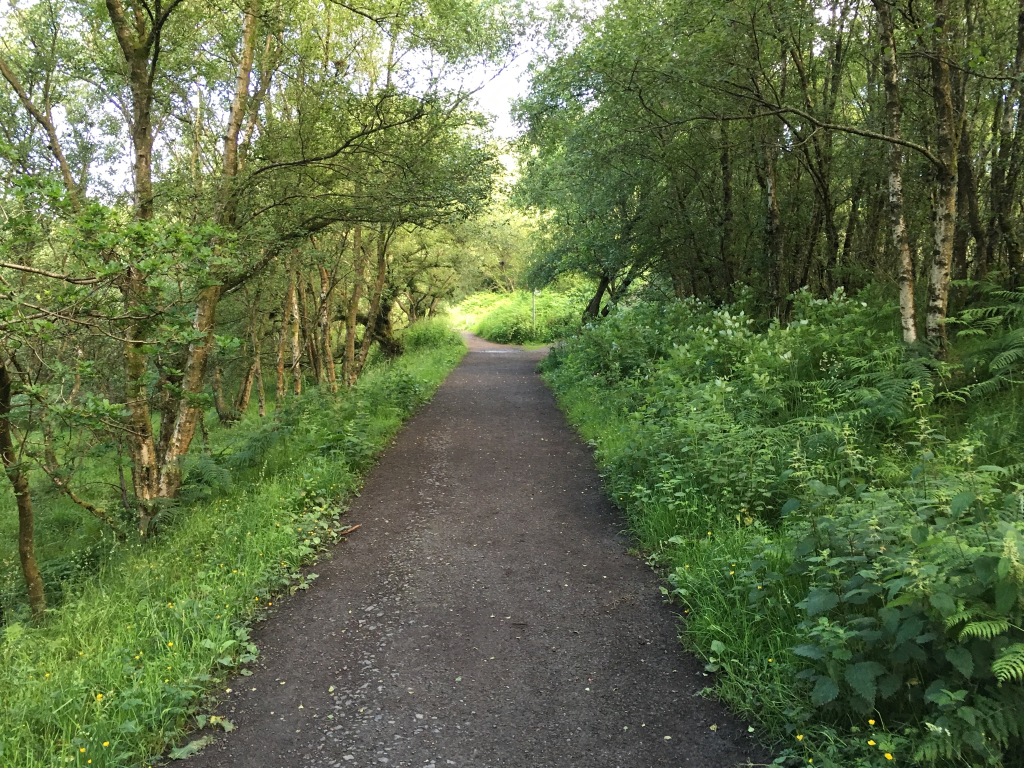
The path from Milgavnie first takes you through the Mugdock Wood, a typical Scottish broadleaf forest. My first day was the 12 mile walk from Milgavnie to Drymen (pronounced, approximately, Mill-gaav and Driihmen). At 8:30, as I headed out, it was beginning to rain. Being cautious, not wanting to start out soaked, I put on my raincoat and rain pants.
After about 15 minutes, the rain stopped and the sun came out. After the first good hill, I was too hot and had to strip down to just my long sleeve cotton base layer. A local fellow slinging tennis balls for his dog was there on the hilltop, and said most walkers had to adjust clothing there.
As I will note later, this was not the last sudden weather switch!
The trees varied, though most were broadleaf.
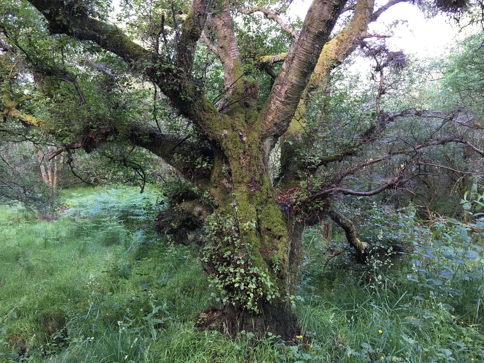
There were some very old oaks.
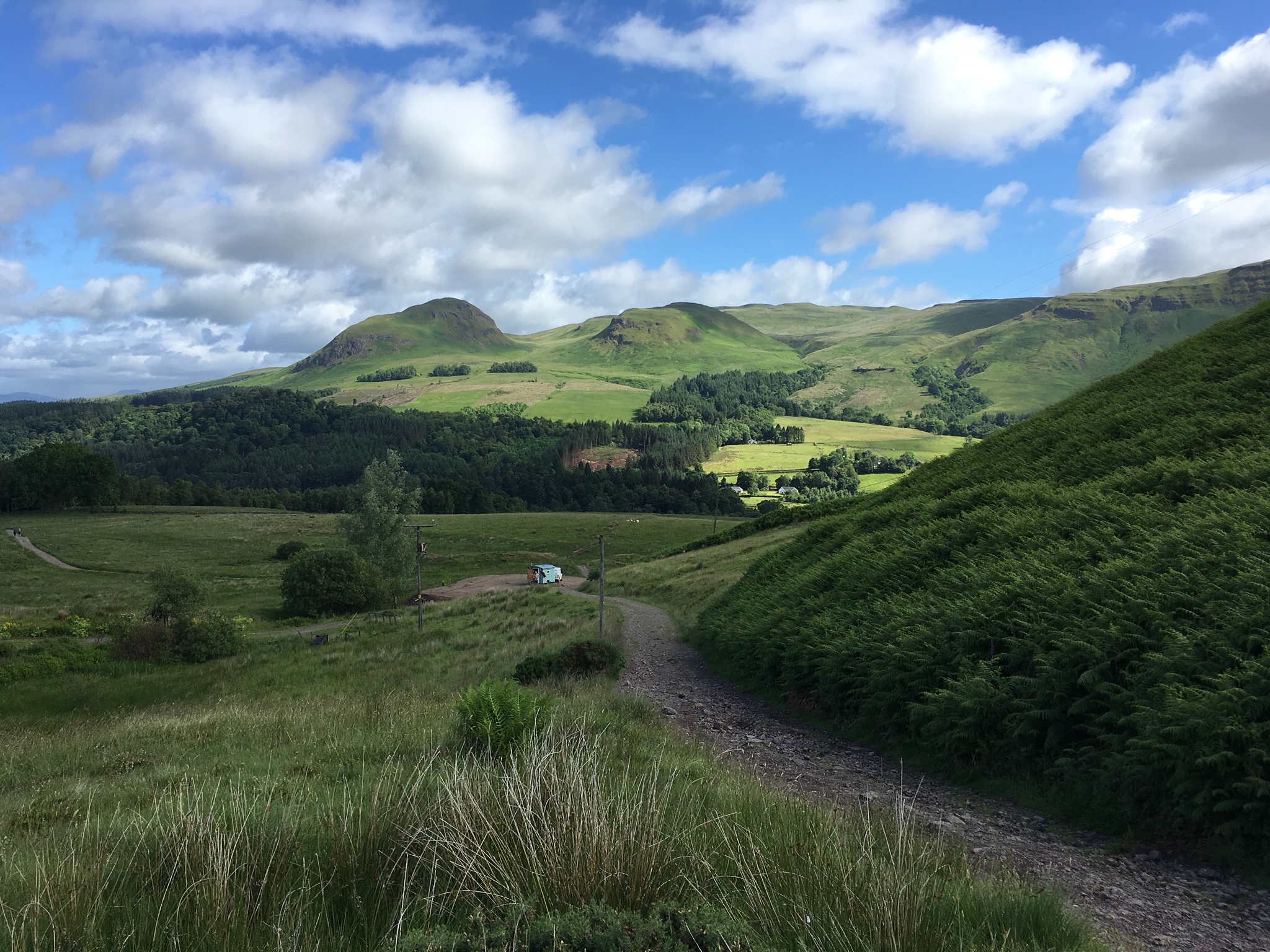
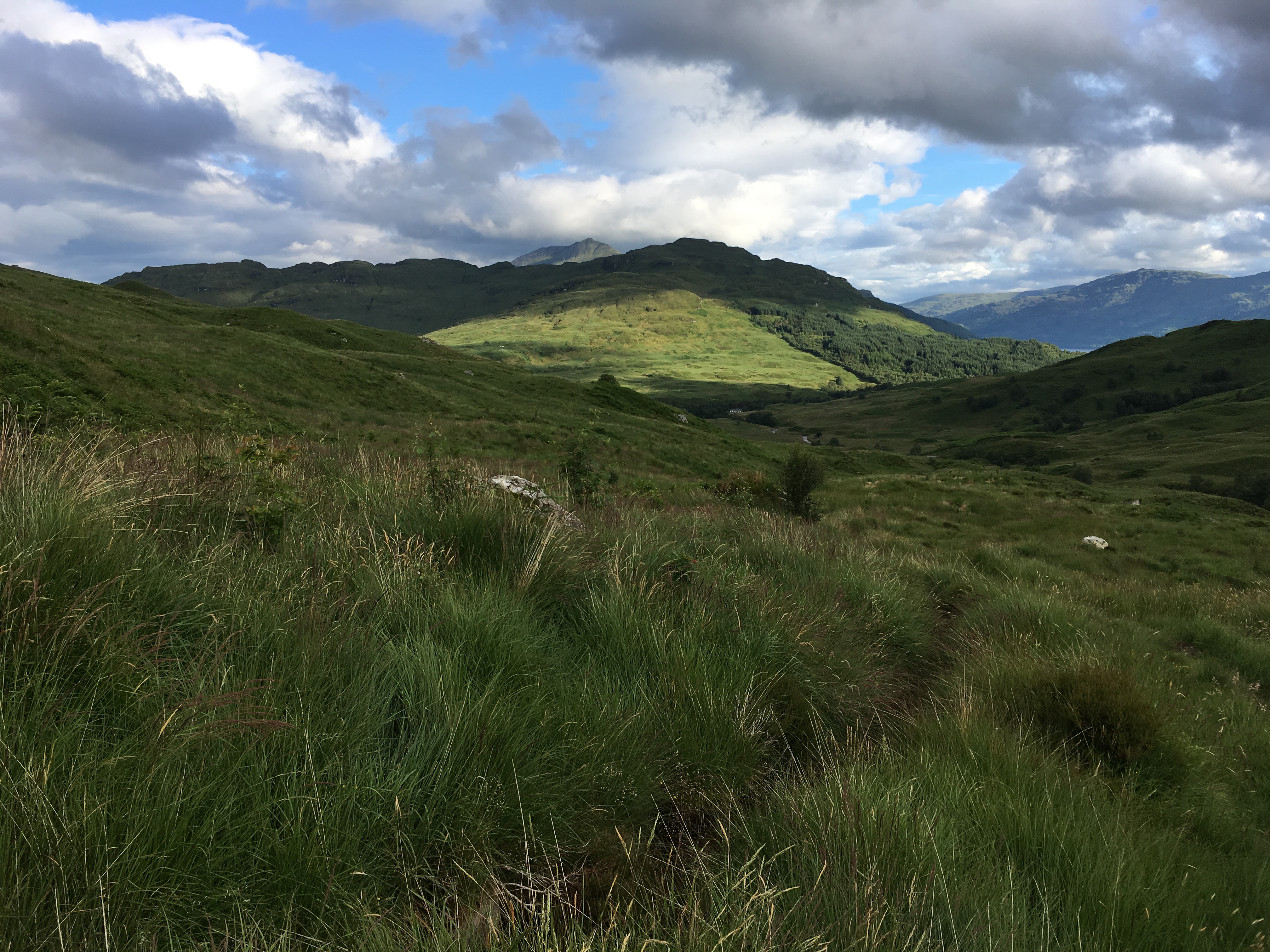
Then, the highlands came into view! Quite dramatic. Not too long after this, in came a squall, and it was rainclothes time again. I got a bit tired of suiting up and suiting down. That’s Scotland, where they say you can have 4 seasons in one hour.
Around 9 miles out, I felt my toes getting a bit ‘hot’. Hotspots are signs of irritation, early warnings of possible blisters to come. It’s important to not blister! So I stopped, took my boots off to air out my toes and my socks, and have some lunch. Luckily, the sun was shining. Then, I switched to my athletic shoes for a bit. The combination did the trick. I wound up with slightly sore but unblistered toes. Hopefully, they will tough a bit and do better tomorrow.
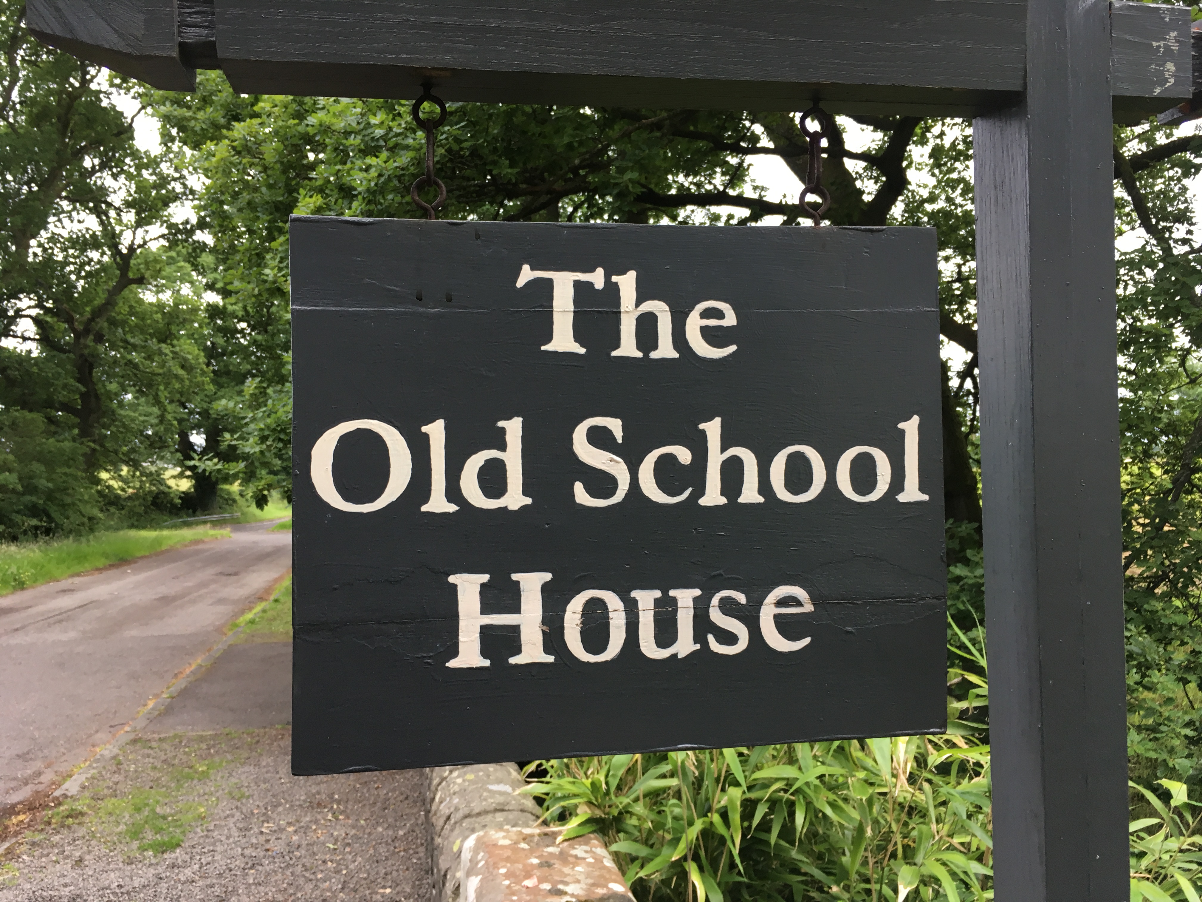
A side trip from the end of the first day’s walk is into the village of Drymen, where I stayed overnight. Along the way I passed this old building:

The Old School House . Now, into Drymen to a comfy hot bath at the old Buchanan Arms Hotel.
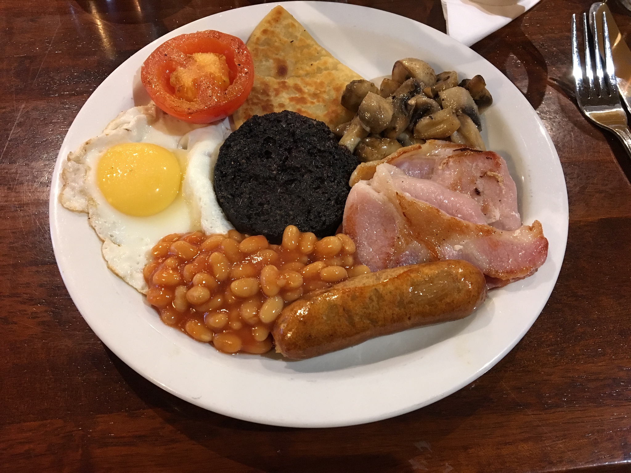
A ‘Full Scottish Breakfast’. Egg, bacon, sausage, bacon, mushrooms, potato scone, tomato, beans and ‘black pudding’.
Day 2: Drymen to ‘Shepherd’s House’
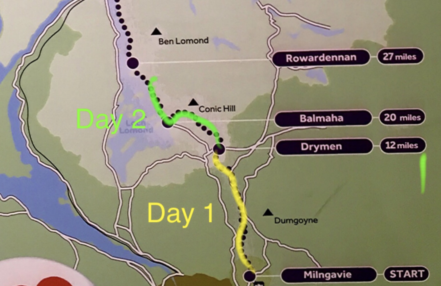 Up early in the morning, on Day 2, I headed out early in hopes of beating the predicted afternoon rains.
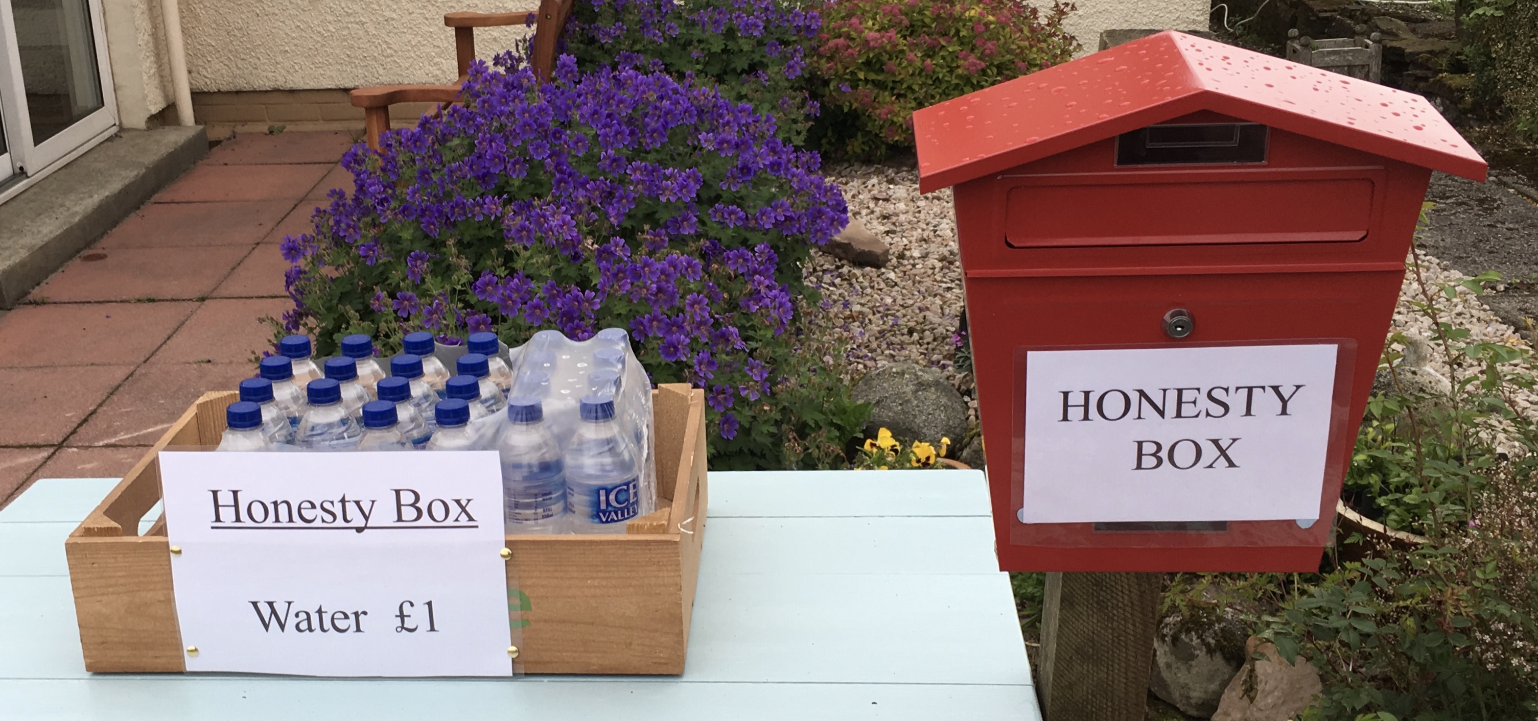
Along the road, I passed a little stand set up for hikers. No one was supervising, you were trusted to pay up.

Leaving the road, and up into the hills. The trail is well-marked.

First year calves find the passing hikers bemusing? Perhaps. They come, and they go, while this is home for them.
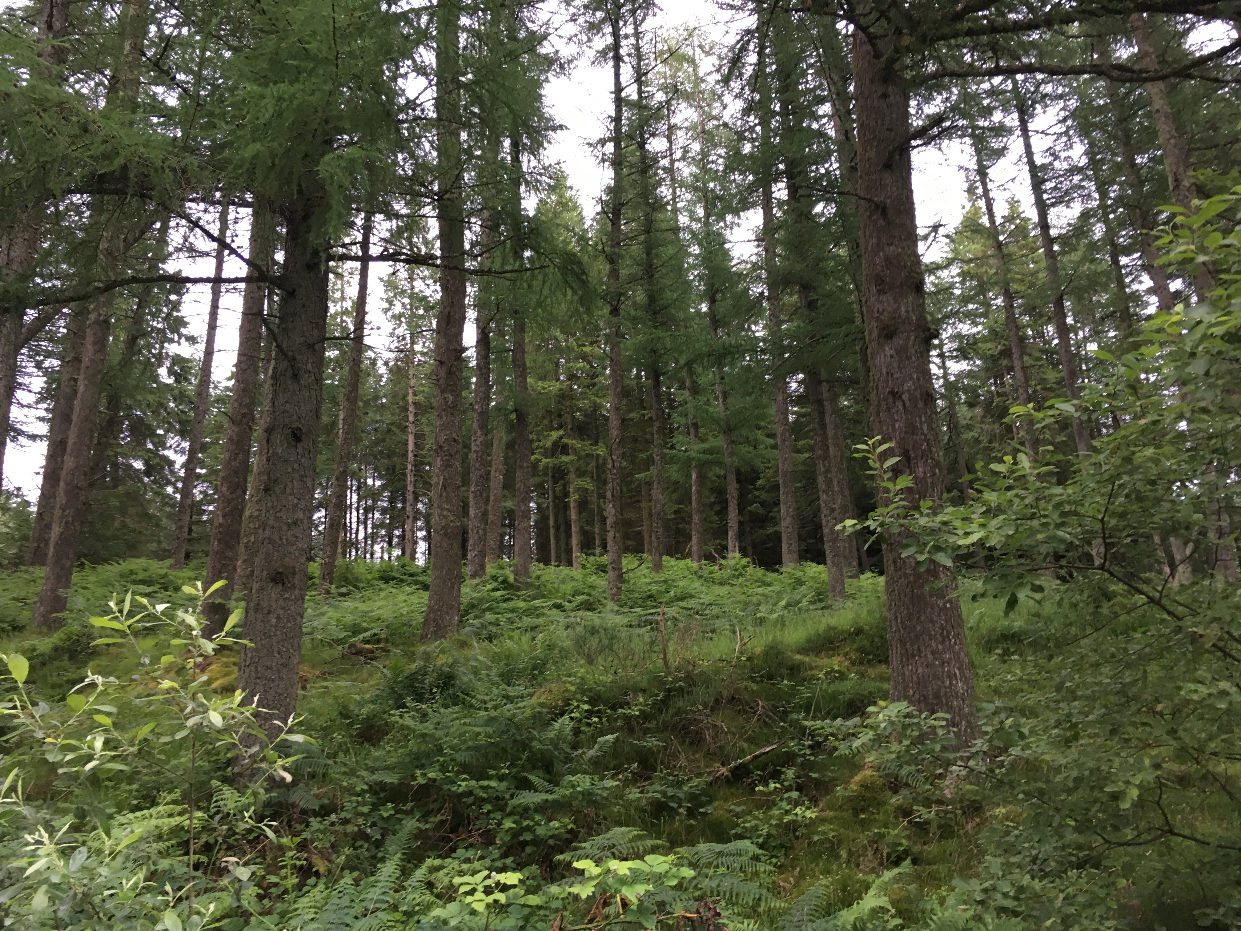
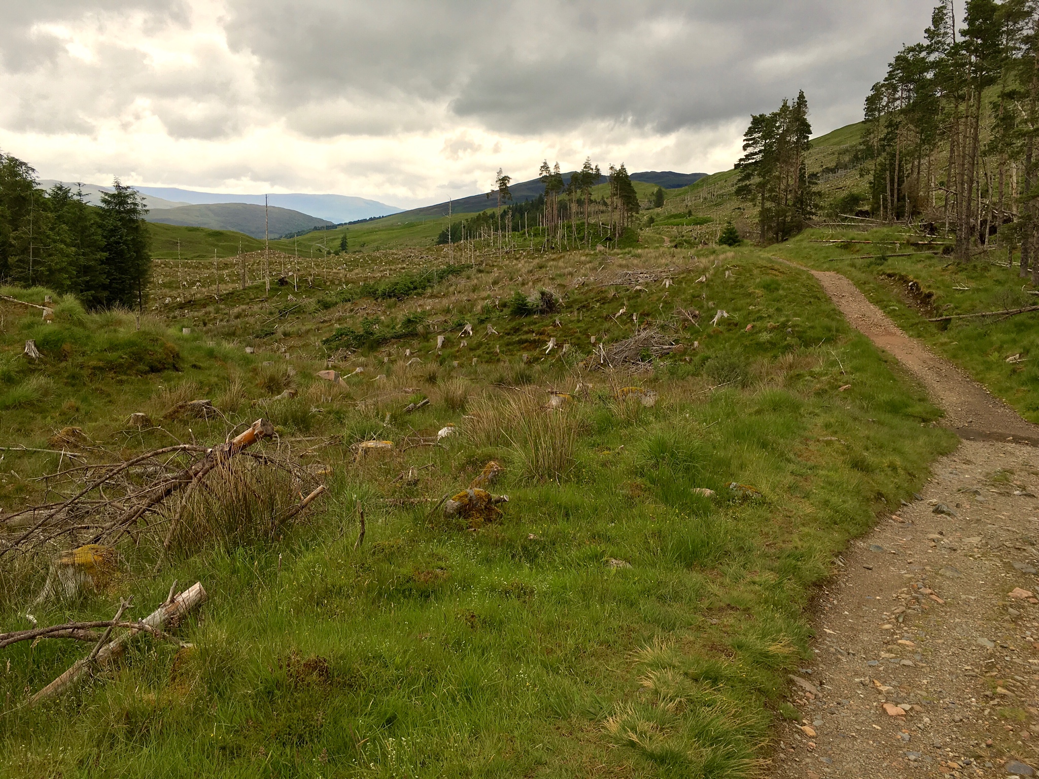
The trail led up from near Drymen through a conifer forestry area. It is a mix of tall conifers and areas that have been clear-cut harvested.
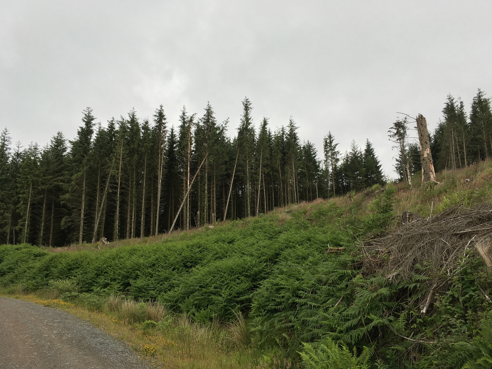
Clear-cut area in foreground. Not such a pretty area to hike through, but better lies ahead.
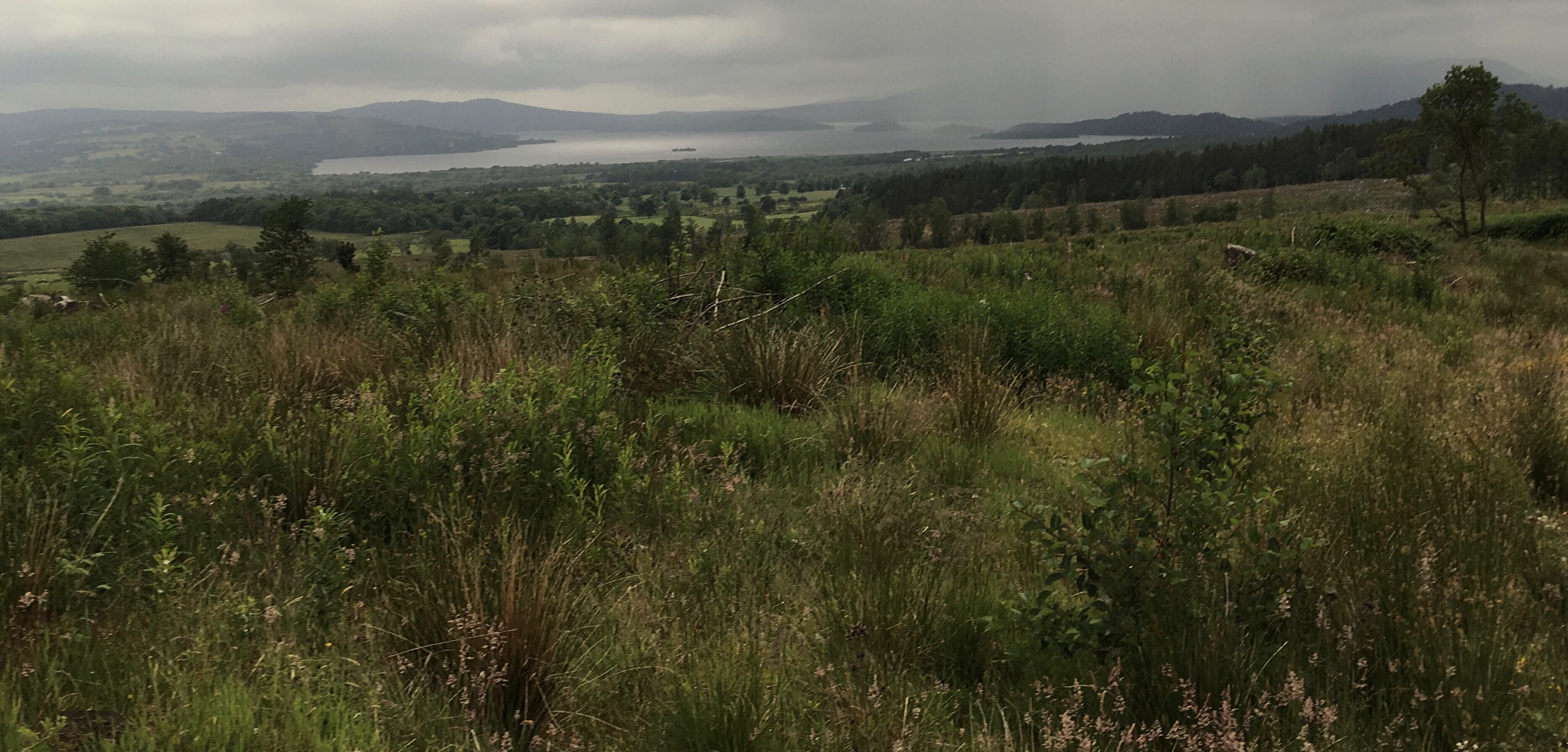
Emerging out of the forestry area, I catch a first glimpse of storied Loch Lomond.
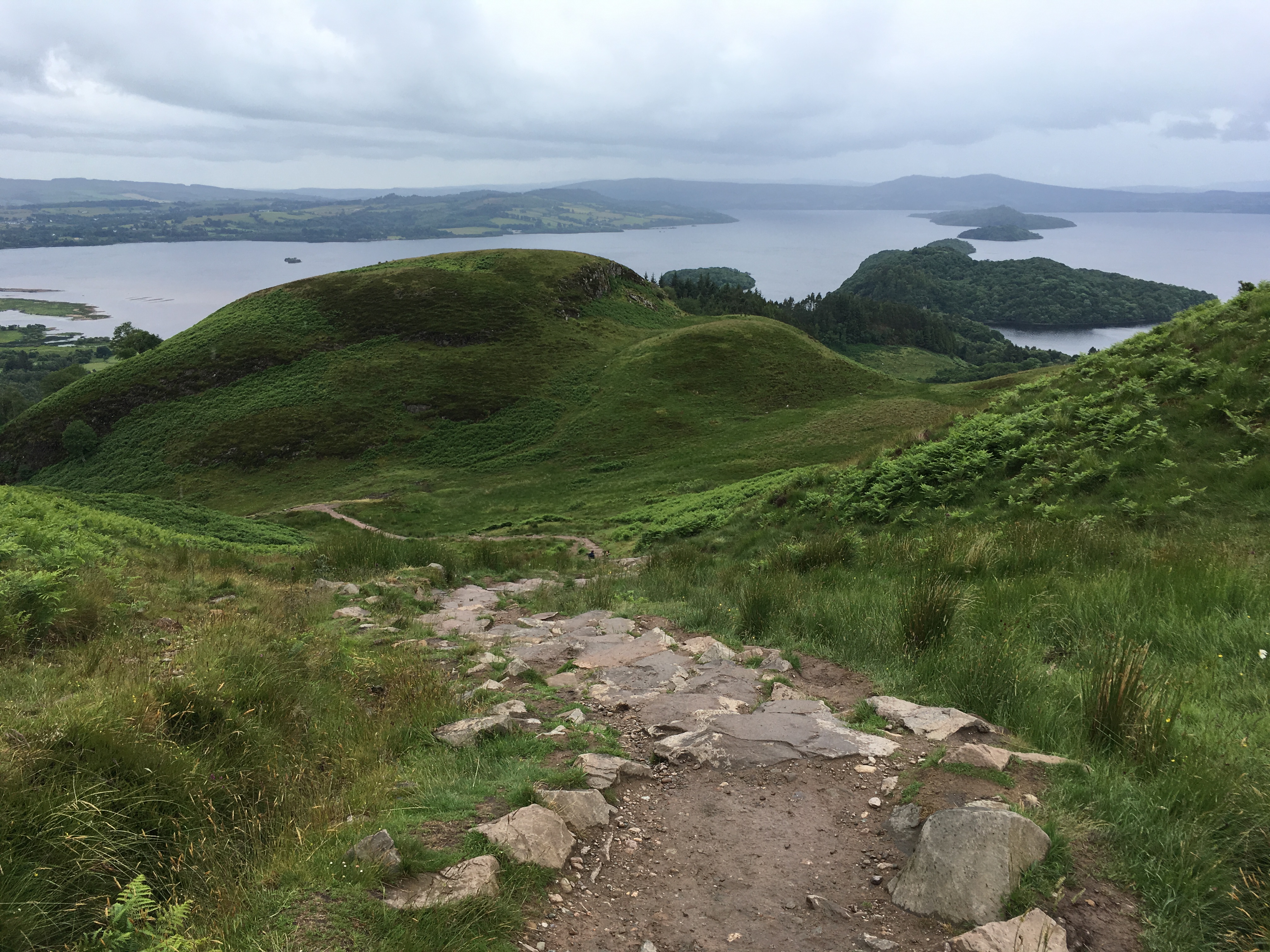
I climbed Conic Hills, a rounded series of domes shaped by ancient glaciers. On the way down, the islands of Loch Lomond (Scotland’s largest Loch) lay just ahead.

The WHW trail continues along this shore of Bonnie Loch Lomond:
O ye’ll tak’ the high road, and I’ll tak’ the low road,
And I’ll be in Scotland afore ye,
But me and my true love will never meet again,
On the bonnie, bonnie banks o’ Loch Lomond.
My second day on the Way ended at my accommodations in a ‘Shepherd’s Hut’ near the lakeshore.
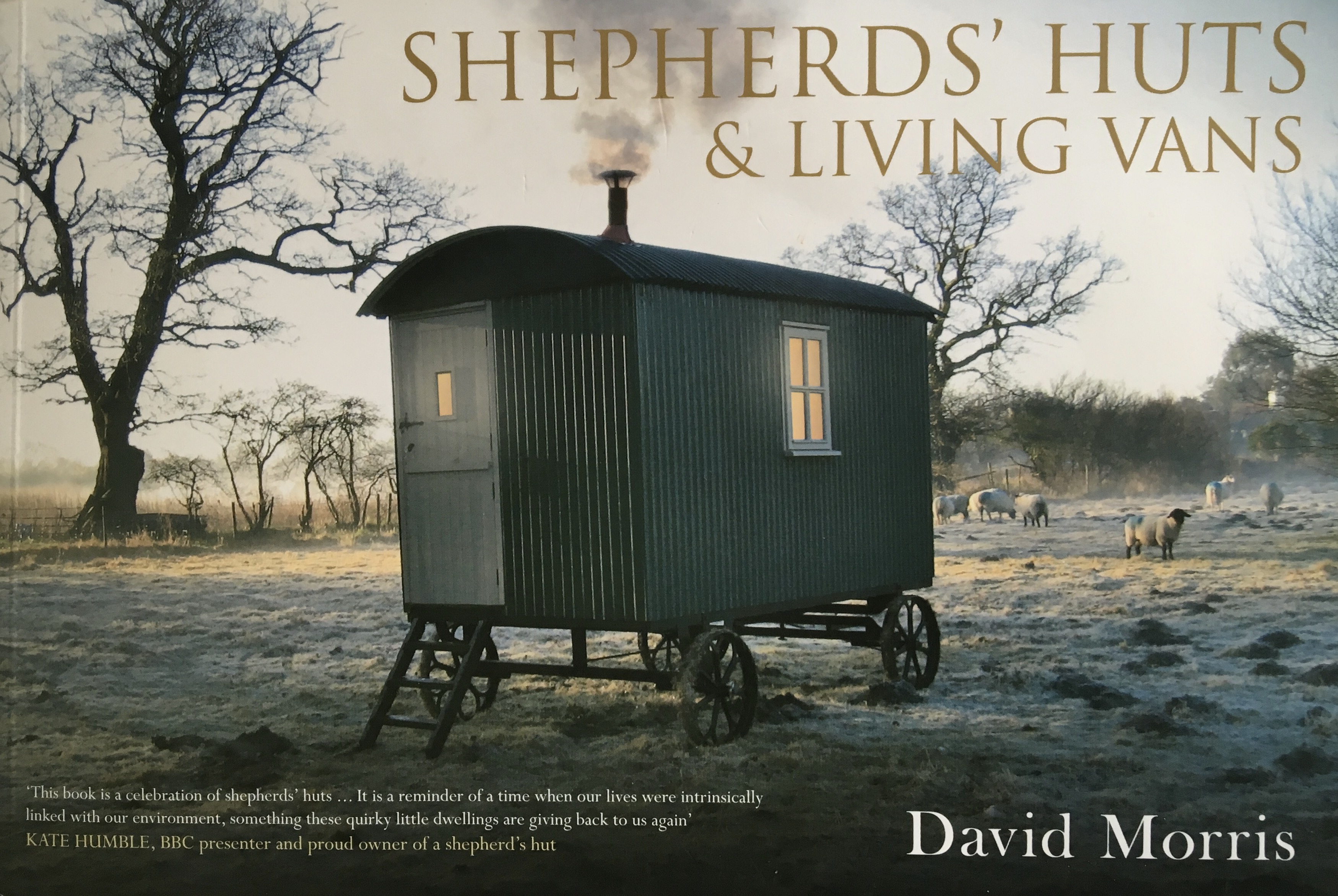
Shepherd’s House B&B has a replica of a traditional shepherd’s living van which you can stay overnight in on your walk.
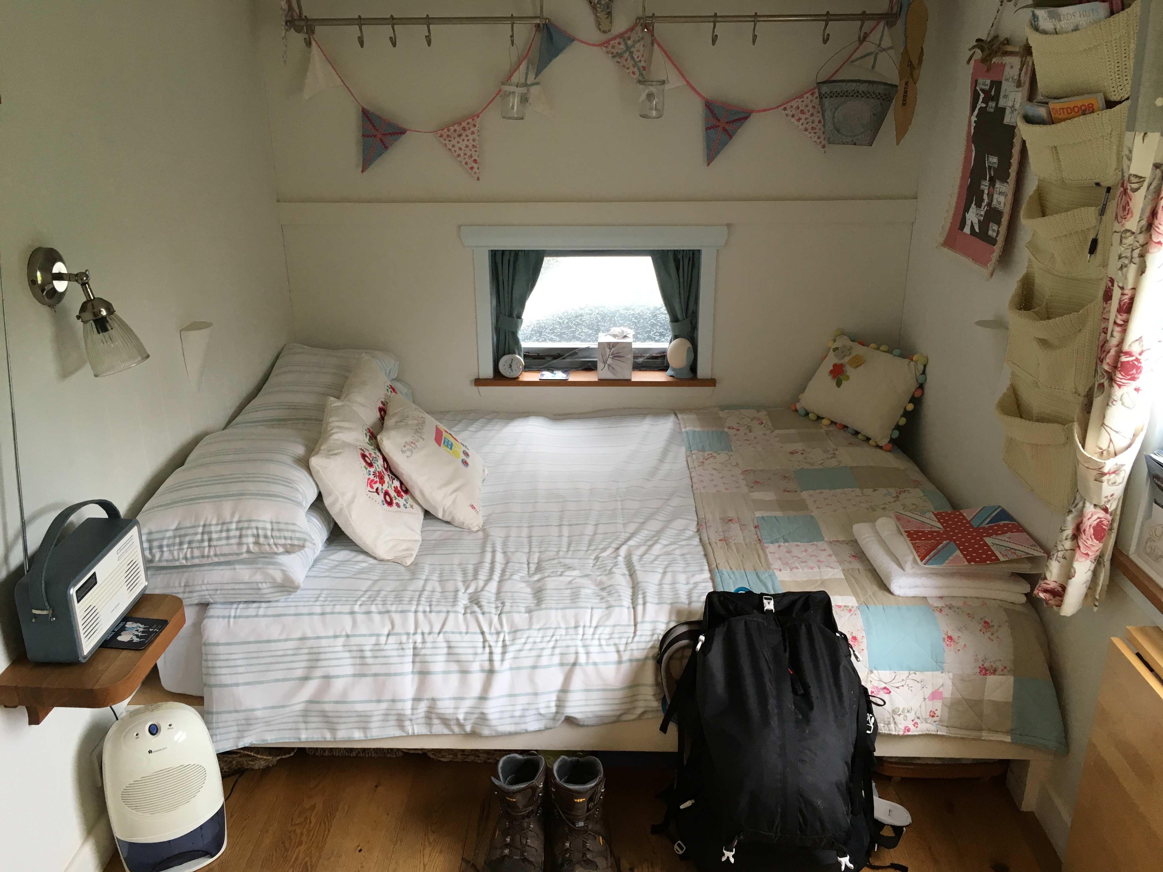
Likely the smallest room I’ve ever slept in (7’x11′ plus a 4’x7′ bathroom with shower), smaller than any dorm room. But it was a cozy charming place to overnight on the trail, after a full day spent out in the Highlands, resting up for tomorrow’s 12 mile walk along Loch Lomond. It seemed just right for my ‘living small’ lifestyle.
Day 3:
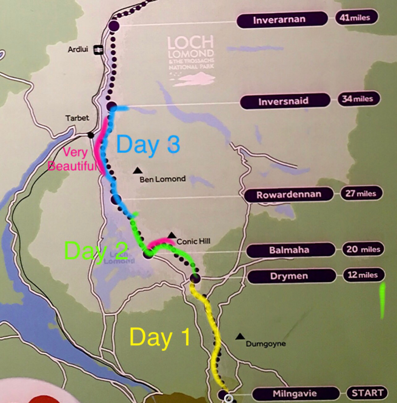
From “The Shepherd’s House” on to the Garrison Farm above Inversnaid
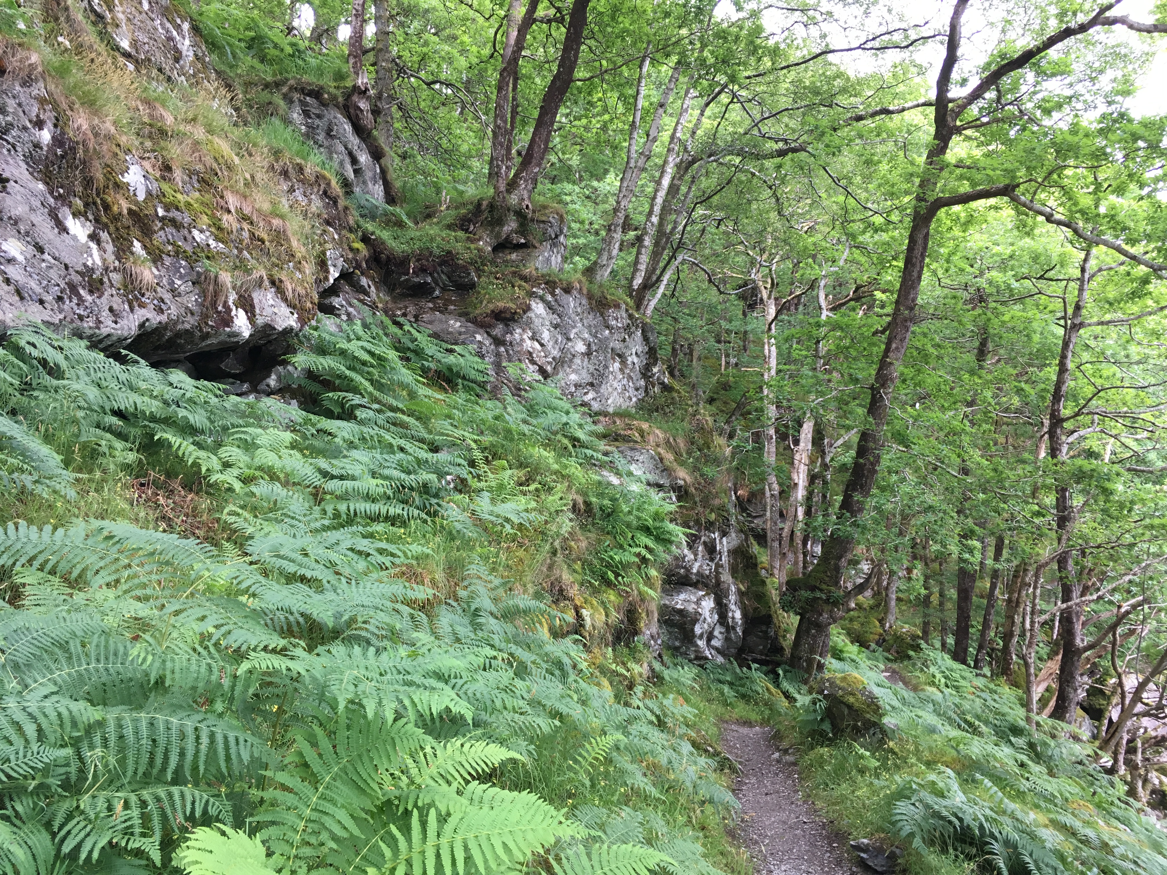
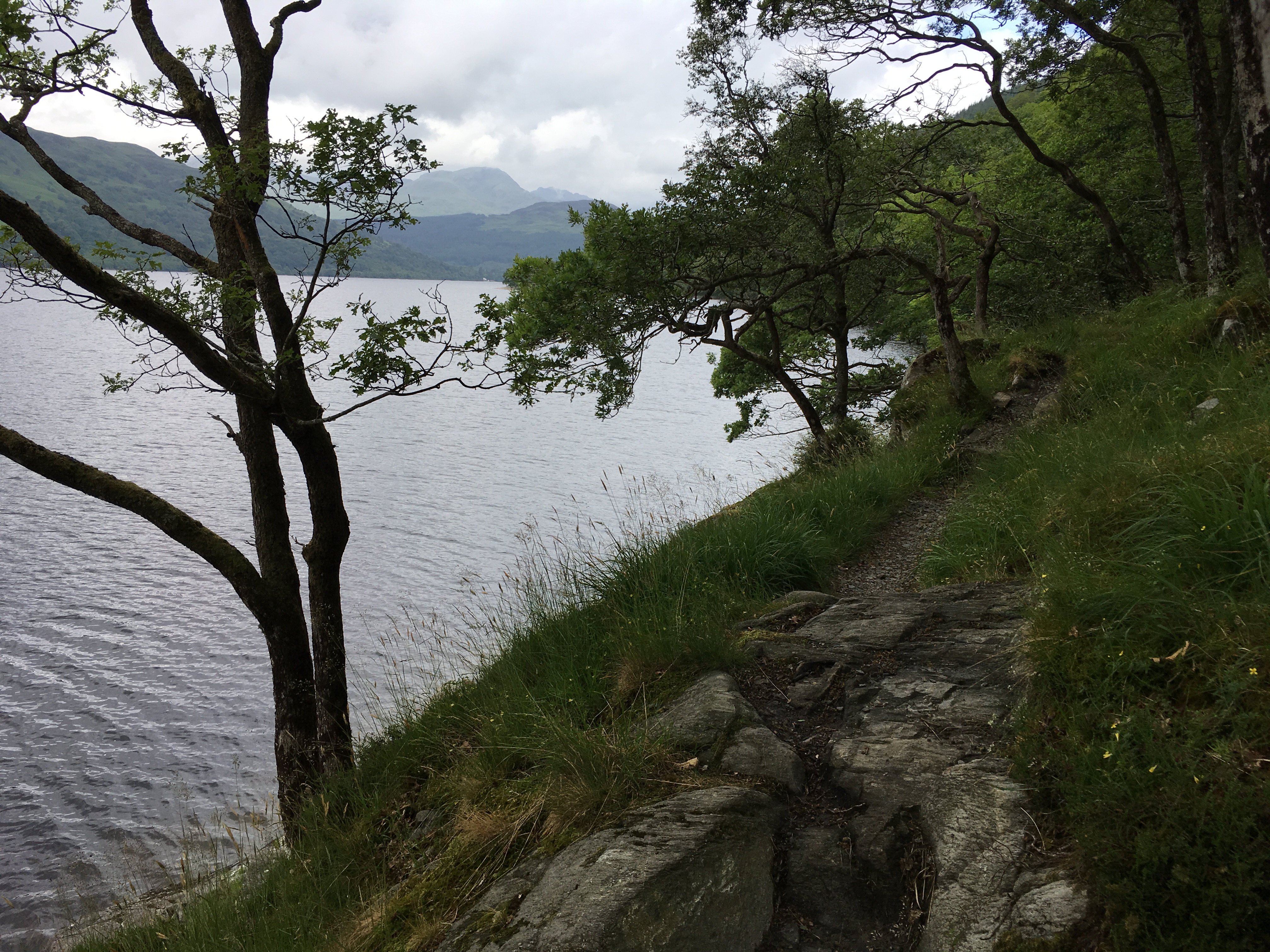
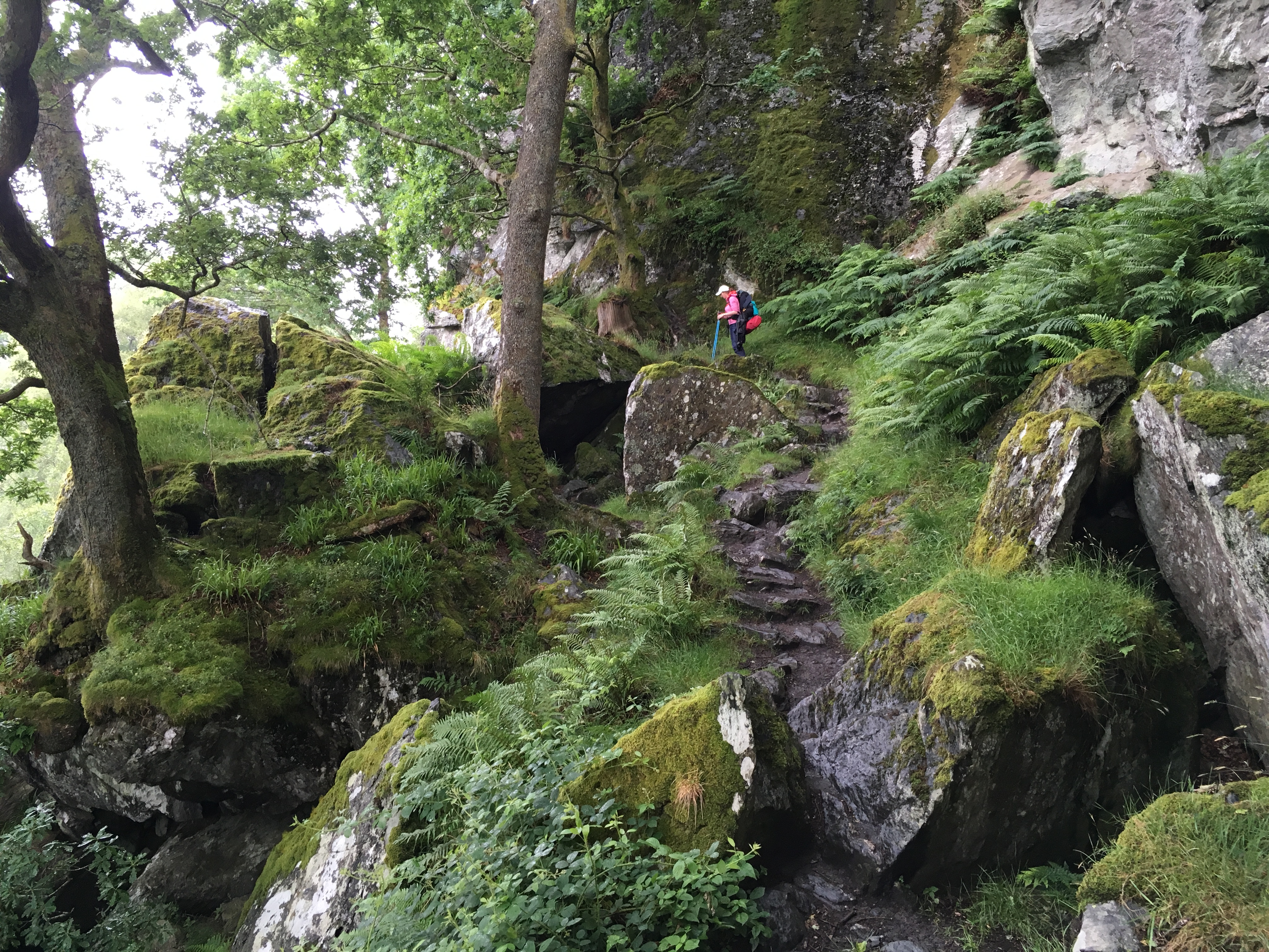
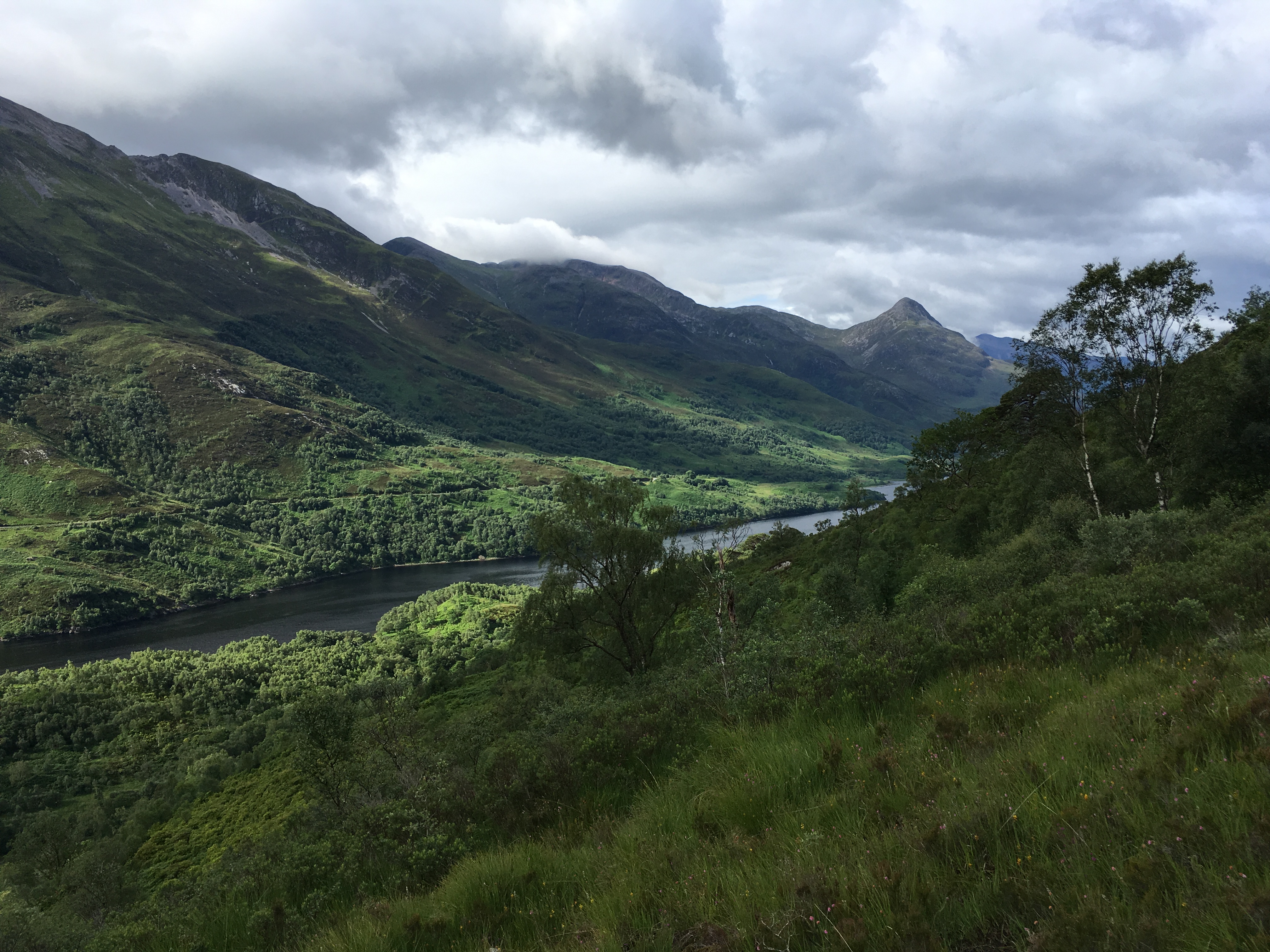
The trail here winds along the steep banks of Loch Lomond formed by the roots of Ben Lomond, at 3, 192 feet high the most southerly of Scotland’s 46 peaks over 3,000 feet high (which are called ‘Munros’). The result is a rocky, spectacular trail, my favorite so far along the WHW.

Lots of rain in Scotland, that’s a fact.
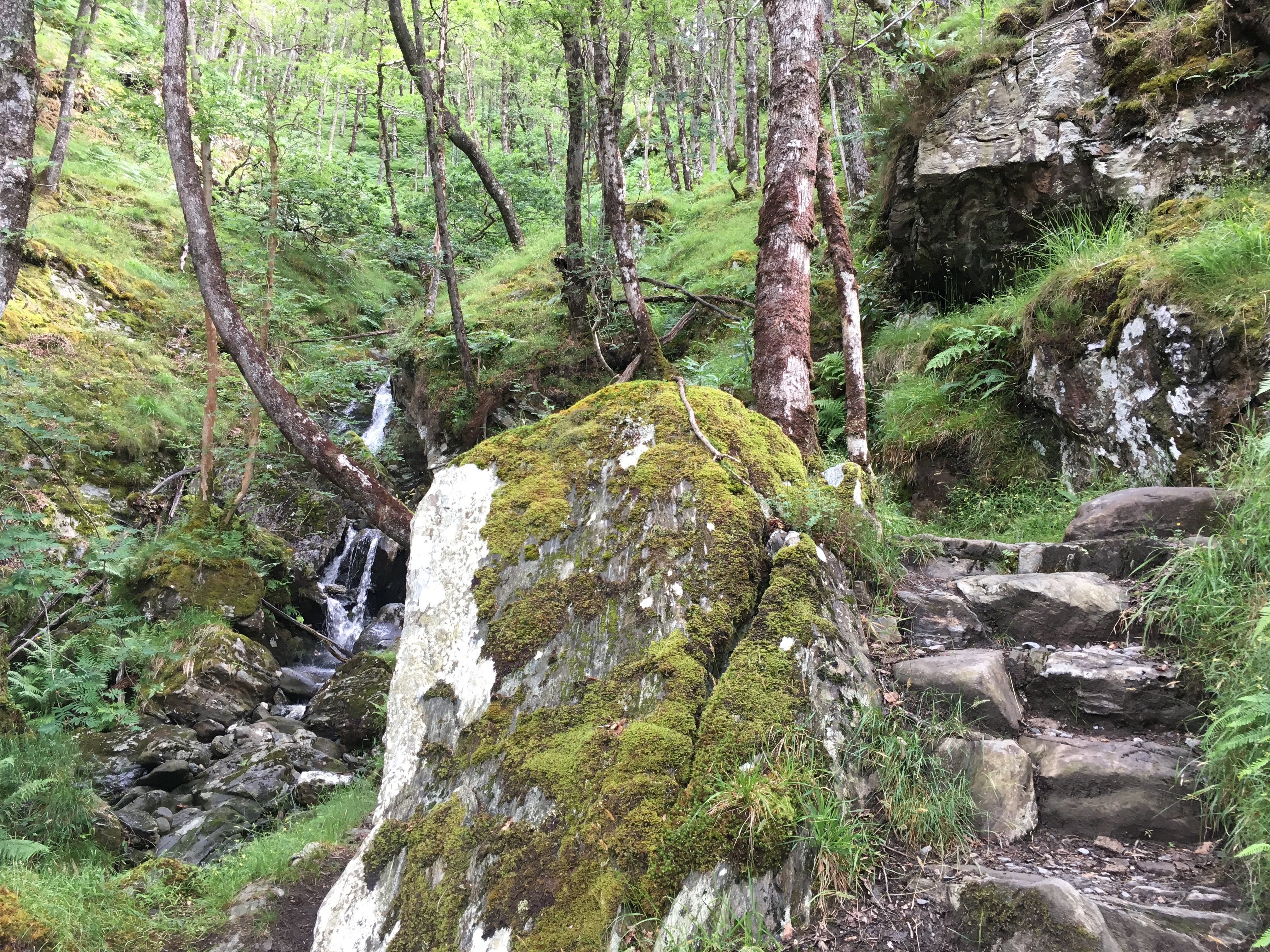
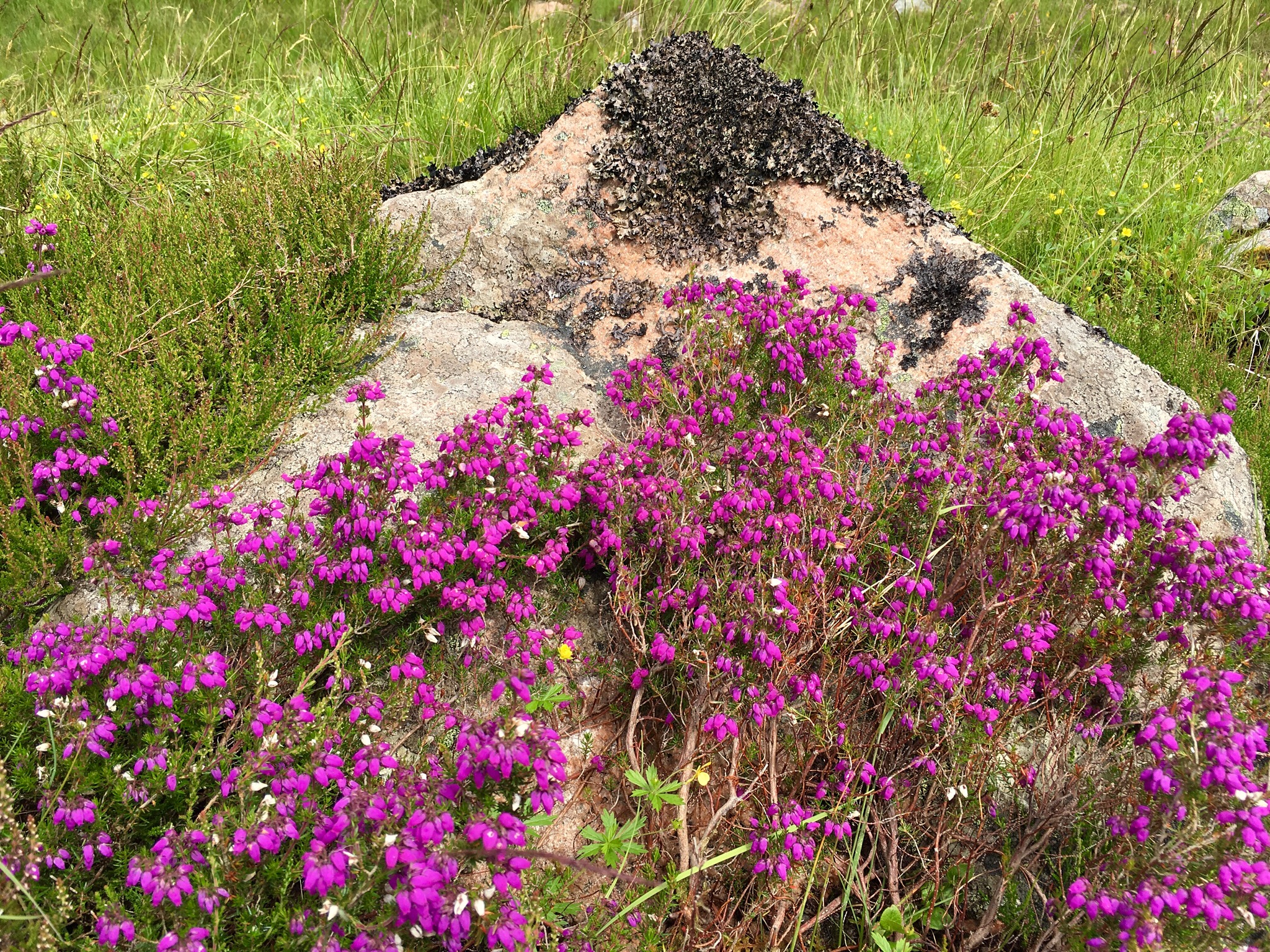
Lush, rocky, green–what more can you want?

Many wildflowers.

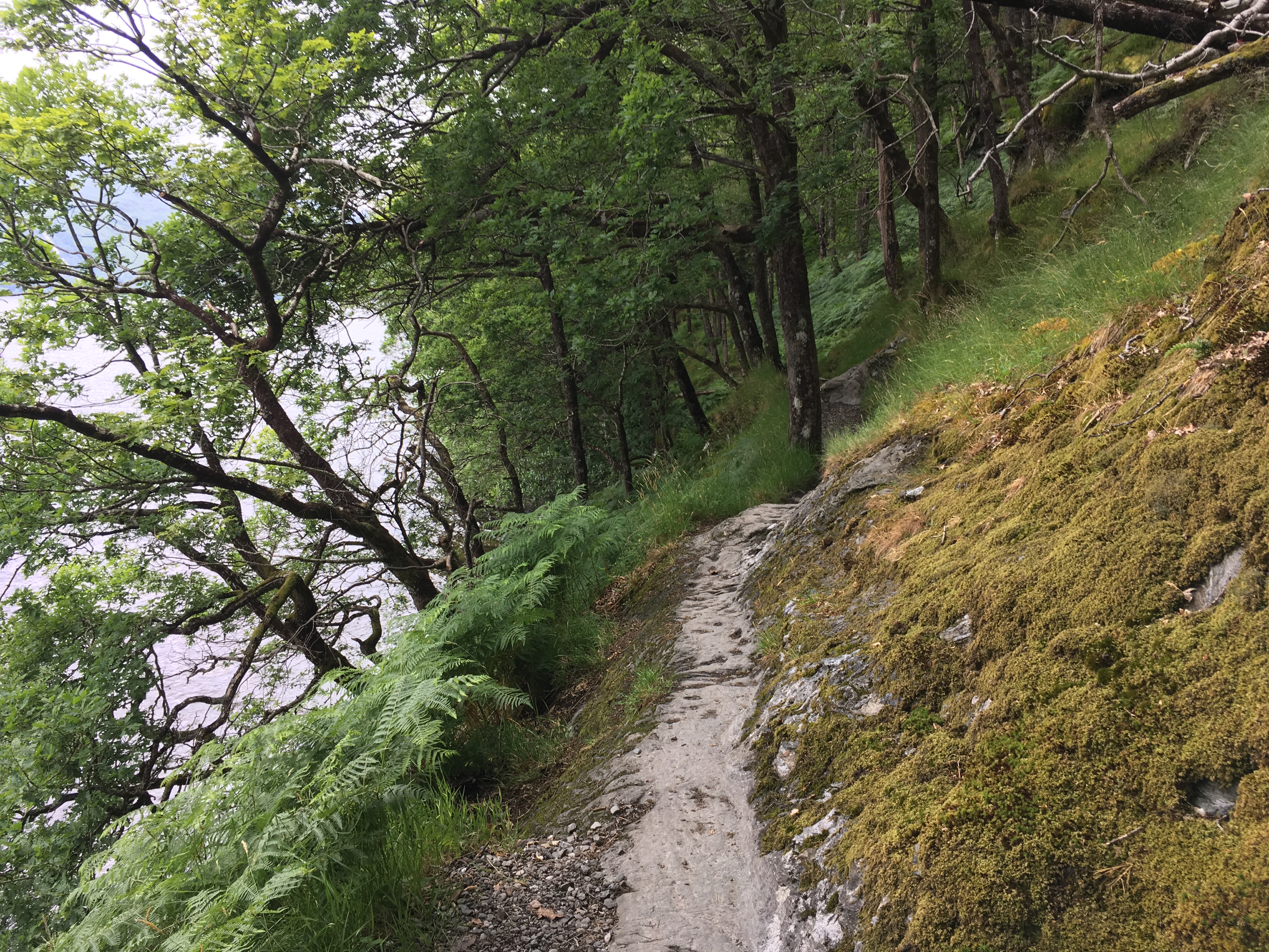
Here, the path is literally carved from the solid rock.
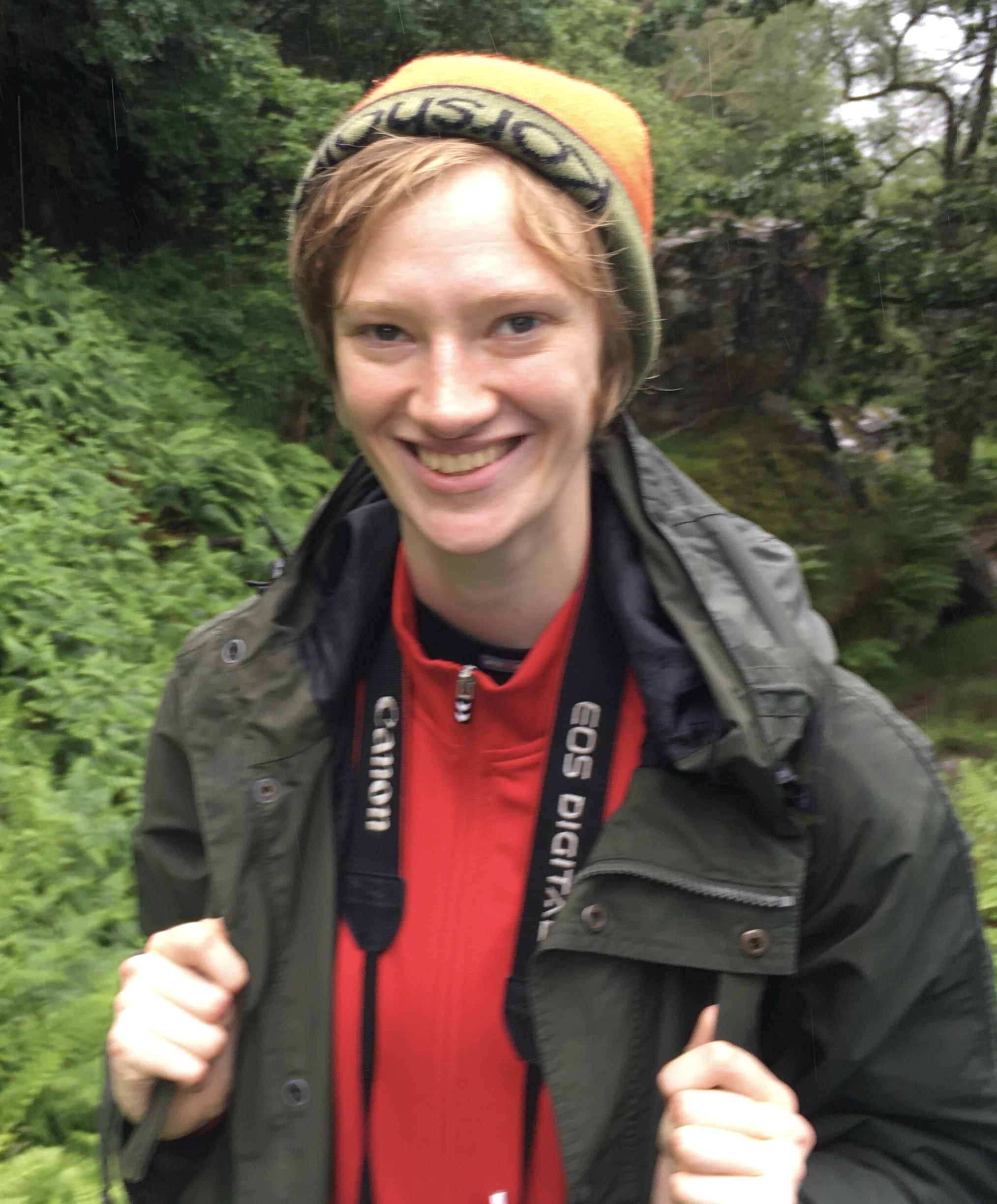
Another redhead with green eyes, Karen from Denmark.

What a trail!
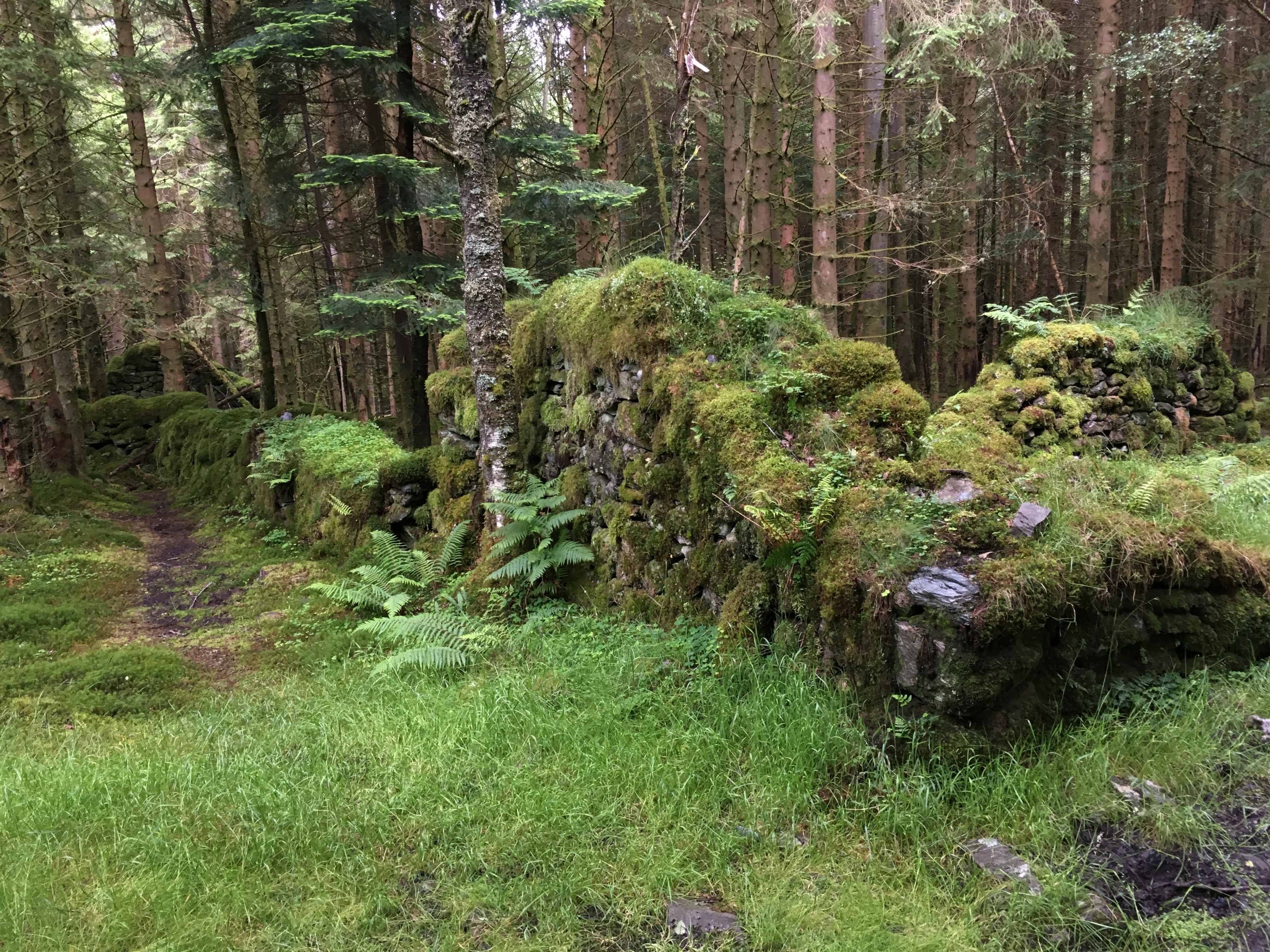
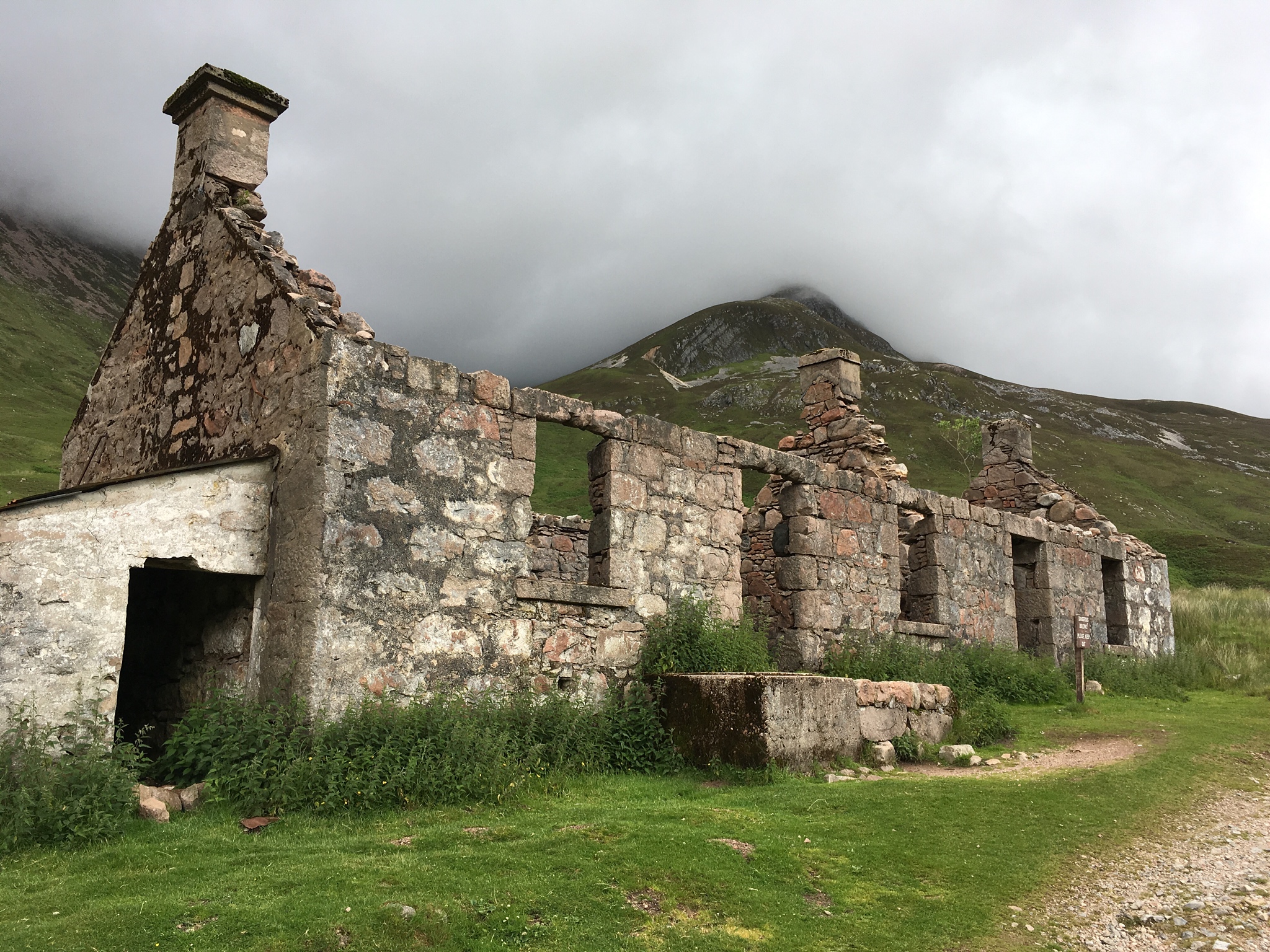
Then, the path leads through another Sitka Spruce forest, by this building ruin.

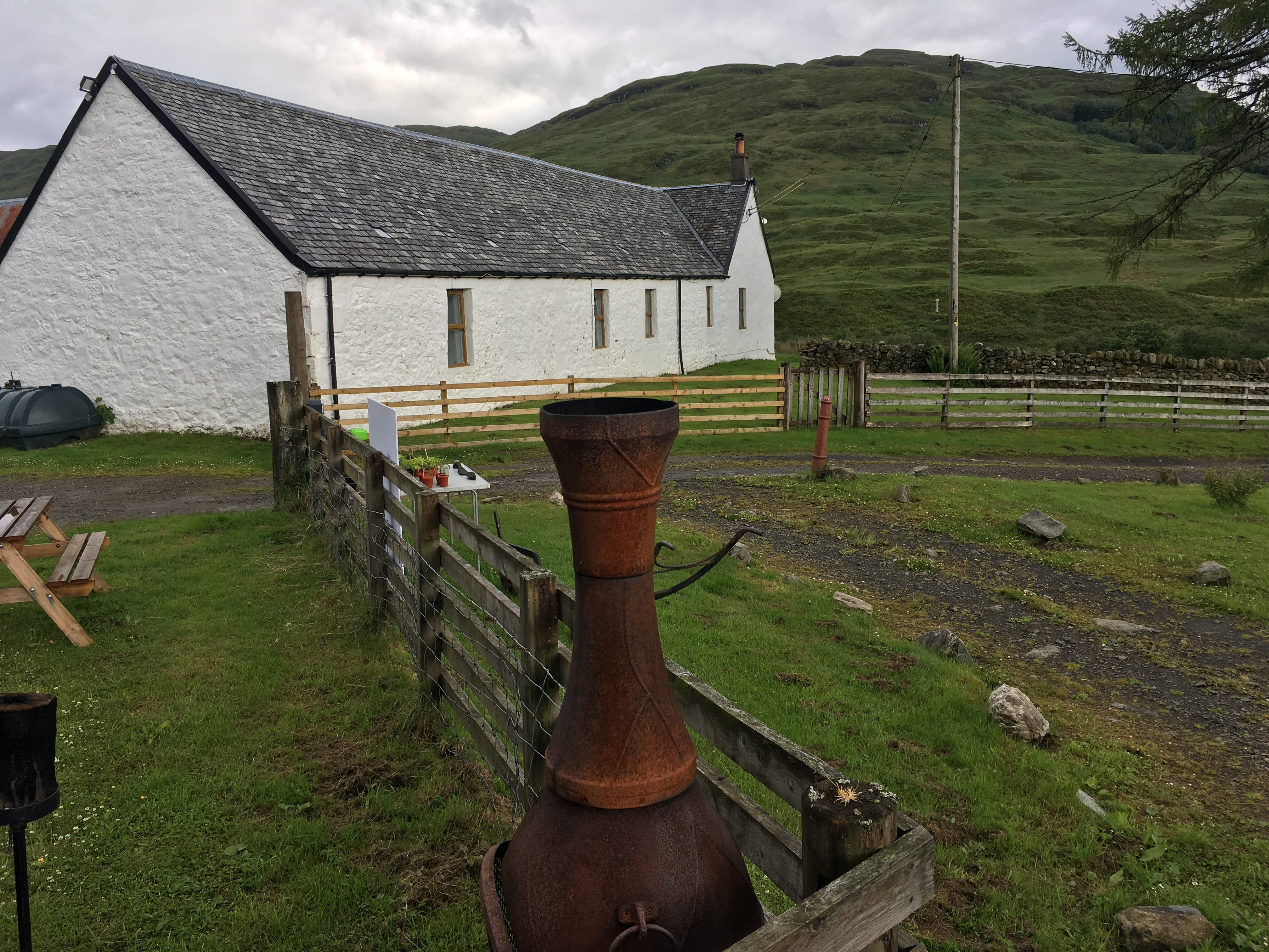
On the way up the hill from Inversnaid (going off trail to Garrison Farm for the night) I passed this former church, now a B&B and campsite.
Garrison Farm, my lodgings for the night. At the end of a long hiking day, the 400 foot elevation, 2 km climb up the hill seemed more tiring than usual. This was built as a military garrison to control the unruly Highlanders, some led by local boy ‘Rob Roy’ MacGregor.

Free range eggs were for sale at Garrison farm, so I bought some and made a fine omelette for dinner, and another for breakfast.
After a few hours rest, refreshed, I took a walk up in the hills above the farm. In the far distance you can see Ben Lomond.
Day 4: Inversnaid to Inverarnan
Day 4 was along the lakeside, very rugged and dramatic, but rougher, more strenuous hiking as you were negotiating steep rocky ups and downs where you really needed to use your hands on the rocky patches.
This tree root is straining to find purchase on the rocky hillside.
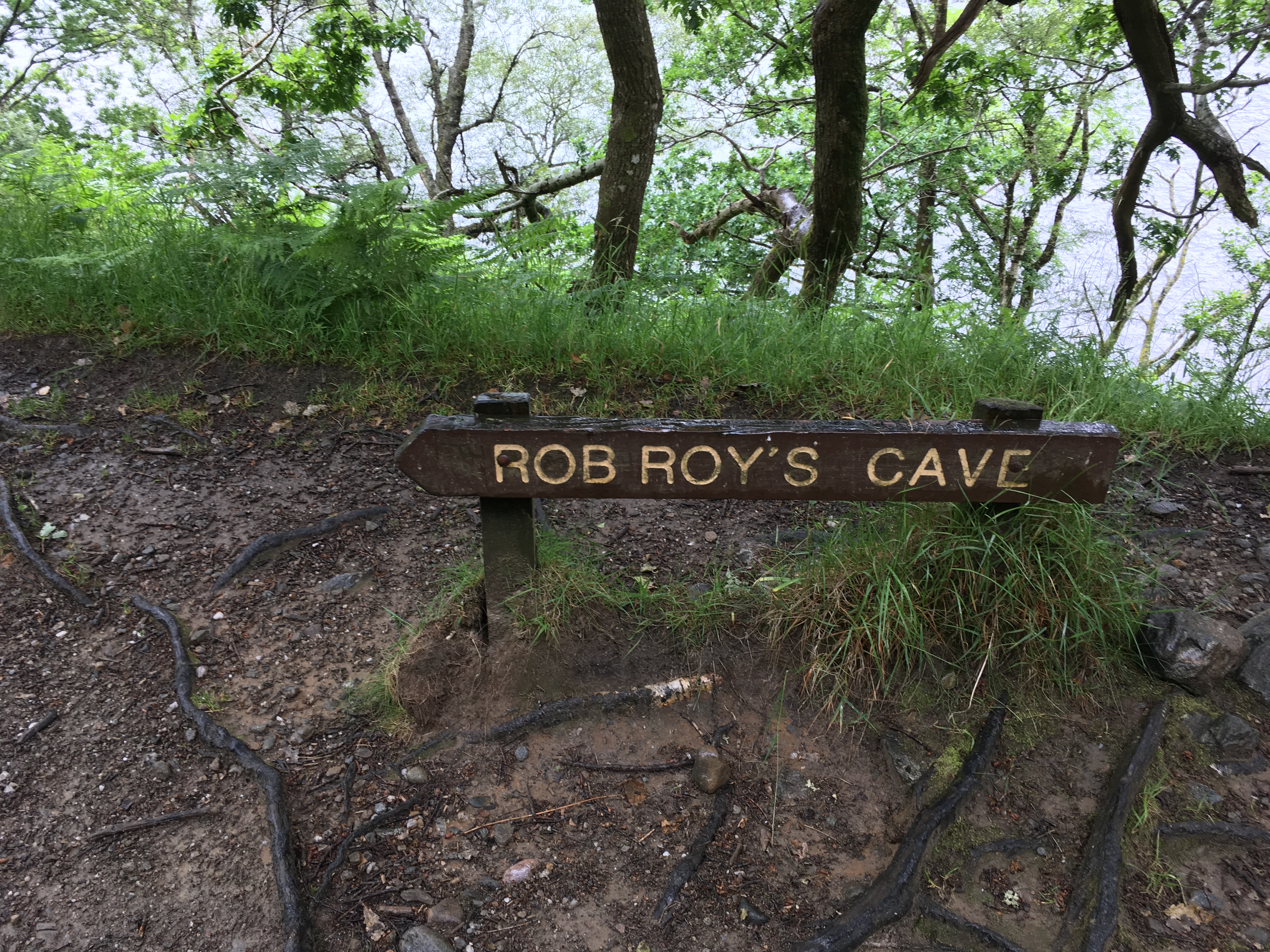
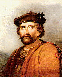
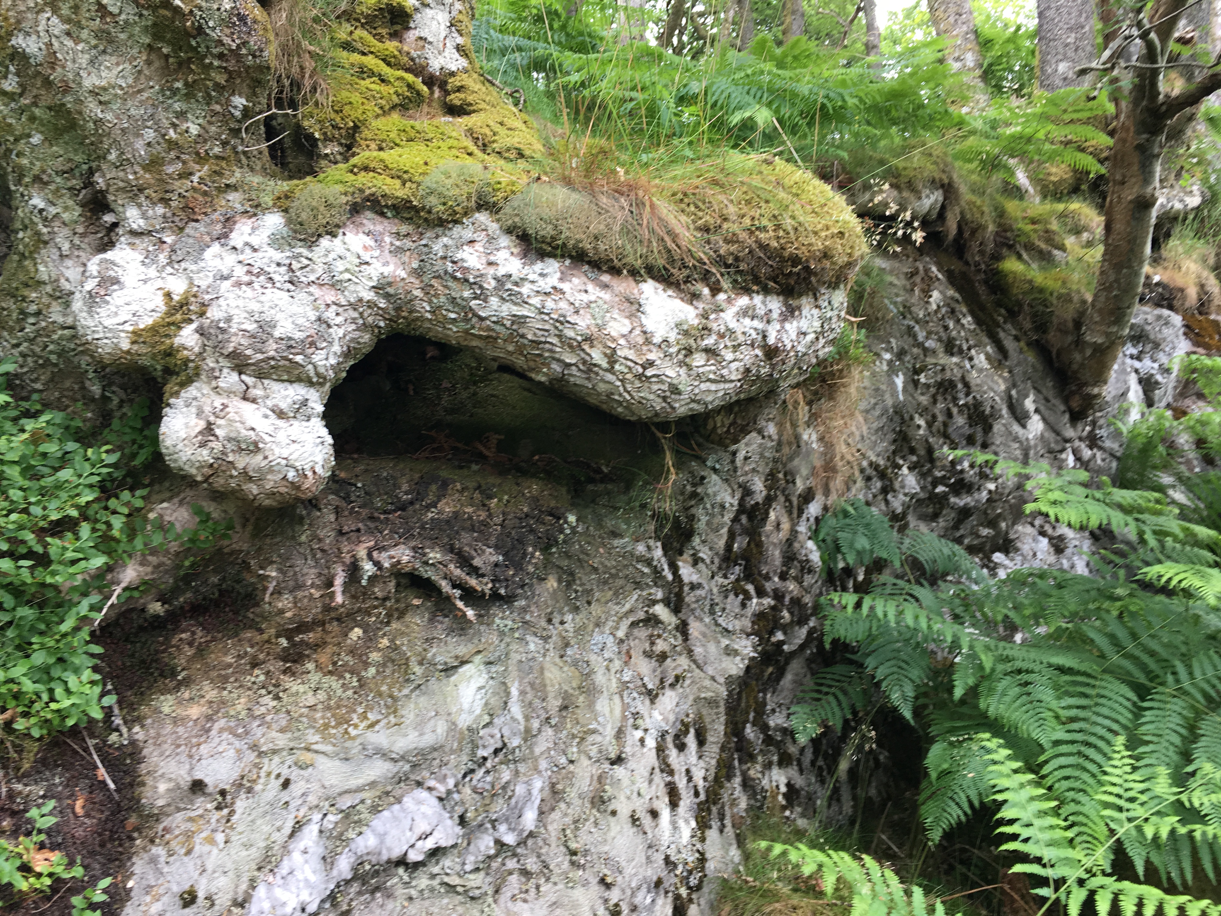
A painted portrait of Rob Roy MacGregor

Rob Roy’s cave? Perhaps, certainly a place you could shelter down by the Loch.
Leaving the way, I walk on over to the Drover’s Inn

Possibly the oldest Inn I have slept in. Rob Roy, as you saw above, was not above sleeping in caves by the Lochside, so I’m not sure how good a recommendation this is.
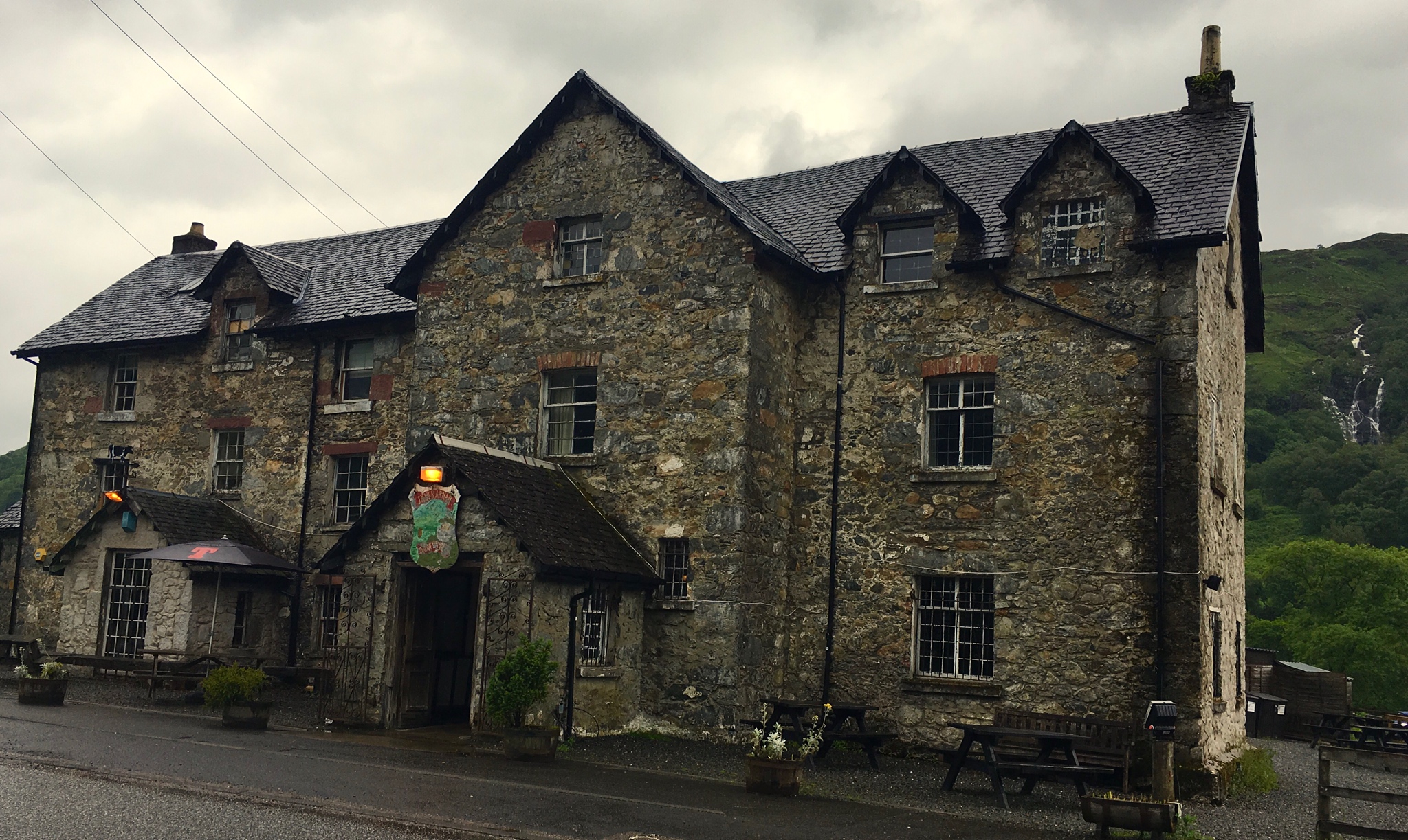
However, the Drover’s Inn is actually quite comfortable!
Day 5:
Way out here in the Highlands, Internet service is simple and slow. I may have to wait to add in pictures. I’ll try to put in the basics for now, and add pictures later.
Day 6: Tyndrum to Bridge of Orky
I made the mistake of not firming up my schedule until a month before leaving, partly because it was unclear to me whether I should push and do long hikes, or go more slowly. As a result, a few places with minimal accommodations were booked out, and I had to take a bit longer. Tyndrum to Bridge of Orky was one such case. I would have gone on to Inveroran, but there is only one accommodation there, and it was full. That meant a short day, followed by a long hike the next day. Oh, well. Try to plan further ahead if you do the Way.

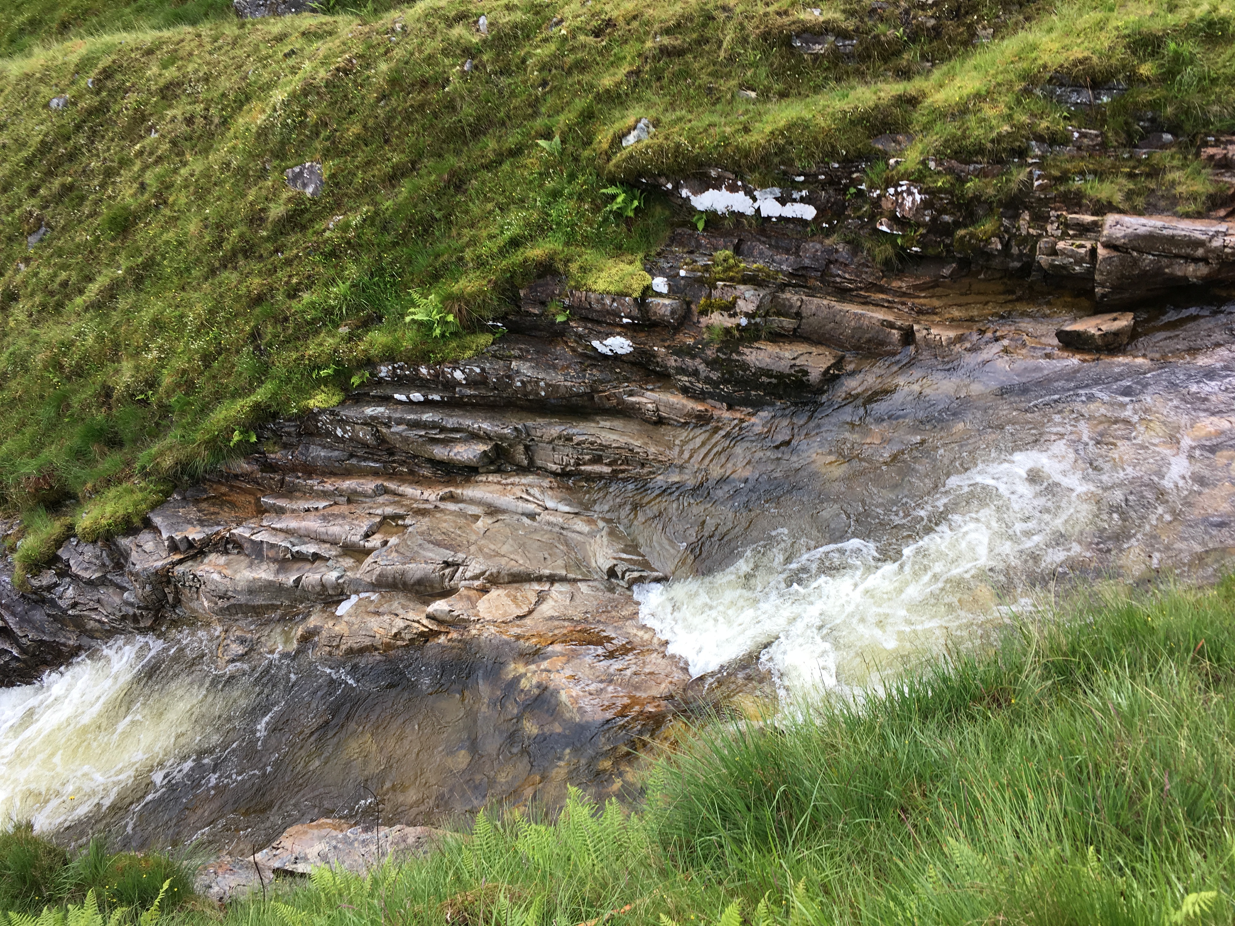
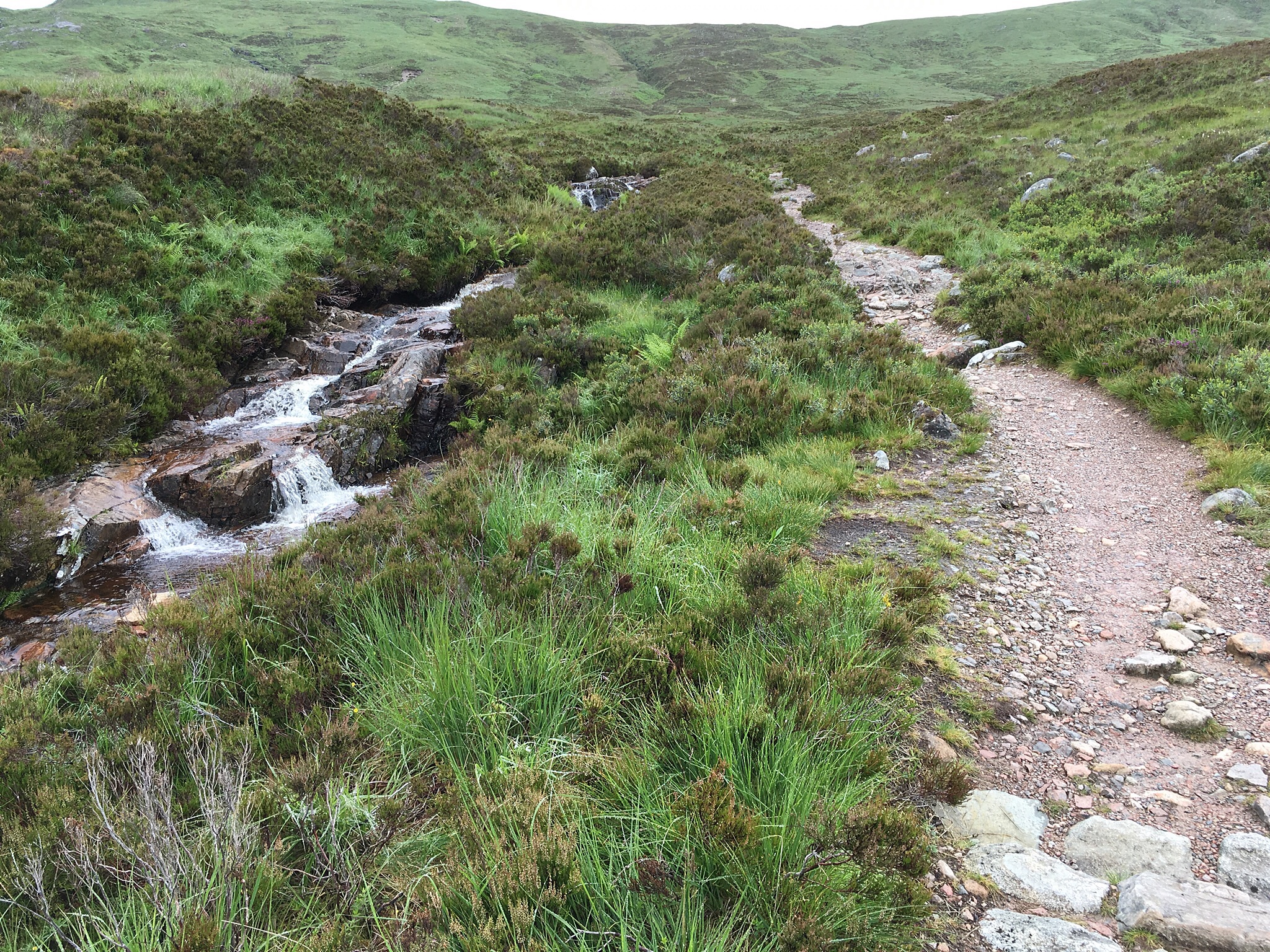
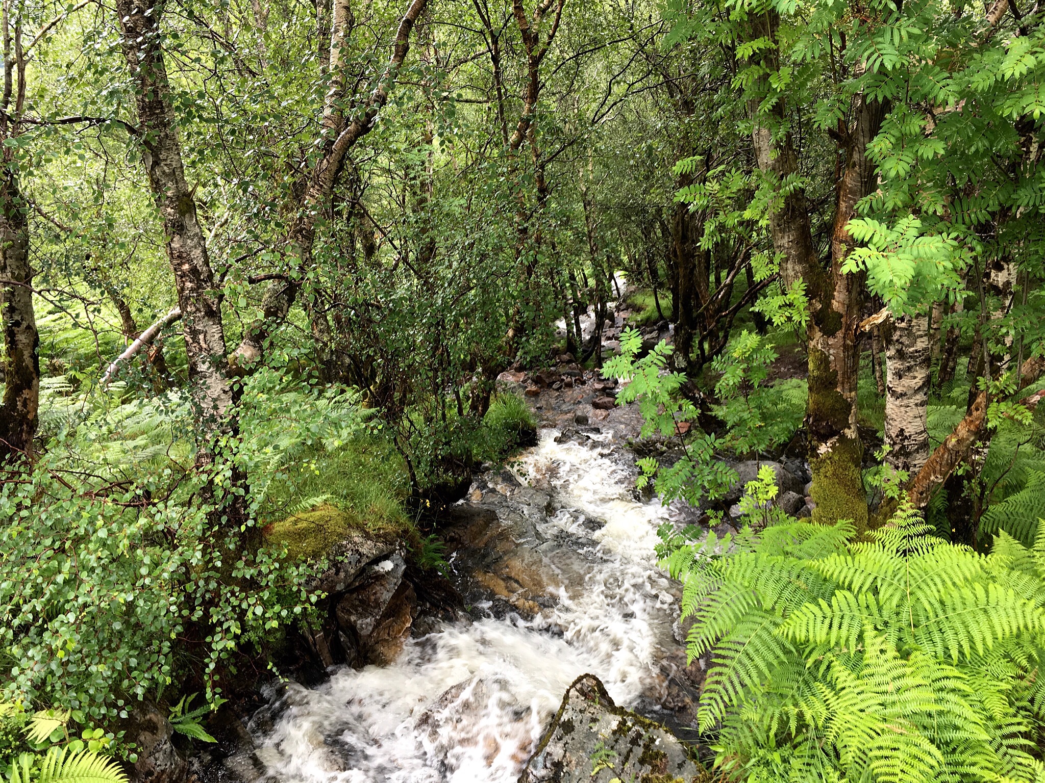
There are so many beautiful streams along the WHW, I have not depicted them all.

If the wind blows but no sun, wind power. If it is sunny and still, photovoltaic power. A good choice along an isolated railroad track!

Along the way, I met a Scottish woman hiking the Way with three of her four children. She had strawberry blonde hair and green eyes. Her children all had blonde hair and blue eyes. So I ventured a guess that her husband had blue eyes, and that was correct! We had a funny, interesting talk as I matched their quite brisk walking pace.
Further along, her husband and their dog joined us, approaching from the other direction. I asked their 10 year old daughter if she could suggest a Scottish song to learn, and also if she had heard one of our silly songs, “Do your ears hang low, do they wobble to and fro” and was surprised that she knew it well. Maybe it originally is an English song.
 Looking back towards Tyndrum.

The West Highlands Railway heads in the same general direction as the WHW, and if the hike is too strenuous, it offers another way to see some of this area. In a few cases, the trail crosses under the rails in underpasses probably built for the sheep!

As sheep on the whole are not as tall as us, this underpass required ducking down to walk through!
At Bridge of Orky Hotel, I met a fellow hiker with red hair and green eyes:

Her name is Elin, and she is from Sweden. Red hair genes are not limited to the Irish or Scottish.
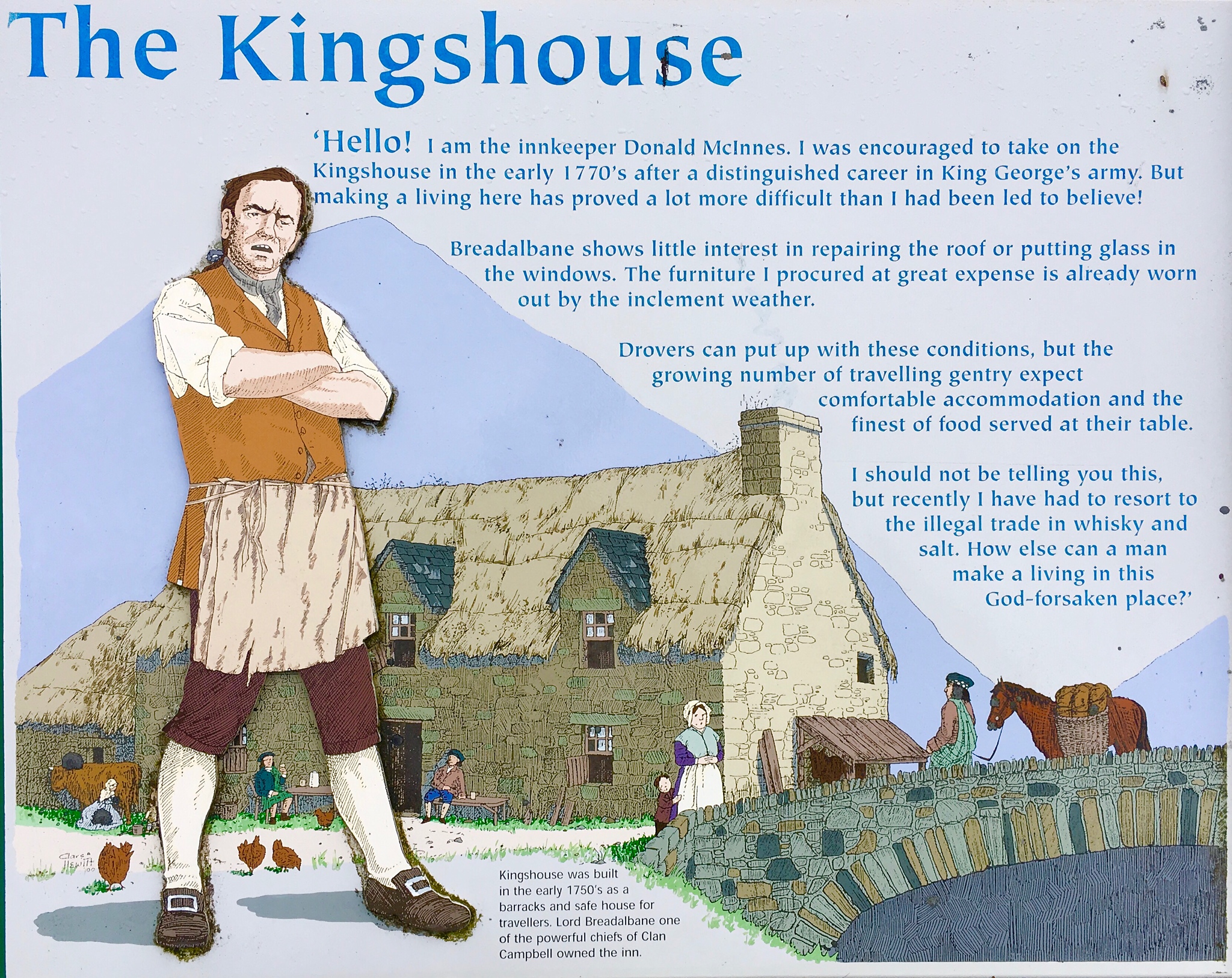
Day 7: Bridge of Orchy to Kingshouse

You begin by walking across the Bridge of Orky, built as part of the government program began in 1807 to provide good roads up into the remote Highlands area that they were having trouble pacifying (remember Rob Roy MacGregor!). So these were really military roads, but they encouraged and enabled commerce as well. The roads were well designed with moderate slopes and well constructed, so that although they are no longer used as vehicle roads, they make good walking trails. This made the 12 mile walk seem like less.
As I was leaving Bridge of Orky Hotel, so was a woman from the Netherlands, and we made the days hike together. As her husband and 10 year old daughter we’re not eager to make this particular strenuous hike, she was off doing it on her own. She is hopeful that her daughter will soon join her on her hikes. Debby struck me as an experienced Trekker, well equipped and savvy. She also had a touch of red in her brown hair:

We had a very interesting talk along the way about Holland and the impact of refugees. She is a social worker in the Netherlands. It used to be that they had perhaps 250 people needing public assistance, in a county with 30,000 people. Now, there are two counties under their care, with a combined total of about 57,000, and they need to assist 1,500 due to the economic downturn and refugees. This is putting a strain on the community resources, of course.
The U.K. is getting more refugees than most other countries in Europe, and that and the economic downturn were factors in the recent vote by the U.K. to leave the European Union. As a member of the EU, they are required to accept any other EU citizens.
I told the story of how Judy and I were in Peru, visiting a former AFS exchange student in Ariquipa, and at the end of a family party, everyone sang a song to share. I persuaded her to alternate singing songs with me, and with some coaxing, she overcame her shyness and sang some lovely Frisian language songs. She has an undertone of red in her brown hair, something I am tracking while in Scotland.
On the way up from the bridge, walking through a Sitka Spruce forest, a large doe crossed the trail ahead of us, froze and watched us. My first deer sighting in Scotland.
 It was a very rainy, cold hike across the great wild moorland area. Broad and high, it is a peat bog of sorts, so you do not want to leave the military road or you would risk sinking into deep spots. In the heart of the moorland, you could see not a single fence nor building as far as the eye could see in any direction. Unlike the Isle of Skye, where sheep could be seen on all slopes, there are no sheep being grazed out here now.
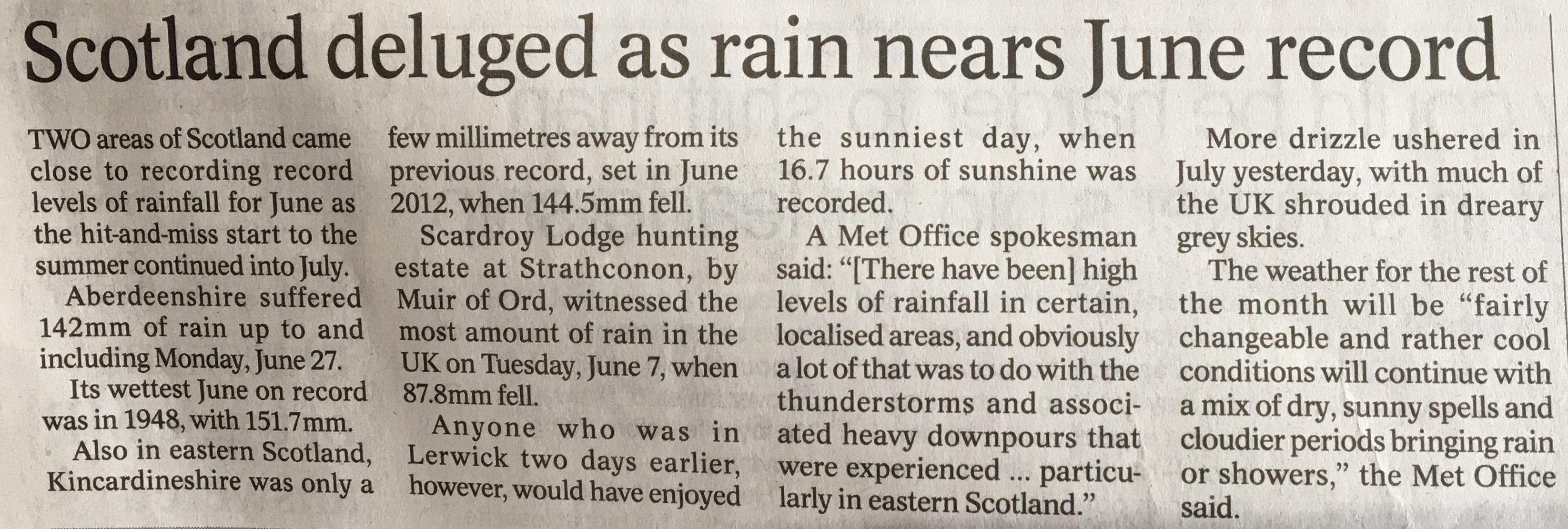
It has been a wet walk along the West Highlands Way in late June, 2016!
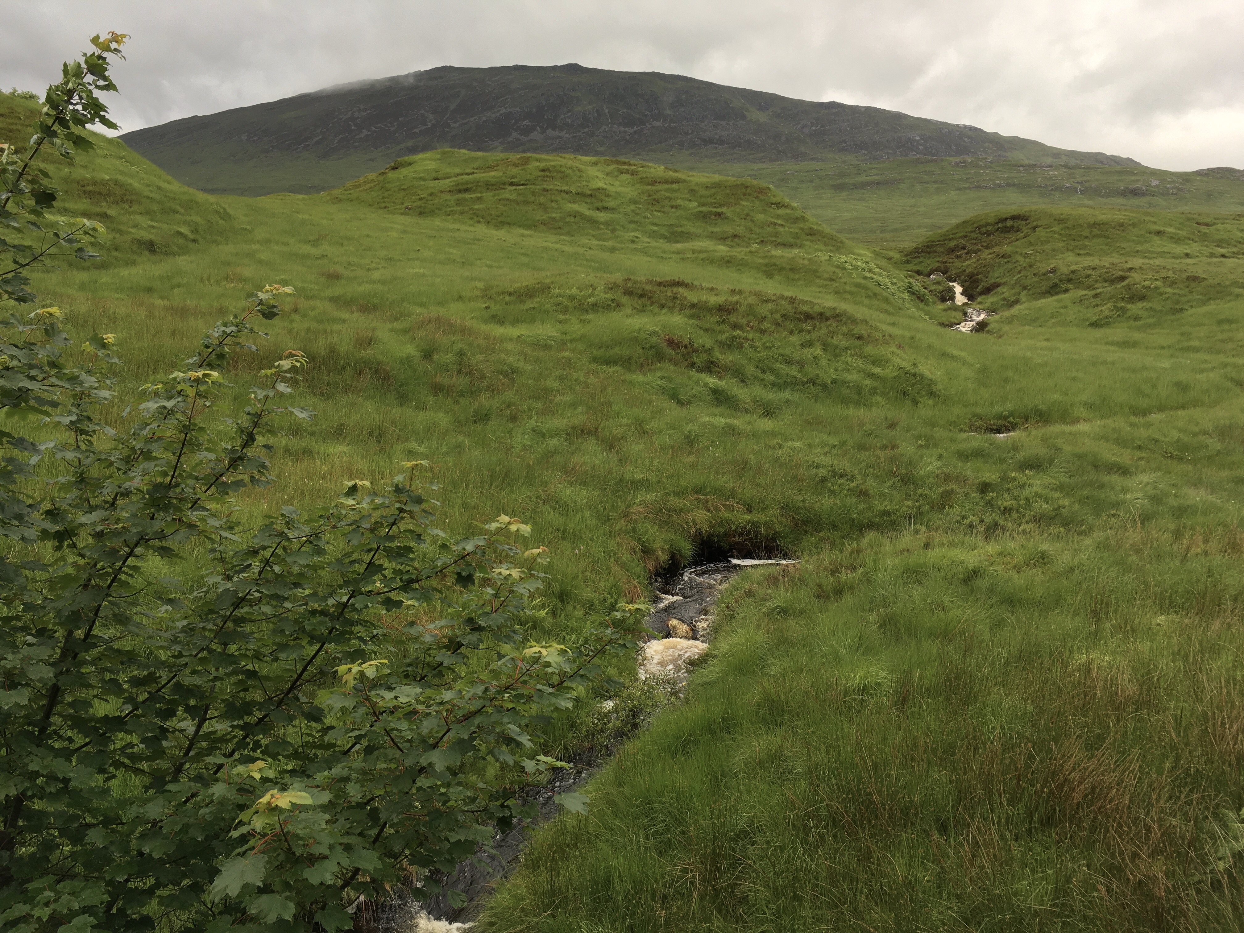
Broad and wild, with lots of streams bringing the rainwater down the hills.
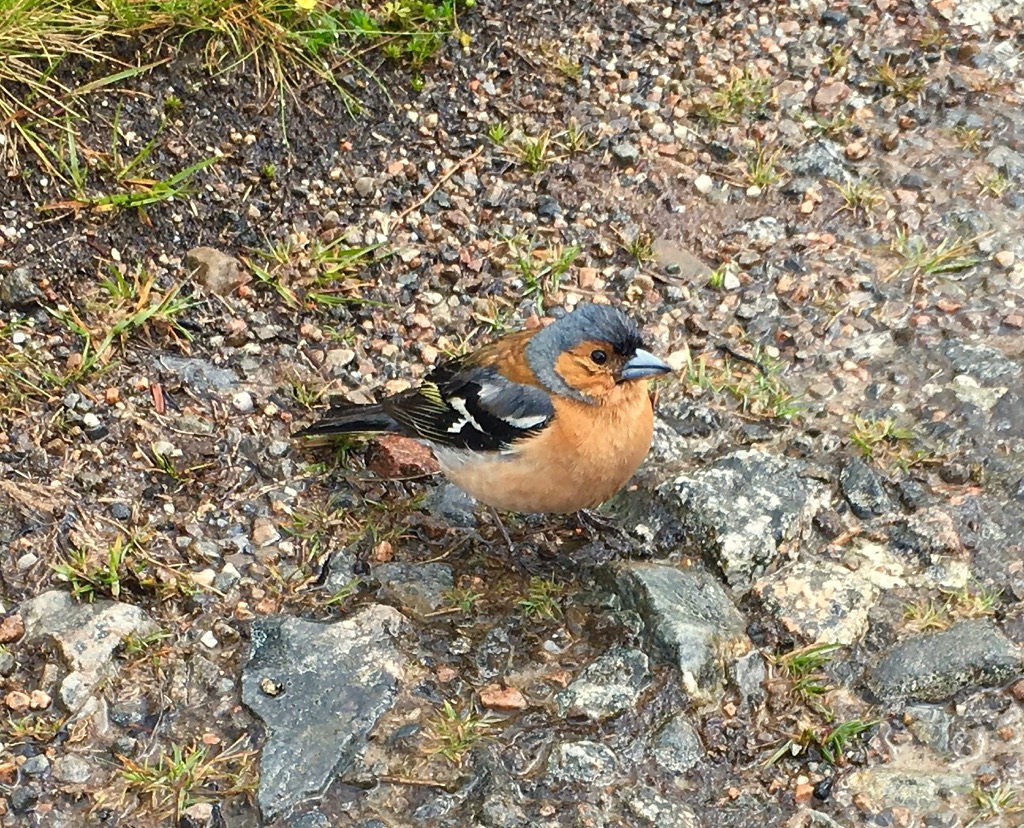
This little bird approached us, probably because some hikers fed it. We did not, as feeding the wild birds this way can cause problems. Perhaps one of our readers can identify it.
As we dropped down into the valley, we passed right near the base of Glencoe Ski Area.
I was surprised to find when I went to register at Kingshouse, my hands were cold enough from the rain and windchill that I had some trouble making my signature. This is just how your body reacts when you have hypothermia: you begin to lose co-ordination. Maybe I was colder than I thought! I suppose I should be a bit more careful to not let my hands get super chilled in the future, lest I need them limber for something important.
Day 8: King’s House to Kinlochleven
Today’s hike is reputed to be a tough one, with a lot of climb, up the ‘Devil’s Staircase’.


Leaving Kingshouse


Beginning to climb out of the valley.
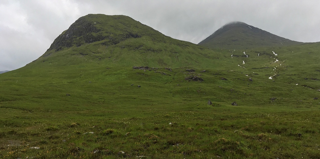
Big, rugged hills rise all around. This whole area must be covered with snow in winter.

Looking back down ‘The Devil’s Staircase’, which for all its aura is just a very long, steep climb up to a pass. Puff, puff, puff, you’re there. Almost that easy. At the top, I ran into Debby from the Netherlands again, resting up after the big climb. The red jacket is that of a French mother, climbing up with her three children, one daughter as well as a pair of twins, boy and girl, and her husband (who was ahead). One fun part about a long trail such as WHW is that you meet interesting people, and often run into them again on the trail, and sometimes in the Inns in the evening. I have had many interesting conversations this way.
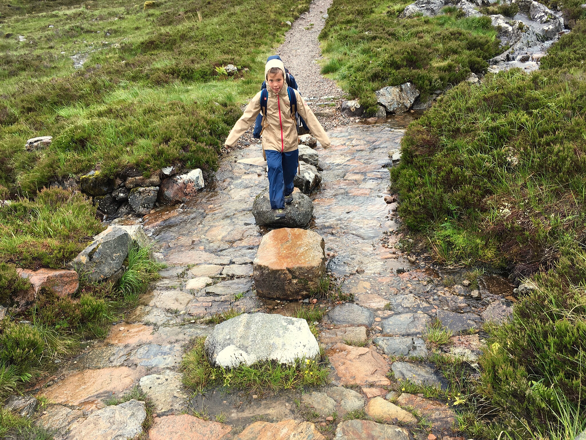
Up and past the pass, the twins cross the stream

Ahead lies Lochleven and Kinlochleven
Water, water everywhere!
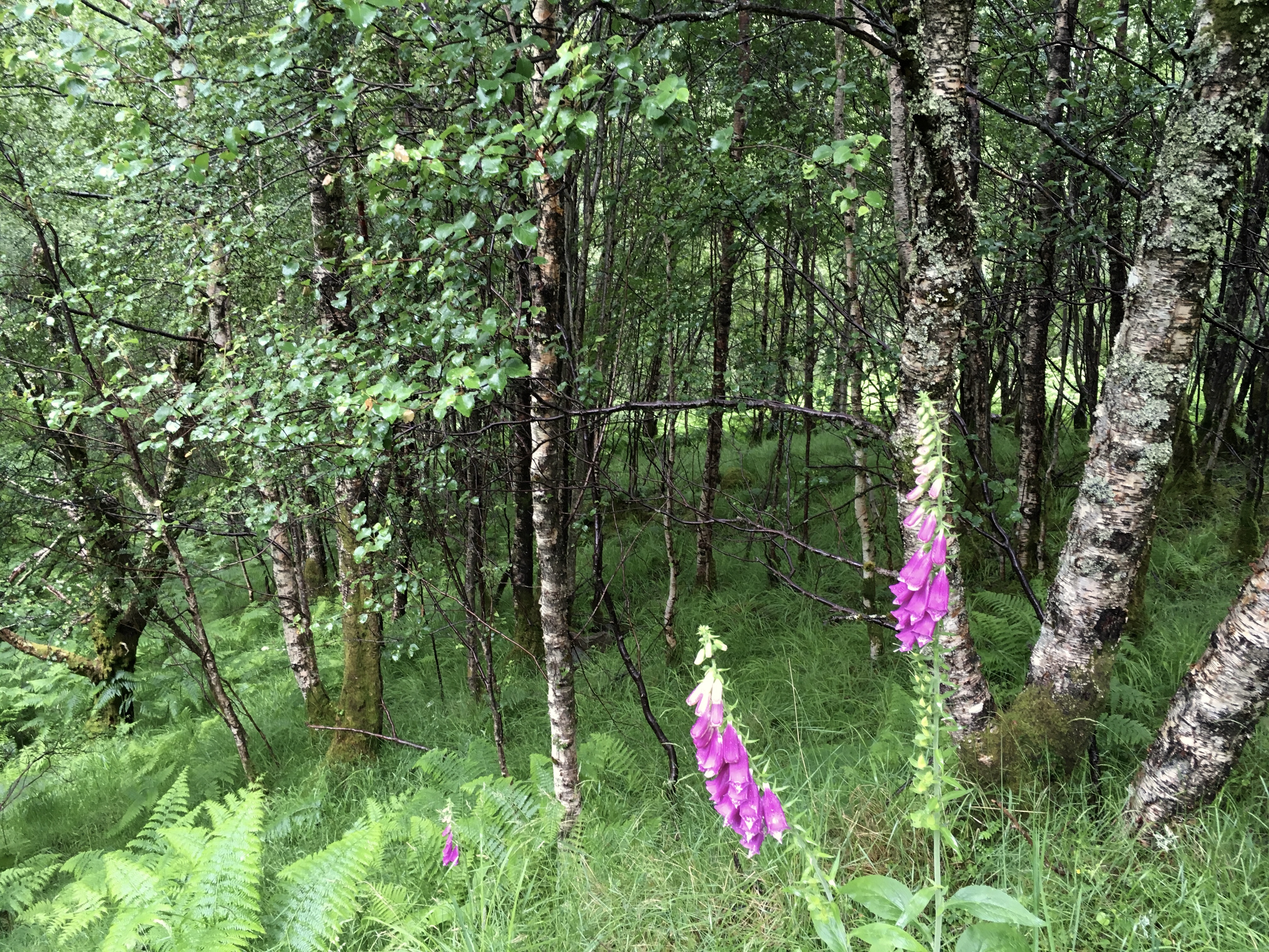
Then, we dropped into a birch forest just above Kinlochleven. These foxtail plants line the trails all over Scotland. We had them in Amboy, Washington, USA too where I grew up. We kids liked to pick them and put them on our fingertips. They were gathered and digitalis, a heart drug, was extracted from them.
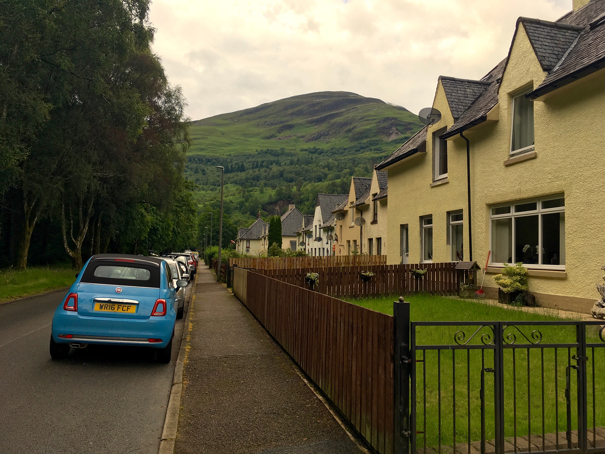
Kinlochleven is a relatively big village (note: hamlets are small villages without a church. If you have a church, you are upgraded to Village status) due to having a hydro generating station and (until it was closed in 2002) an aluminum smelter.
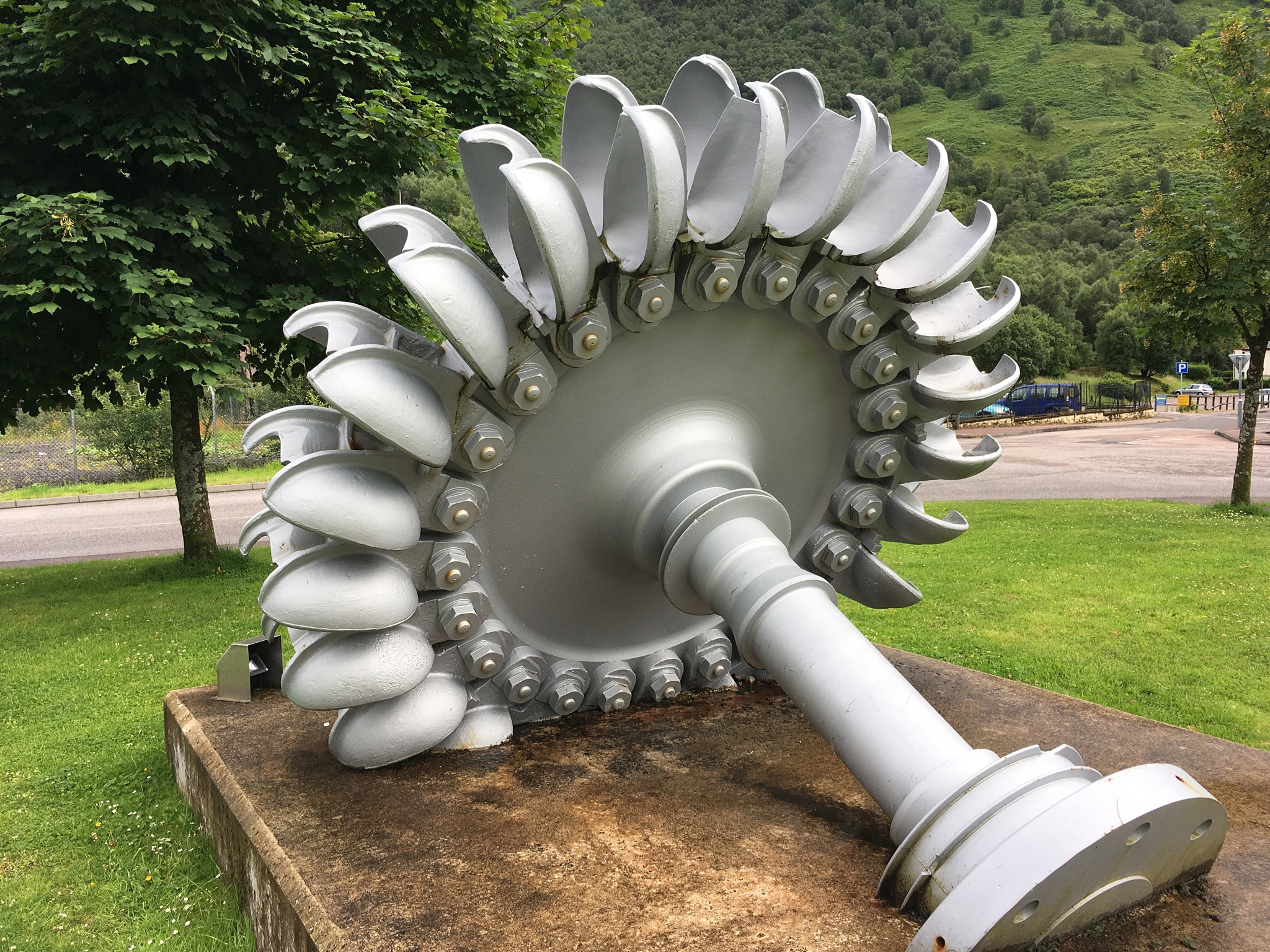
One of the old Pelton water turbine wheels. There were 11 turbines turning 11 DC power generators (smelting used DC). Now they have been converted to AC power for general transmission reasons. Pelton wheels date from 1870, and were very efficient with high head (pressure), low flow water sources. They extra almost all the kinetic energy from the water source.
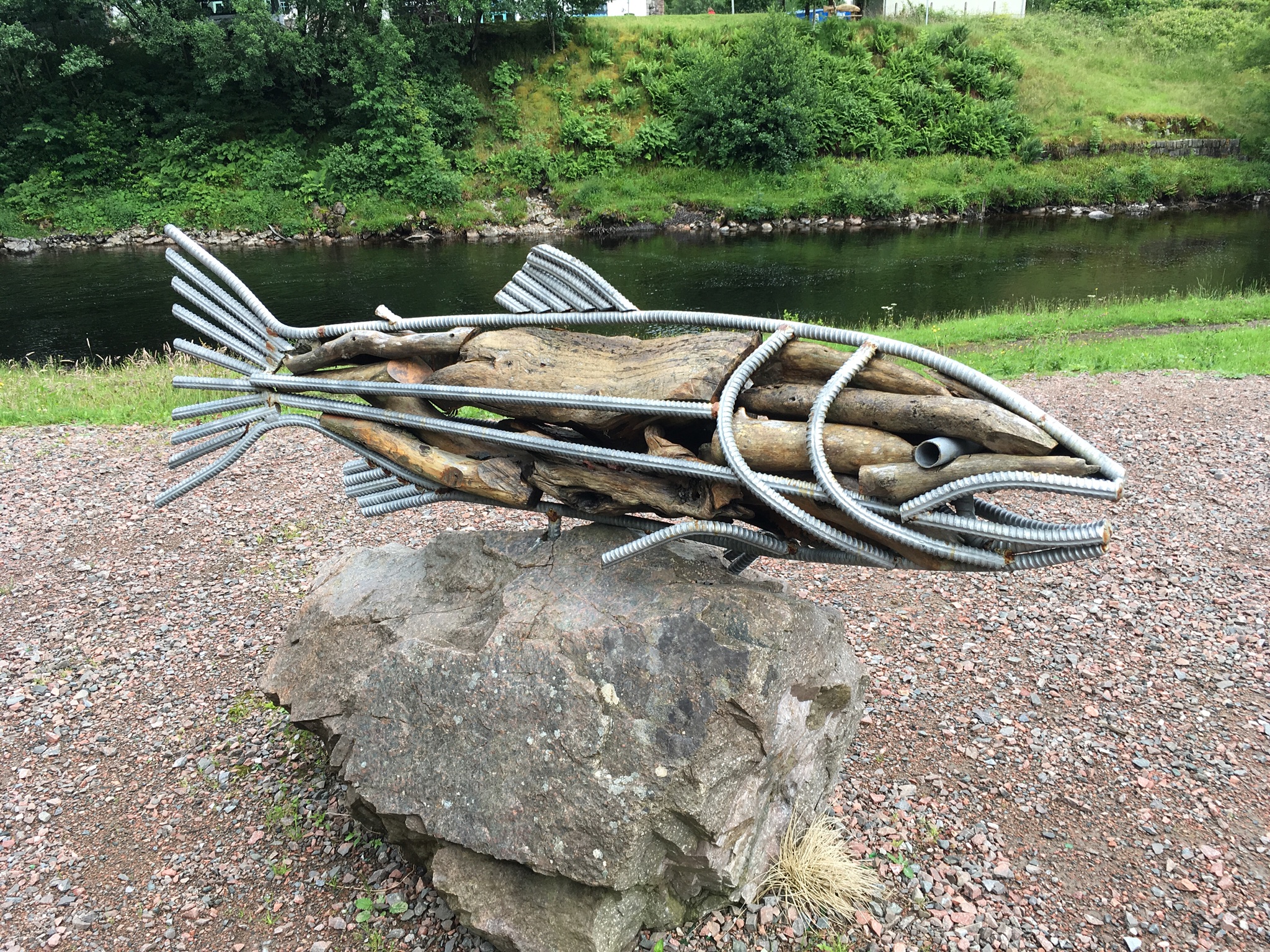
One of the more unusual salmon sculptures I’ve seen. Only fly fishing allowed in this river.

The River Leven
[vc_video link=”https://vimeo.com/173395244″]
Last day: Kinlochleven to Fort William, 15 miles

Today is a long hike, 15 miles plus a lot of elevation to climb, more than 2,000 feet. A bit of sunshine in the morning led me to set out without the usual rain gear on, so as not to overheat on the steep climb out of Kinlochleven.
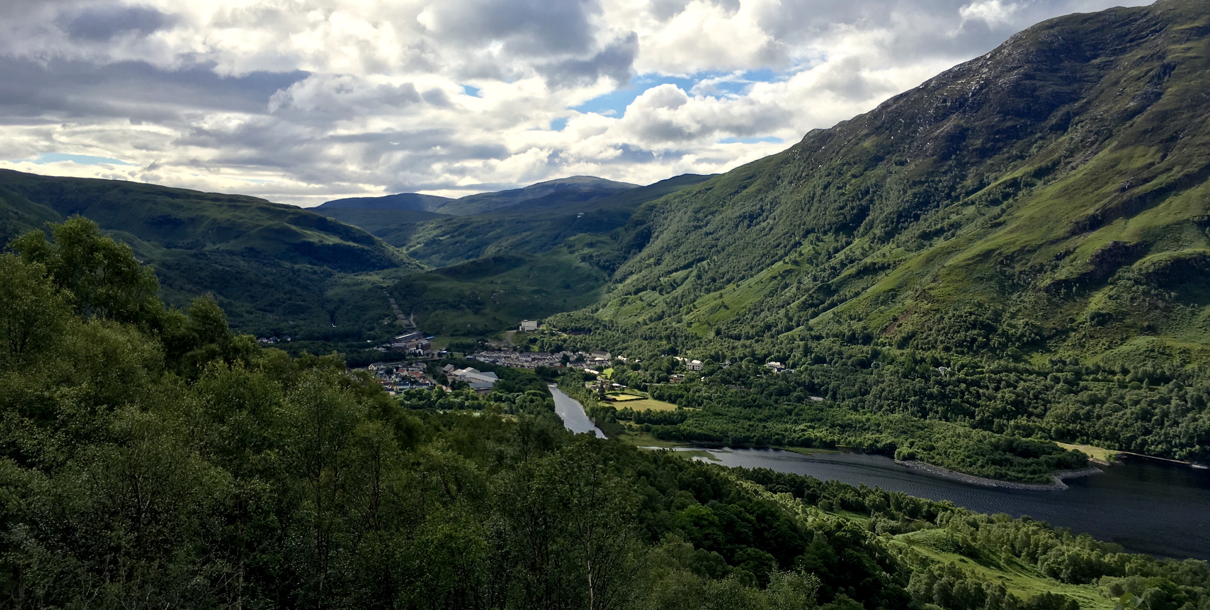
Looking back at Kinlochleven. You can see the hydro powerhouse, as well as the building that was the aluminum smelter. A local fellow who worked there said it was one of the earliest aluminum smelters, located here for the water, and cheap hydro electricity. He said it also was the smallest smelter in the world, as well as the most polluting. It was closed in 2002. A very vertical, dramatic valley along the River Leven.
Looking on down the River Leven.

The trail became rocky and steep. A good place to have sturdy mountain boots!

Further up, you climb up above tree line.

And then rejoin the ‘Military Road’. This section is not in as good a condition as that through the moorland, and the water running sideways across it has left some of it pretty rocky and uneven.

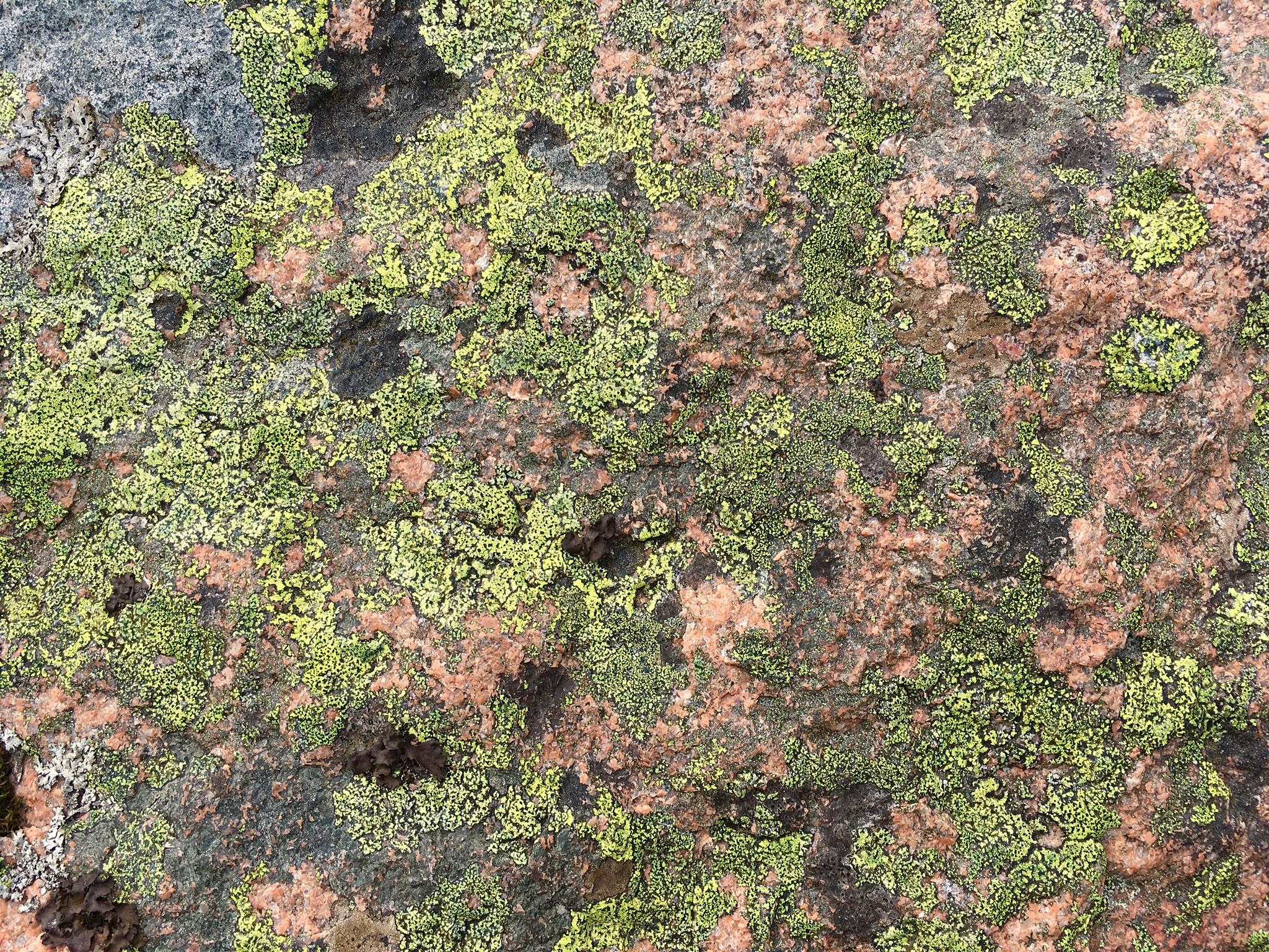
Rosy granite with lots of lichens in this damp valley.
Ruins of an old crafters home. Though undoubtedly sheep were pastured here, there are none now.

Further on, the trail drops into a forested area.
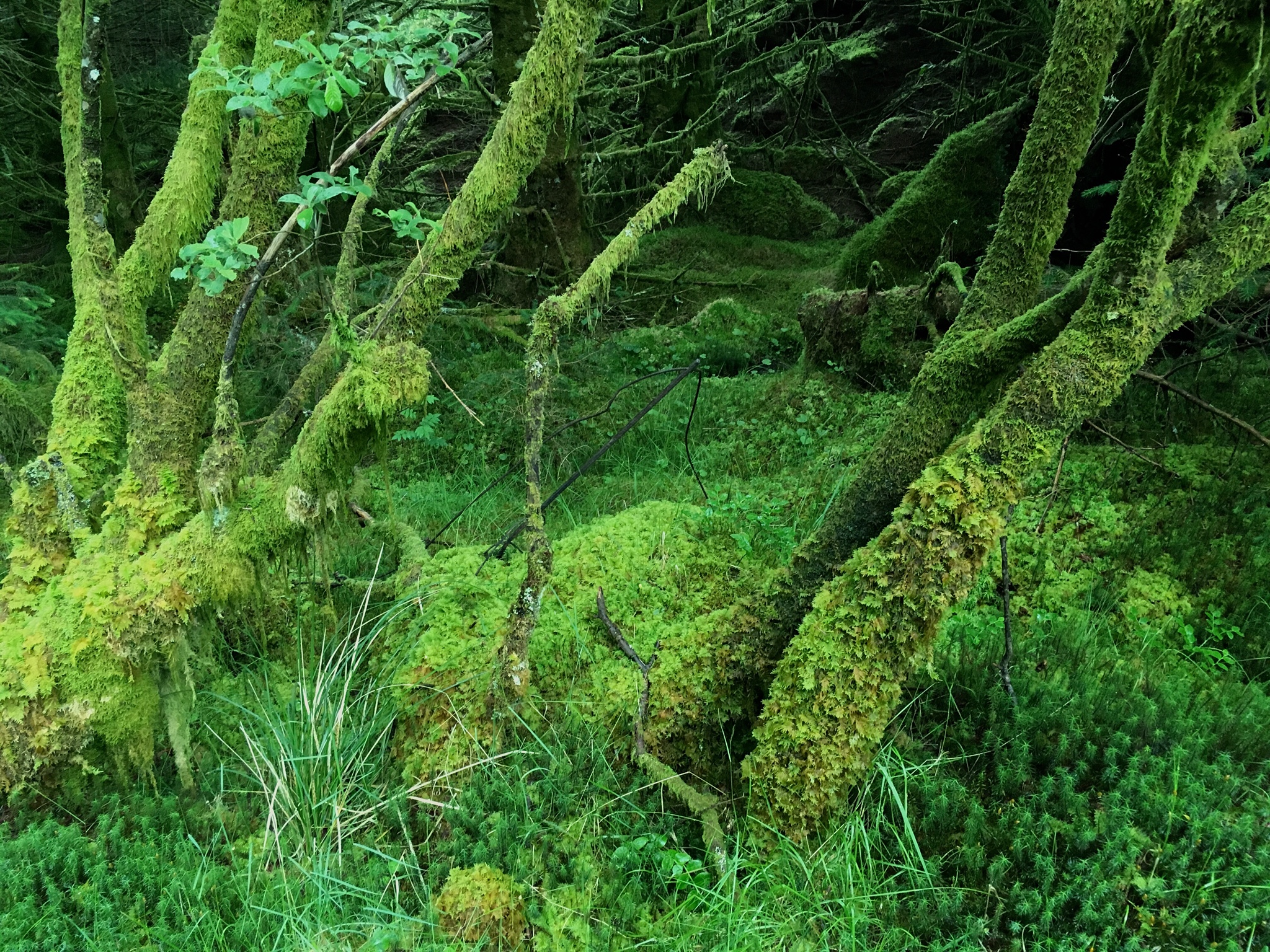
Very wet and mossy, even covering the tree trunks.

The shallow soil here left after glaciation makes the trees vulnerable to tipping over in storms as in this case.
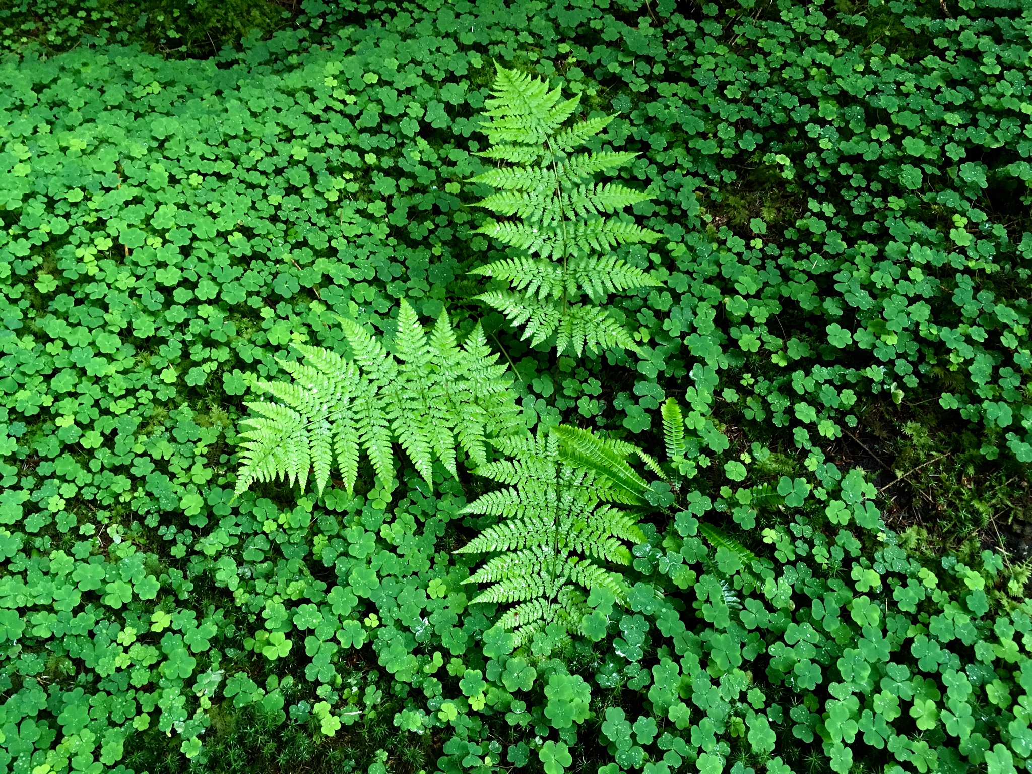
This appears to be the same kind of plant we kids called ‘sour sorrel’, gathered and ate for the pungent sour flavor burst. At least it tastes the same!
Then the trail goes through a forestry area with big clear cut areas. Not so pretty. This section seemed like a rather long trudge.
At last you emerge overlooking Fort William:


A side trail beckons to the hilltop that had an ancient fort. Near the end of a long day’s hike, was it worth the climb? Why not?

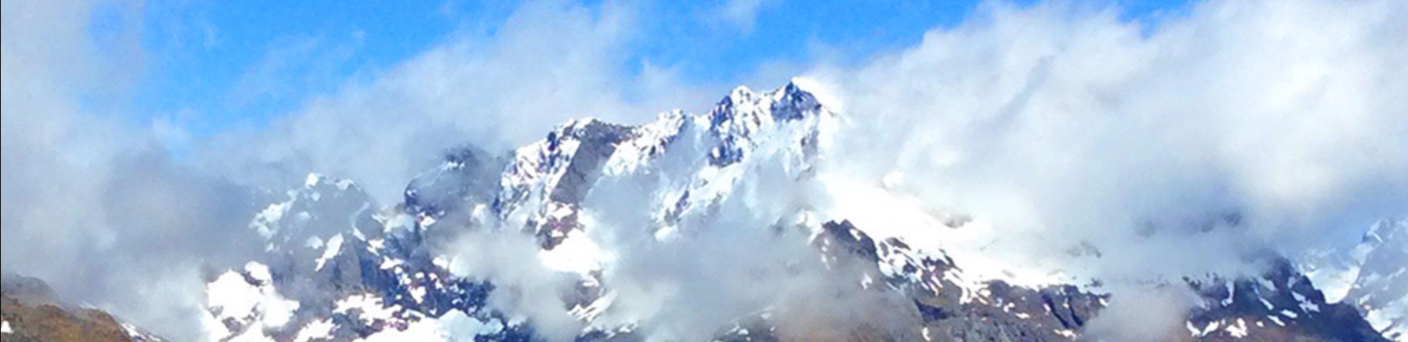
After the climb, it was a bit disappointing that there are no visible ruins atop the hill. However, the views of Ben Nevis (albeit only the lower part, the top was in the cloud as it is 9 days out of 10) were dramatic.

A Scottish family I walked with one day (mentioned earlier) arrived at the end of the Way the day after me. It was just beginning to rain–but, with an eye on the weather, they started early from Kinlochleven, and hiked in short sleeve shirts the whole way. What a fine bunch of hikers!
I have found the Scottish people to be quite open and friendly. They are currently having a national debate about whether it would be better to become independent from the United Kingdom. A clear majority want to stay within the European Union, and the U.K. vote to leave the EU has further muddied the water. Opinion is rather split, and it is unclear so far how this will play out. With a population of less than six million, an independent Scotland would be one of the smaller countries in the world.
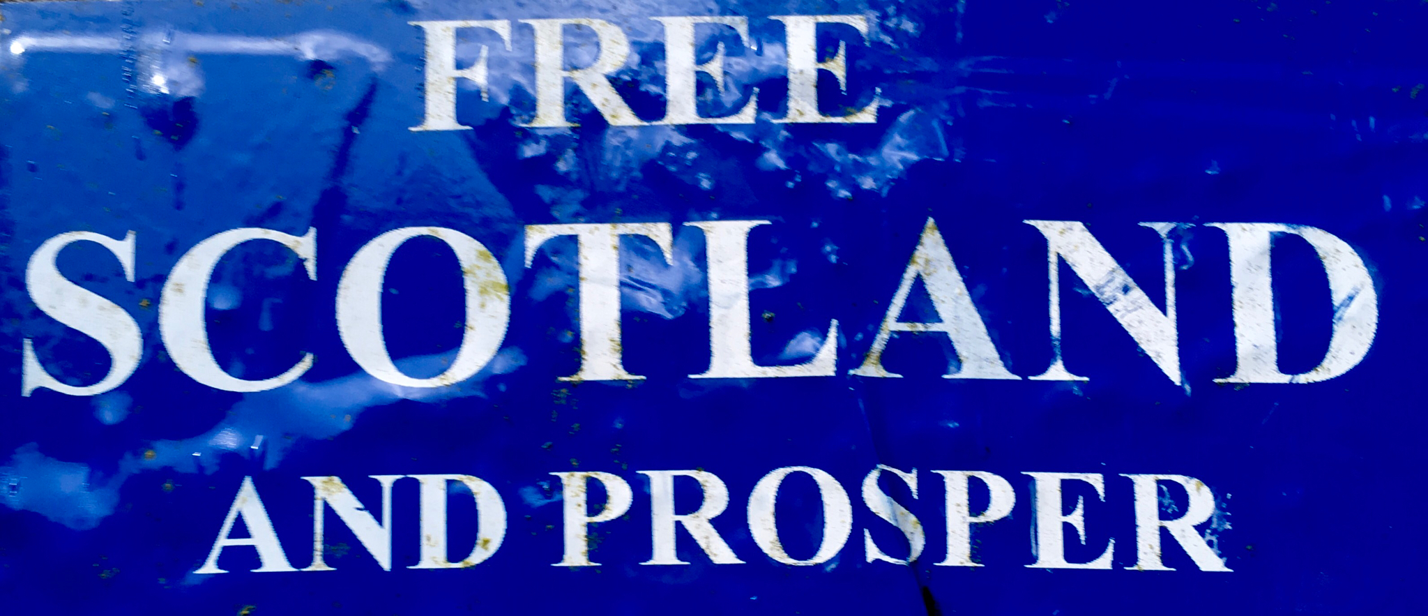
One point of view we saw along the way. Not all agree independence would improve prosperity.
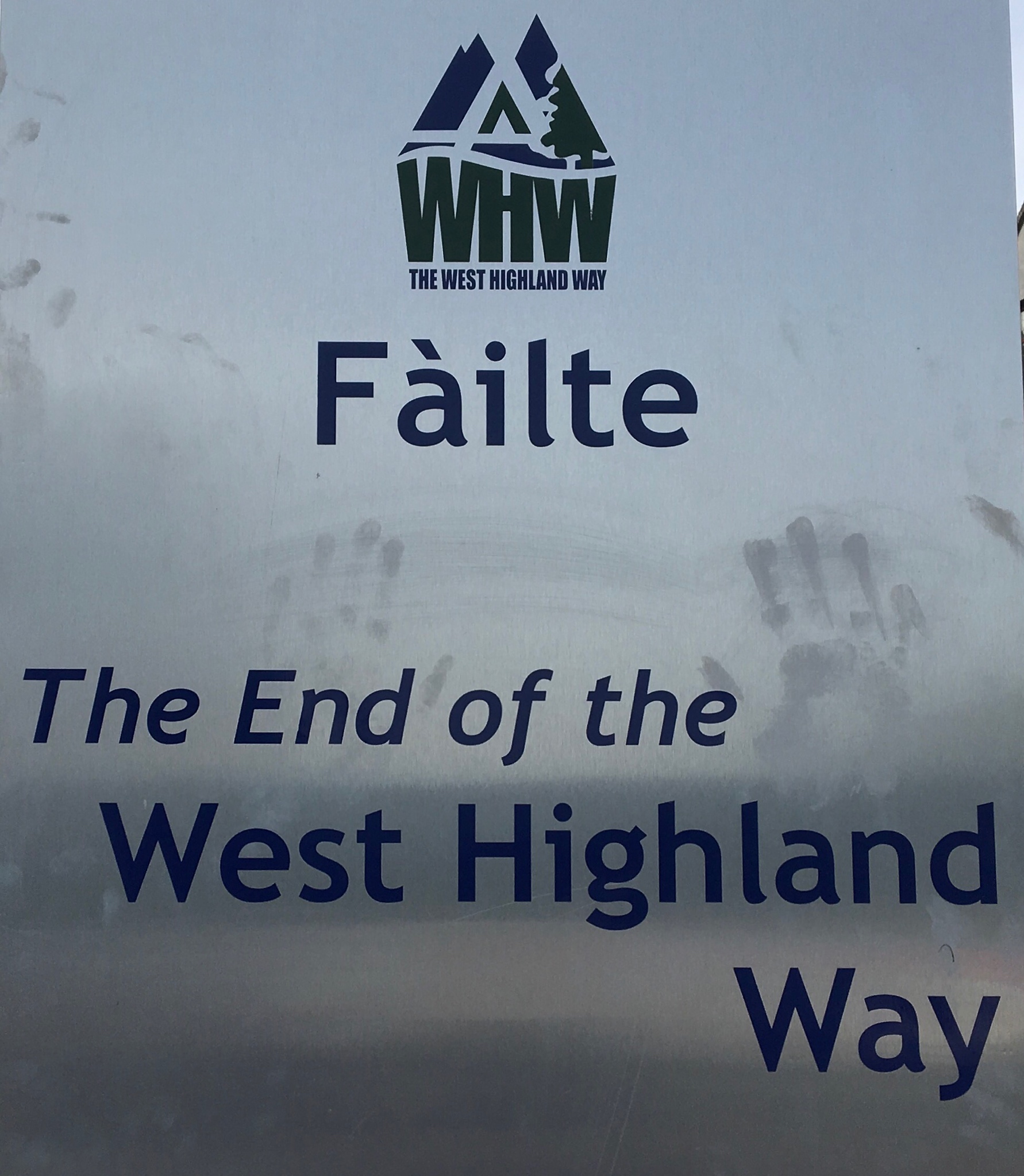
The end of the trail. A good 96 miles it was! I was surprised to see rain most days, even in late June. However, perhaps this is not new. It rained the afternoon I arrived in Fort Williams, and pretty much all day the following day. Here’s a comment from 1838:

A few tips in retrospective should you choose to walk the WHW:
Do not underestimate the wetness and cool weather of this area! You must have serious breathable rain gear, including rain pants. They also serve as a windbreaker when walking into a stiff, moist wind. Wind chill can be considerable.
There are long stretches with no toilets, so try to be prepared. Bring food and water for mid-day. I found that if I was well-hydrated at breakfast, one liter of water sufficed in the cool, wet weather. You would want more if it were hot (hard to imagine!).
Oddly enough, there are few mileages noted along the way. Rely on your own GPS or map resources to know where you are and how far you have left to go. If you do walk the 12-15 mile days, be very careful to not get blisters. If you have good footwear, your feet will likely gradually toughen and do better. Trim your toenails way back to avoid losing them on the steep downhill stretches. Though a few people walk the Way in athletic shoes, most use real mountain boots, probably because the Way is often rough, sharp stones, and sometimes very wet.
The Way is walked in winter, but take care if you try this. It looks to me like winter conditions could be challenging, and there are long, isolated stretches that could be fearsome in a winter storm.
The West Highlands Way is a very interesting long journey well worth the effort. It would be possible to hike just parts of it, taking buses in between, to scale it down. It is not a wilderness experience, but it is not a walk in the park, either. You need to be fit and have proper mountain clothing and gear to go out there. If you do, you will be rewarded with some spectacular rugged Highland surroundings that are unforgettable.
Tomorrow: a ride on the Jacobite Steam Train, which was seen in the Harry Potter movies.
![]()
Leave a Reply to Mavie
You must be logged in to post a comment.